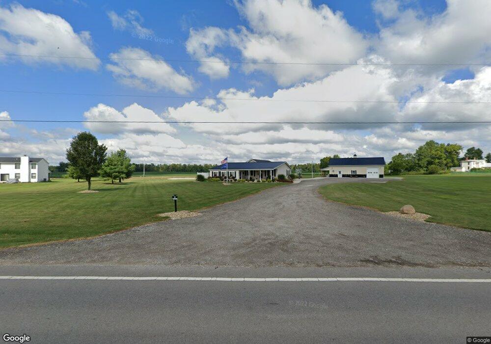
4575 Us Highway 42 S Delaware, OH 43015
Concord NeighborhoodEstimated Value: $399,000 - $476,000
3
Beds
2
Baths
2,106
Sq Ft
$208/Sq Ft
Est. Value
About This Home
This home is located at 4575 Us Highway 42 S, Delaware, OH 43015 and is currently estimated at $438,181, approximately $208 per square foot. 4575 Us Highway 42 S is a home located in Delaware County with nearby schools including Buckeye Valley High School.
Ownership History
Date
Name
Owned For
Owner Type
Purchase Details
Closed on
Sep 14, 2017
Sold by
Muir Robert J and Muir Margaret W
Bought by
Mills Charles and Mills Susan
Current Estimated Value
Home Financials for this Owner
Home Financials are based on the most recent Mortgage that was taken out on this home.
Original Mortgage
$454,775
Outstanding Balance
$378,538
Interest Rate
3.78%
Mortgage Type
VA
Estimated Equity
$59,643
Create a Home Valuation Report for This Property
The Home Valuation Report is an in-depth analysis detailing your home's value as well as a comparison with similar homes in the area
Home Values in the Area
Average Home Value in this Area
Purchase History
| Date | Buyer | Sale Price | Title Company |
|---|---|---|---|
| Mills Charles | -- | -- |
Source: Public Records
Mortgage History
| Date | Status | Borrower | Loan Amount |
|---|---|---|---|
| Open | Mills Charles | $454,775 |
Source: Public Records
Tax History Compared to Growth
Tax History
| Year | Tax Paid | Tax Assessment Tax Assessment Total Assessment is a certain percentage of the fair market value that is determined by local assessors to be the total taxable value of land and additions on the property. | Land | Improvement |
|---|---|---|---|---|
| 2024 | $3,374 | $97,170 | $24,750 | $72,420 |
| 2023 | $3,371 | $97,170 | $24,750 | $72,420 |
| 2022 | $3,163 | $82,360 | $15,400 | $66,960 |
| 2021 | $3,164 | $82,360 | $15,400 | $66,960 |
| 2020 | $3,184 | $82,360 | $15,400 | $66,960 |
| 2019 | $2,734 | $64,760 | $12,850 | $51,910 |
| 2018 | $2,777 | $64,760 | $12,850 | $51,910 |
| 2017 | $2,584 | $63,810 | $10,190 | $53,620 |
| 2016 | $2,566 | $63,810 | $10,190 | $53,620 |
| 2015 | $2,702 | $63,810 | $10,190 | $53,620 |
| 2014 | $2,547 | $63,810 | $10,190 | $53,620 |
| 2013 | $2,531 | $61,260 | $10,190 | $51,070 |
Source: Public Records
Map
Nearby Homes
- 5229 Bean Oller Rd
- 5310 S Section Line Rd
- 5701 Dublin Rd
- 0 Us-42 Tract 3
- 0 Us-42 Tract 4
- 5968 S Section Line Rd
- 4161 Clark Shaw Rd
- 4040 Clark Shaw Rd
- 4132 Bluebird Dr
- 0 S Section Line Rd Unit Tract 6 225024549
- 0 S Section Line Rd Unit Tract 5 225024546
- 0 S Section Line Rd Unit Tract 4B 225024545
- 0 S Section Line Rd Unit Tract 4A 225024542
- 0 S Section Line Rd Unit Tract 3 225024539
- 0 S Section Line Rd Unit Tract 2B 225024538
- 0 S Section Line Rd Unit Tract 2A 225024534
- 0 S Section Line Rd Unit Tract 1 225024531
- 6299 S Section Line Rd
- 3226 Bean Oller Rd
- 0 Clark-Shaw Rd Unit 225020834
- 4771 Riverside Dr
- 4801 Riverside Dr
- 4623 Riverside Dr
- 4823 Riverside Dr
- 5167 Bellepoint Rd
- 4637 Klondike Rd
- 5167 Bellepoint Rd
- 5164 Bellepoint Rd
- 4540 Us Highway 42 S
- 4877 Riverside Dr
- 4586 Klondike Rd
- 4488 Us Highway 42 S
- 4535 Klondike Rd
- 5000 Bellpointe Rd
- 4909 Riverside Dr
- 4548 Klondike Rd
- 4945 Riverside Dr
- 4500 Klondike Rd
- 4981 Riverside Dr
- 5141 Riverside Dr