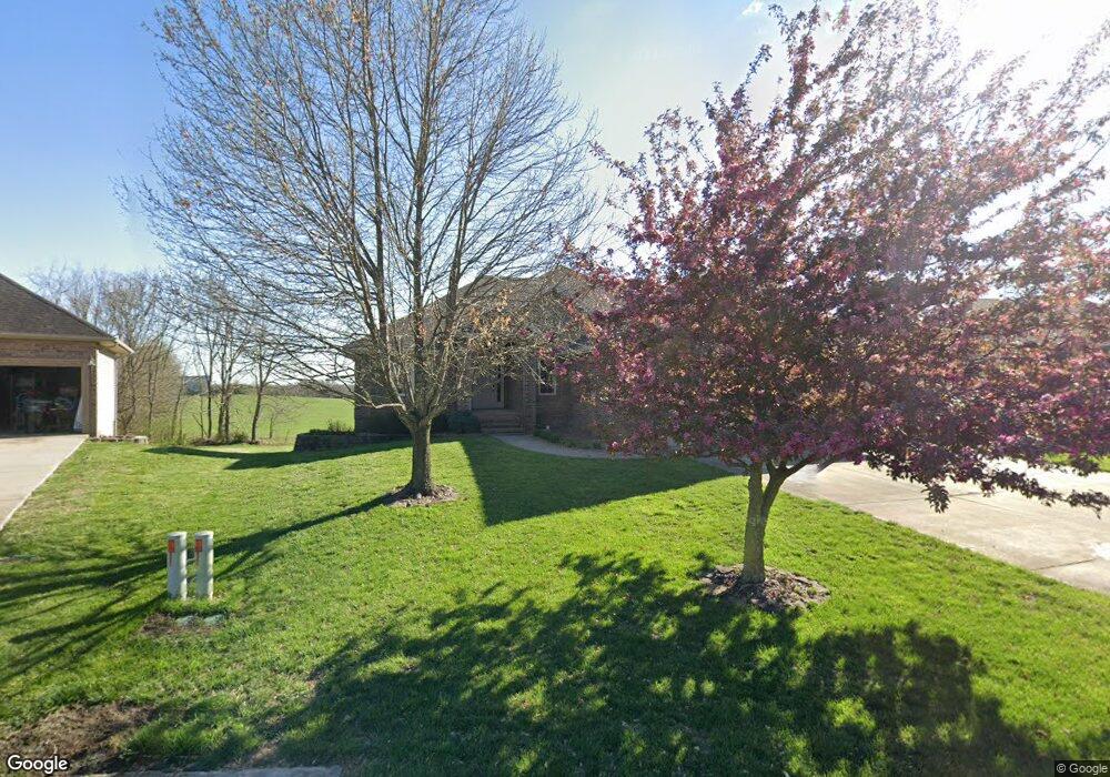
4576 E Fox Run Dr Springfield, MO 65802
Southeast Springfield NeighborhoodEstimated Value: $477,367 - $606,000
4
Beds
3
Baths
3,332
Sq Ft
$159/Sq Ft
Est. Value
About This Home
This home is located at 4576 E Fox Run Dr, Springfield, MO 65802 and is currently estimated at $531,342, approximately $159 per square foot. 4576 E Fox Run Dr is a home located in Greene County with nearby schools including Hickory Hills K-8 School, Glendale High School, and Grace Classical Academy.
Ownership History
Date
Name
Owned For
Owner Type
Purchase Details
Closed on
Jun 13, 2025
Sold by
Green Deborah L
Bought by
Deborah L Green Living Trust and Green
Current Estimated Value
Purchase Details
Closed on
Aug 25, 2005
Sold by
Parks Rick and Parks Becky
Bought by
Green Deborah L
Home Financials for this Owner
Home Financials are based on the most recent Mortgage that was taken out on this home.
Original Mortgage
$130,000
Interest Rate
5.78%
Mortgage Type
New Conventional
Create a Home Valuation Report for This Property
The Home Valuation Report is an in-depth analysis detailing your home's value as well as a comparison with similar homes in the area
Home Values in the Area
Average Home Value in this Area
Purchase History
| Date | Buyer | Sale Price | Title Company |
|---|---|---|---|
| Deborah L Green Living Trust | -- | None Listed On Document | |
| Deborah L Green Living Trust | -- | None Listed On Document | |
| Green Deborah L | -- | None Available |
Source: Public Records
Mortgage History
| Date | Status | Borrower | Loan Amount |
|---|---|---|---|
| Previous Owner | Green Deborah L | $130,000 |
Source: Public Records
Tax History
| Year | Tax Paid | Tax Assessment Tax Assessment Total Assessment is a certain percentage of the fair market value that is determined by local assessors to be the total taxable value of land and additions on the property. | Land | Improvement |
|---|---|---|---|---|
| 2025 | $3,701 | $69,140 | $12,350 | $56,790 |
| 2024 | $3,547 | $62,810 | $8,550 | $54,260 |
| 2023 | $3,564 | $62,810 | $8,550 | $54,260 |
| 2022 | $3,431 | $58,790 | $8,550 | $50,240 |
| 2021 | $3,249 | $58,790 | $8,550 | $50,240 |
| 2020 | $3,146 | $54,190 | $8,550 | $45,640 |
| 2019 | $3,062 | $54,190 | $8,550 | $45,640 |
| 2018 | $2,953 | $52,210 | $7,600 | $44,610 |
| 2017 | $2,925 | $48,560 | $7,600 | $40,960 |
| 2016 | $2,719 | $48,560 | $7,600 | $40,960 |
| 2015 | $2,697 | $48,560 | $7,600 | $40,960 |
| 2014 | $2,643 | $47,220 | $7,600 | $39,620 |
Source: Public Records
Map
Nearby Homes
- 4479 E Summerfield Dr
- 700 N Farm Road 193
- 1545 N Oakfair Place
- 4035 E Brookdale Terrace
- 4156 E Division St
- 1527 N Edgemont Cir
- 1581 N Oakfair Place
- 4464 E Lancaster Way
- 4818 E Silverado Rd
- 3953 E Windsmore Dr
- 1653 N Oakfair Place
- 4584 E Hidden Oak St
- 4671 E Beaux Creek Ln
- Lot 23 N Mumford Ct
- 4835 E Silverado Rd
- Lot 24 N Mumford Ct
- 1630 N Waterstone Ave
- 254 S Mumford Ct
- 1734 Marlowe Ave
- 3912 E Windsmore Dr
- 4582 E Fox Run Dr
- 4570 E Fox Run Dr
- 4577 E Fox Run Dr
- 4588 E Fox Run Dr
- 4583 E Fox Run Dr
- 4589 E Fox Run Dr
- 832 N Cedar Ridge Ave
- 4568 E Fox Run Dr
- 4571 E Fox Run Dr
- 820 N Cedar Ridge Ave
- 4594 E Fox Run Dr
- 4595 E Fox Run Dr
- 814 N Cedar Ridge Ave
- 4565 E Fox Run Dr
- 879 N Pearson Ct
- 878 N Pearson Ct
- 825 N Cedar Ridge Ave
- 831 N Cedar Ridge Ave
- 4559 E Fox Run Dr
- 885 N Pearson Ct
Your Personal Tour Guide
Ask me questions while you tour the home.