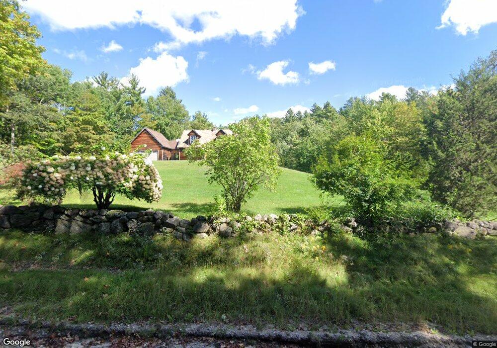
458 Height of Land Rd Grafton, NH 03240
Estimated Value: $440,000 - $528,000
4
Beds
2
Baths
2,096
Sq Ft
$231/Sq Ft
Est. Value
About This Home
This home is located at 458 Height of Land Rd, Grafton, NH 03240 and is currently estimated at $483,551, approximately $230 per square foot. 458 Height of Land Rd is a home with nearby schools including Canaan Elementary School, Indian River School, and Mascoma Valley Regional High School.
Ownership History
Date
Name
Owned For
Owner Type
Purchase Details
Closed on
Oct 15, 2013
Sold by
Petrin Valori M
Bought by
Donnelly Donna J
Current Estimated Value
Purchase Details
Closed on
Feb 20, 2002
Sold by
Petrin Matthew R
Bought by
Petrin Valori M
Home Financials for this Owner
Home Financials are based on the most recent Mortgage that was taken out on this home.
Original Mortgage
$97,000
Interest Rate
7.08%
Create a Home Valuation Report for This Property
The Home Valuation Report is an in-depth analysis detailing your home's value as well as a comparison with similar homes in the area
Home Values in the Area
Average Home Value in this Area
Purchase History
| Date | Buyer | Sale Price | Title Company |
|---|---|---|---|
| Donnelly Donna J | $200,000 | -- | |
| Donnelly Donna J | $200,000 | -- | |
| Petrin Valori M | $48,400 | -- | |
| Petrin Valori M | $48,400 | -- |
Source: Public Records
Mortgage History
| Date | Status | Borrower | Loan Amount |
|---|---|---|---|
| Previous Owner | Petrin Valori M | $97,000 |
Source: Public Records
Tax History Compared to Growth
Tax History
| Year | Tax Paid | Tax Assessment Tax Assessment Total Assessment is a certain percentage of the fair market value that is determined by local assessors to be the total taxable value of land and additions on the property. | Land | Improvement |
|---|---|---|---|---|
| 2024 | $7,286 | $238,100 | $60,000 | $178,100 |
| 2023 | $6,500 | $238,100 | $60,000 | $178,100 |
| 2022 | $6,310 | $238,100 | $60,000 | $178,100 |
| 2021 | $6,162 | $238,100 | $60,000 | $178,100 |
| 2020 | $6,393 | $238,100 | $60,000 | $178,100 |
| 2019 | $6,421 | $202,100 | $34,400 | $167,700 |
| 2018 | $5,818 | $202,100 | $34,400 | $167,700 |
| 2017 | $5,570 | $199,000 | $34,400 | $164,600 |
| 2016 | $5,202 | $199,000 | $34,400 | $164,600 |
| 2015 | $5,407 | $199,000 | $34,400 | $164,600 |
| 2014 | $4,271 | $187,400 | $41,100 | $146,300 |
| 2013 | $3,905 | $187,400 | $41,100 | $146,300 |
Source: Public Records
Map
Nearby Homes
- 0 Highland St
- 1145 Us Route 4
- 0 US Route 4 Unit 34 5038886
- 0 US Route 4 Unit 94
- 47 Nh Route 118
- 35 Canaan St
- 122 Northwood Estates Dr
- 21 Northwood Estates
- 33 Bruce Rd
- 1164 Main St
- 232 Kilton Pond Rd
- 0 Tunnel Rd Unit 727 5024585
- 0 Potato Rd Unit 75A
- 00 Corno Rd Unit 2
- 00 Corno Rd Unit 6
- 00 Corno Rd Unit 5
- 00 Corno Rd Unit 3
- 00 Corno Rd Unit 4
- 00 Corno Rd Unit 1
- 242 Jerusalem Rd
- 36 Spectacle Pond Rd
- 22 Spectacle Pond Rd
- 474 Height of Land Rd
- 463 Height of Land Rd
- 485 Mill Hill Rd
- 485 Height of Land Rd
- 50 Spectacle Pond Rd
- 495 Height of Land Rd
- 367 Glass Hill Rd
- 507 Height of Land Rd
- 376 Height of Land Rd
- 538 Height of Land Rd
- 560 Height of Land Rd
- 417 Height of Land Rd
- 432 Height of Land Rd
- 72 Spectacle Pond Rd
- 5 Spectacle Pond Rd
- 405 Height of Land Rd
- 18 Gunnerson Ln
- 14 Sugar Hill Rd