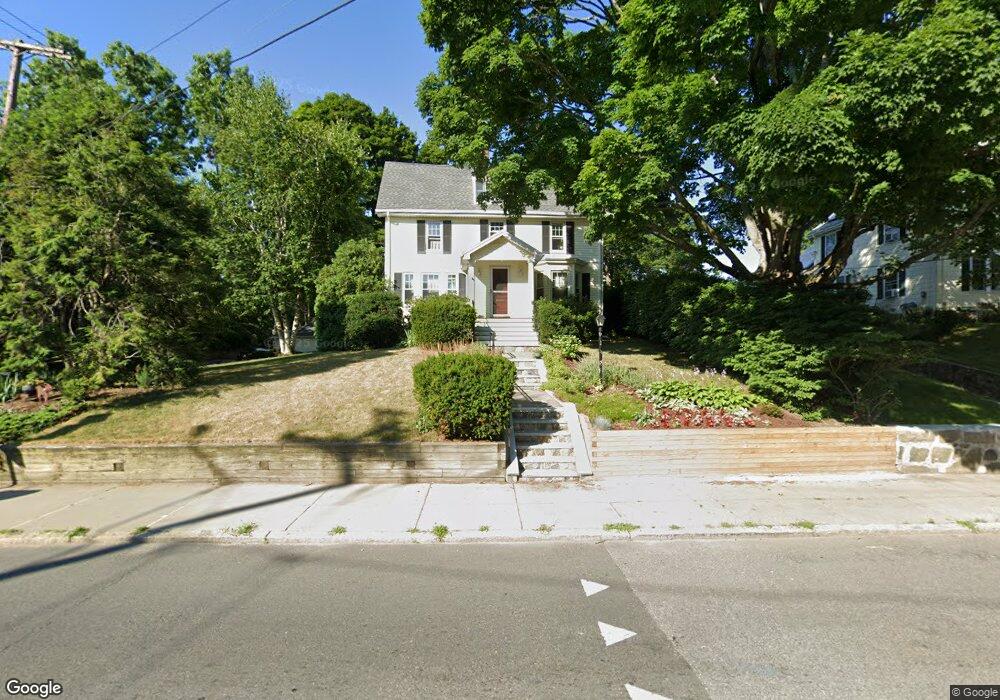
458 Lagrange St West Roxbury, MA 02132
West Roxbury NeighborhoodEstimated Value: $991,000 - $1,302,000
4
Beds
2
Baths
3,541
Sq Ft
$321/Sq Ft
Est. Value
About This Home
This home is located at 458 Lagrange St, West Roxbury, MA 02132 and is currently estimated at $1,137,130, approximately $321 per square foot. 458 Lagrange St is a home located in Suffolk County with nearby schools including St Theresa School, Holy Name Parish School, and The Roxbury Latin School.
Ownership History
Date
Name
Owned For
Owner Type
Purchase Details
Closed on
Sep 24, 2021
Sold by
Ammerman Jackie W and Ammerman Nancy T
Bought by
J W Ammerman T 2021
Current Estimated Value
Purchase Details
Closed on
May 28, 2003
Sold by
Snell Richard E and Snell Shirley H
Bought by
Ammerman Jackie W and Ammerman Nancy T
Home Financials for this Owner
Home Financials are based on the most recent Mortgage that was taken out on this home.
Original Mortgage
$349,650
Interest Rate
5.86%
Mortgage Type
Purchase Money Mortgage
Purchase Details
Closed on
Jan 30, 1995
Sold by
Merrick Edward M and Leone Donna M
Bought by
Snell Richard E and Snell Shirley H
Purchase Details
Closed on
Feb 19, 1988
Sold by
Bench John P
Bought by
Merrick Edward M
Create a Home Valuation Report for This Property
The Home Valuation Report is an in-depth analysis detailing your home's value as well as a comparison with similar homes in the area
Home Values in the Area
Average Home Value in this Area
Purchase History
| Date | Buyer | Sale Price | Title Company |
|---|---|---|---|
| J W Ammerman T 2021 | -- | None Available | |
| Ammerman Jackie W | $547,000 | -- | |
| Snell Richard E | $185,000 | -- | |
| Merrick Edward M | $176,500 | -- |
Source: Public Records
Mortgage History
| Date | Status | Borrower | Loan Amount |
|---|---|---|---|
| Previous Owner | Merrick Edward M | $225,000 | |
| Previous Owner | Merrick Edward M | $349,650 |
Source: Public Records
Tax History Compared to Growth
Tax History
| Year | Tax Paid | Tax Assessment Tax Assessment Total Assessment is a certain percentage of the fair market value that is determined by local assessors to be the total taxable value of land and additions on the property. | Land | Improvement |
|---|---|---|---|---|
| 2025 | $10,776 | $930,600 | $279,000 | $651,600 |
| 2024 | $9,274 | $850,800 | $280,000 | $570,800 |
| 2023 | $8,704 | $810,400 | $266,700 | $543,700 |
| 2022 | $8,016 | $736,800 | $242,500 | $494,300 |
| 2021 | $7,531 | $705,800 | $237,700 | $468,100 |
| 2020 | $6,935 | $656,700 | $211,600 | $445,100 |
| 2019 | $6,481 | $614,900 | $196,300 | $418,600 |
| 2018 | $5,967 | $569,400 | $196,300 | $373,100 |
| 2017 | $5,909 | $558,000 | $196,300 | $361,700 |
| 2016 | $5,959 | $541,700 | $196,300 | $345,400 |
| 2015 | $6,086 | $502,600 | $193,900 | $308,700 |
| 2014 | $5,964 | $474,100 | $193,900 | $280,200 |
Source: Public Records
Map
Nearby Homes
- 425 Lagrange St Unit 203
- 73 Dent St Unit 1
- 76 Potomac St
- 539 Lagrange St
- 27-29 Temple St
- 14 Sanborn Ave
- 54 Sturges Rd
- 183 Temple St
- 348 Lagrange St
- 110 Park St Unit 3
- 37 Hastings St Unit 103
- 59 Chesbrough Rd
- 28 Dow Rd
- 340 Baker St Unit 1
- 105 Chesbrough Rd
- 7 Cass St Unit 6
- 9 Carroll St
- 331 Vermont St
- 76 Vermont St
- 89 Dwinell St
- 462 Lagrange St
- 13 Dent St
- 9 Dent St
- 466 Lagrange St
- 10 Chapin Ave
- 17 Dent St Unit 2
- 17 Dent St Unit 1
- 17 Dent St
- 461 Lagrange St
- 12 Chapin Ave
- 470 Lagrange St Unit 2
- 470 Lagrange St Unit 1
- 6 Dent St Unit 2
- 465 Lagrange St
- 4-6 Dent St Unit 2
- 46 Dent St Unit 2
- 46 Dent St Unit 1
- 4 Dent St Unit 1
- 4 Dent St
- 4-6 Dent St