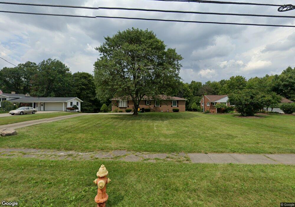
4580 Norquest Blvd Youngstown, OH 44515
Austintown NeighborhoodEstimated Value: $219,000 - $309,000
3
Beds
2
Baths
1,740
Sq Ft
$153/Sq Ft
Est. Value
About This Home
This home is located at 4580 Norquest Blvd, Youngstown, OH 44515 and is currently estimated at $266,732, approximately $153 per square foot. 4580 Norquest Blvd is a home located in Mahoning County with nearby schools including Austintown Elementary School, Austintown Intermediate School, and Austintown Middle School.
Ownership History
Date
Name
Owned For
Owner Type
Purchase Details
Closed on
Sep 10, 2020
Sold by
Terlesky Tod J
Bought by
Terlesky Tricia A
Current Estimated Value
Purchase Details
Closed on
Sep 10, 2011
Sold by
Terlesky Patricia A
Bought by
Terlesky Patricia A and Terlesky Theodore J
Purchase Details
Closed on
Aug 25, 2011
Sold by
Brooks Charles J
Bought by
Terlesky Patricia A
Purchase Details
Closed on
Jan 1, 1990
Bought by
Terlesky Patricia A
Create a Home Valuation Report for This Property
The Home Valuation Report is an in-depth analysis detailing your home's value as well as a comparison with similar homes in the area
Home Values in the Area
Average Home Value in this Area
Purchase History
| Date | Buyer | Sale Price | Title Company |
|---|---|---|---|
| Terlesky Tricia A | -- | None Available | |
| Terlesky Patricia A | -- | Commonwealth Suburban Title | |
| Terlesky Patricia A | -- | Commonwealth Suburban Title | |
| Terlesky Patricia A | -- | -- |
Source: Public Records
Tax History
| Year | Tax Paid | Tax Assessment Tax Assessment Total Assessment is a certain percentage of the fair market value that is determined by local assessors to be the total taxable value of land and additions on the property. | Land | Improvement |
|---|---|---|---|---|
| 2025 | $4,255 | $88,680 | $9,010 | $79,670 |
| 2024 | $4,062 | $88,680 | $9,010 | $79,670 |
| 2023 | $3,998 | $88,680 | $9,010 | $79,670 |
| 2022 | $3,314 | $58,920 | $9,010 | $49,910 |
| 2021 | $3,315 | $58,920 | $9,010 | $49,910 |
| 2020 | $3,329 | $58,920 | $9,010 | $49,910 |
| 2019 | $3,131 | $50,490 | $8,190 | $42,300 |
| 2018 | $3,163 | $50,490 | $8,190 | $42,300 |
| 2017 | $3,009 | $50,490 | $8,190 | $42,300 |
| 2016 | $2,718 | $45,150 | $8,190 | $36,960 |
| 2015 | $2,635 | $45,150 | $8,190 | $36,960 |
| 2014 | $2,647 | $45,150 | $8,190 | $36,960 |
| 2013 | $2,619 | $45,150 | $8,190 | $36,960 |
Source: Public Records
Map
Nearby Homes
- 151 N Yorkshire Blvd
- 181 N Yorkshire Blvd
- 97 Idlewood Rd
- 4258 Mahoning Ave
- 262 Idlewood Rd
- 225 S Raccoon Rd
- 406 S Raccoon Rd
- 179 S Beverly Ave
- 50 N Main St
- 603 S Raccoon Rd Unit 61
- 255 S Beverly Ave
- 0 Norquest Blvd Unit 5175953
- 0 Norquest Blvd Unit 5175593
- 527 N Raccoon Rd
- 220 Carnegie Ave
- 4828 Shadow Oak Dr
- 4876 Shadow Oak Dr
- 4888 Shadow Oak Dr
- 0 N Navarre Ave
- 613 N Raccoon Rd
- 4556 Norquest Blvd
- 4602 Norquest Blvd
- 4526 Norquest Blvd
- 4628 Norquest Blvd
- 4555 Norquest Blvd
- 4551 Norquest Blvd
- 4625 Norquest Blvd
- 4518 Norquest Blvd
- 4545 Norquest Blvd
- 4636 Norquest Blvd
- 4535 Norquest Blvd
- 4629 Norquest Blvd
- 4527 Norquest Blvd
- 4631 Norquest Blvd
- 4646 Norquest Blvd
- 4505 Norquest Blvd
- 4635 Norquest Blvd
- 4645 Norquest Blvd
- 4704 Norquest Blvd
- 14 Rheims Ave Unit 16
Your Personal Tour Guide
Ask me questions while you tour the home.