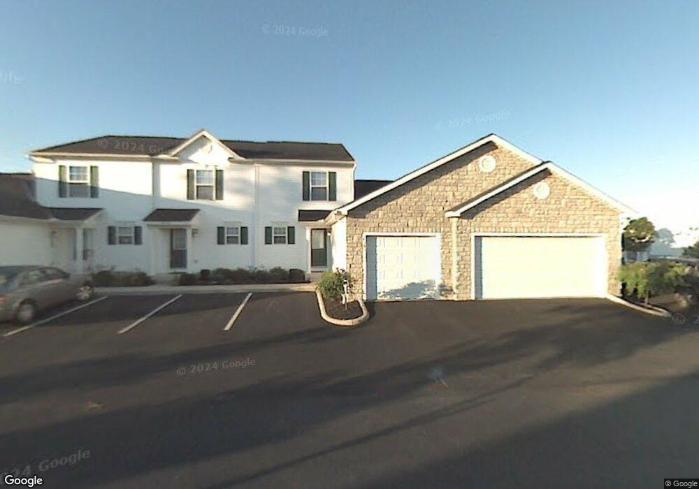
4583 Hobson Dr Unit 84D Columbus, OH 43228
Estimated Value: $195,100 - $206,000
2
Beds
2
Baths
1,280
Sq Ft
$157/Sq Ft
Est. Value
About This Home
This home is located at 4583 Hobson Dr Unit 84D, Columbus, OH 43228 and is currently estimated at $200,775, approximately $156 per square foot. 4583 Hobson Dr Unit 84D is a home located in Franklin County with nearby schools including Bolton Crossing Elementary School, Holt Crossing Intermediate School, and Pleasant View Middle School.
Ownership History
Date
Name
Owned For
Owner Type
Purchase Details
Closed on
Mar 21, 2003
Sold by
The Qualstan Corp
Bought by
Residential Condominium Holdings Ltd
Current Estimated Value
Home Financials for this Owner
Home Financials are based on the most recent Mortgage that was taken out on this home.
Original Mortgage
$878,990
Interest Rate
5.96%
Mortgage Type
Purchase Money Mortgage
Purchase Details
Closed on
Mar 18, 2003
Sold by
Residential Condominium Holdings Ltd
Bought by
Mora Ignacio
Home Financials for this Owner
Home Financials are based on the most recent Mortgage that was taken out on this home.
Original Mortgage
$878,990
Interest Rate
5.96%
Mortgage Type
Purchase Money Mortgage
Create a Home Valuation Report for This Property
The Home Valuation Report is an in-depth analysis detailing your home's value as well as a comparison with similar homes in the area
Home Values in the Area
Average Home Value in this Area
Purchase History
| Date | Buyer | Sale Price | Title Company |
|---|---|---|---|
| Residential Condominium Holdings Ltd | $775,000 | Connor Land Title | |
| Mora Ignacio | $98,900 | Connor Land Title |
Source: Public Records
Mortgage History
| Date | Status | Borrower | Loan Amount |
|---|---|---|---|
| Closed | Residential Condominium Holdings Ltd | $878,990 | |
| Closed | Mora Ignacio | $96,650 |
Source: Public Records
Tax History Compared to Growth
Tax History
| Year | Tax Paid | Tax Assessment Tax Assessment Total Assessment is a certain percentage of the fair market value that is determined by local assessors to be the total taxable value of land and additions on the property. | Land | Improvement |
|---|---|---|---|---|
| 2024 | $2,095 | $57,470 | $10,500 | $46,970 |
| 2023 | $2,058 | $57,470 | $10,500 | $46,970 |
| 2022 | $1,744 | $35,740 | $4,550 | $31,190 |
| 2021 | $1,779 | $35,740 | $4,550 | $31,190 |
| 2020 | $1,769 | $35,740 | $4,550 | $31,190 |
| 2019 | $1,542 | $27,480 | $3,500 | $23,980 |
| 2018 | $1,492 | $27,480 | $3,500 | $23,980 |
| 2017 | $1,488 | $27,480 | $3,500 | $23,980 |
| 2016 | $1,449 | $23,950 | $3,610 | $20,340 |
| 2015 | $1,449 | $23,950 | $3,610 | $20,340 |
| 2014 | $1,450 | $23,950 | $3,610 | $20,340 |
| 2013 | $845 | $28,140 | $4,235 | $23,905 |
Source: Public Records
Map
Nearby Homes
- 1865 Bashan Dr Unit 78E
- 1842 Bashan Dr Unit 75F
- 4650 Parrau Dr Unit 67E
- 4666 Shalers Dr Unit 49C
- 4686 Parrau Dr Unit 64A
- 4253 Demorest Cove Ct
- 3045 Alkire Rd
- 2209 Owl St
- 1599 Covina Dr
- 1925 Fortstone Ln Unit 1925
- 1870 Berrancher Dr Unit 1870
- 4462 Alameda Dr
- 1800 Georgesville Square Dr
- 4655 Parkwick Dr
- 2360 Bloxom St
- 2345 Demorest Rd
- 4419 Hammerton Dr Unit 13D
- 2157 Hierarch Ct
- 2487 Rosecrest St
- 2445 Linbaugh Rd
- 1968 Bashan Dr Unit 83A
- 4591 Hobson Dr Unit 85A
- 1997 Bashan Dr Unit 81A
- 4585 Hobson Dr Unit 84E
- 1995 Bashan Dr Unit 81B
- 1993 Bashan Dr Unit 81C
- 4593 Hobson Dr Unit 85B
- 4581 Hobson Dr Unit 84C
- 4597 Hobson Dr
- 4597 Hobson Dr Unit 85D
- 1991 Bashan Dr Unit 81D
- 4579 Hobson Dr Unit 84B
- 4595 Hobson Dr Unit 85C
- 1989 Bashan Dr Unit 81E
- 1976 Bashan Dr Unit 83E
- 1974 Bashan Dr Unit 83D
- 1972 Bashan Dr Unit 83C
- 4577 Hobson Dr Unit 84A
- 1970 Bashan Dr Unit 83B
- 4599 Hobson Dr Unit 85E