Estimated Value: $2,368,429 - $3,262,000
10
Beds
9
Baths
5,760
Sq Ft
$489/Sq Ft
Est. Value
About This Home
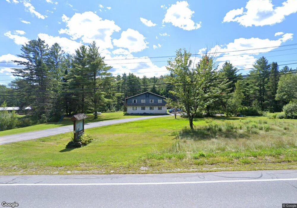
This home is located at 4583 Mountain Rd, Stowe, VT 05672 and is currently estimated at $2,815,215, approximately $488 per square foot. 4583 Mountain Rd is a home located in Lamoille County with nearby schools including Stowe Elementary School, Peoples Academy, and Mount Mansfield Ski Club & Academy.
Ownership History
Date
Name
Owned For
Owner Type
Purchase Details
Closed on
Nov 19, 2018
Sold by
Not Provided
Bought by
Castine Mountain Road Llc
Current Estimated Value
Purchase Details
Closed on
Sep 26, 2016
Sold by
Cook Carolyn and Cook William A
Bought by
Vtre Investments Llc
Purchase Details
Closed on
Aug 28, 1998
Sold by
Horman James N and Horman Christel
Bought by
Cook William A and Cook Carolyn
Create a Home Valuation Report for This Property
The Home Valuation Report is an in-depth analysis detailing your home's value as well as a comparison with similar homes in the area
Home Values in the Area
Average Home Value in this Area
Purchase History
| Date | Buyer | Sale Price | Title Company |
|---|---|---|---|
| Castine Mountain Road Llc | -- | -- | |
| Vtre Investments Llc | $450,000 | -- | |
| Cook William A | $350,000 | -- | |
| Cook William A | $350,000 | -- |
Source: Public Records
Mortgage History
| Date | Status | Borrower | Loan Amount |
|---|---|---|---|
| Closed | Vtre Investments Llc | $0 |
Source: Public Records
Tax History
| Year | Tax Paid | Tax Assessment Tax Assessment Total Assessment is a certain percentage of the fair market value that is determined by local assessors to be the total taxable value of land and additions on the property. | Land | Improvement |
|---|---|---|---|---|
| 2024 | $33,849 | $2,529,800 | $930,000 | $1,599,800 |
| 2023 | $19,343 | $926,000 | $363,000 | $563,000 |
| 2022 | $21,612 | $926,000 | $363,000 | $563,000 |
| 2021 | $21,124 | $926,000 | $363,000 | $563,000 |
| 2020 | $20,666 | $926,000 | $363,000 | $563,000 |
| 2019 | $19,612 | $926,000 | $363,000 | $563,000 |
| 2018 | $15,560 | $755,400 | $363,000 | $392,400 |
| 2017 | $8,645 | $431,900 | $256,800 | $175,100 |
| 2016 | $8,499 | $431,900 | $256,800 | $175,100 |
| 2015 | -- | $4,319 | $0 | $0 |
| 2014 | -- | $4,319 | $0 | $0 |
| 2013 | -- | $4,319 | $0 | $0 |
Source: Public Records
Map
Nearby Homes
- 235 Lower Sanborn Rd
- 56 Turner Mill Ln
- 327 Topnotch Dr Unit 327B
- 199 Topnotch Dr
- 654 Topnotch Dr Unit 654-B
- 646 Topnotch Dr Unit B
- 638 Topnotch Dr
- 608 Topnotch Dr Unit 608B
- 00 Robinson Springs Rd Unit 71
- 1209 Brook Rd Unit 16
- 185 Maple Rd
- 484 Edson Hill Rd Unit Lot 1 and Remainder
- 30 Natures Way Unit 8
- 7 Natures Way Unit WW 4
- 1307 Notchbrook Rd Unit 11 ABC
- 60 Landing Cir Unit 60-B
- 3148 Mountain Rd Unit B
- 3148 Mountain Rd Unit C
- 89 Houston Farm Rd
- 189 Upper Springs Rd
- 4527/4583 Mountain Rd
- 4527 Mountain Rd
- 4527 Mountain Rd Unit 6
- 4527 Mountain Rd Unit 4
- 4612 Mountain Rd
- 4538 Mountain Rd
- 4856 Mountain Rd
- 4494 Mountain Rd
- 4492 Mountain Rd
- 4492 Mountain Rd Unit 3
- 24 Hoadley Brook Ln
- 4515 Mountain Rd
- 95 Lower Sanborn Rd
- TBD 9a Hartson
- 88 Hoadley Brook Ln
- 4409 Mountain Rd
- 112 Hoadly Brook Ln
- 105 W Branch Ln
- Lot #5 Majestic Heights
- 0 Lot 3&4 Majestic Heights Rd Unit 4675478
Your Personal Tour Guide
Ask me questions while you tour the home.