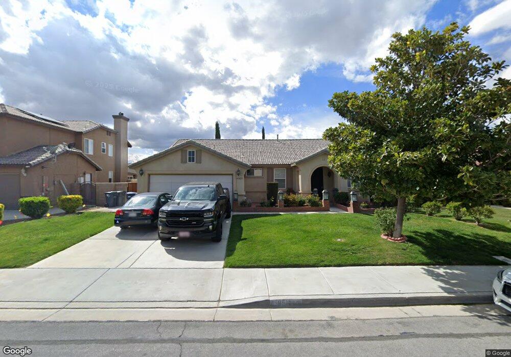
45851 17th St W Lancaster, CA 93534
Central Lancaster NeighborhoodEstimated Value: $441,148 - $494,000
3
Beds
2
Baths
1,860
Sq Ft
$253/Sq Ft
Est. Value
About This Home
This home is located at 45851 17th St W, Lancaster, CA 93534 and is currently estimated at $469,787, approximately $252 per square foot. 45851 17th St W is a home located in Los Angeles County with nearby schools including Desert View Elementary School, Piute Middle School, and Lancaster High School.
Ownership History
Date
Name
Owned For
Owner Type
Purchase Details
Closed on
Jul 1, 2014
Sold by
Delara Jose
Bought by
Delarmares Graciela
Current Estimated Value
Purchase Details
Closed on
Nov 14, 2000
Sold by
Mares Maria Esperanza
Bought by
Delara Jose Manuel
Purchase Details
Closed on
Sep 6, 2000
Sold by
Srhi Llc
Bought by
Delara Jose Manuel
Home Financials for this Owner
Home Financials are based on the most recent Mortgage that was taken out on this home.
Original Mortgage
$139,258
Interest Rate
7.86%
Mortgage Type
FHA
Create a Home Valuation Report for This Property
The Home Valuation Report is an in-depth analysis detailing your home's value as well as a comparison with similar homes in the area
Home Values in the Area
Average Home Value in this Area
Purchase History
| Date | Buyer | Sale Price | Title Company |
|---|---|---|---|
| Delarmares Graciela | -- | None Available | |
| Delara Jose Manuel | -- | Fidelity National Title Co | |
| Delara Jose Manuel | $140,500 | Fidelity National Title Co |
Source: Public Records
Mortgage History
| Date | Status | Borrower | Loan Amount |
|---|---|---|---|
| Previous Owner | Delara Jose Manuel | $139,258 |
Source: Public Records
Tax History
| Year | Tax Paid | Tax Assessment Tax Assessment Total Assessment is a certain percentage of the fair market value that is determined by local assessors to be the total taxable value of land and additions on the property. | Land | Improvement |
|---|---|---|---|---|
| 2025 | $4,016 | $209,901 | $53,825 | $156,076 |
| 2024 | $4,016 | $205,786 | $52,770 | $153,016 |
| 2023 | $3,935 | $201,752 | $51,736 | $150,016 |
| 2022 | $3,736 | $197,797 | $50,722 | $147,075 |
| 2021 | $3,341 | $193,920 | $49,728 | $144,192 |
| 2019 | $3,252 | $188,170 | $48,254 | $139,916 |
| 2018 | $3,197 | $184,481 | $47,308 | $137,173 |
| 2016 | $3,034 | $177,320 | $45,472 | $131,848 |
| 2015 | $2,998 | $174,657 | $44,789 | $129,868 |
| 2014 | $2,542 | $140,635 | $107,988 | $32,647 |
Source: Public Records
Map
Nearby Homes
- 1633 Regents St
- 45812 Caledonia Ct
- 1508 W Avenue h1
- 1751 W Avenue h5
- 90 Victoria Ave
- 0 Victoria Ave
- 0 Vic Ave G10 15 Stw Ave Unit 15 Stw
- 230 Victoria Ave
- 50 Victoria Ave
- 20 Stw Vic Ave F2
- 45724 Victoria Ave
- 45728 Balmoral Ct
- 1800 Windermere Dr
- 45733 Caledonia Ct
- 0 91 Stw Vic Ave G6
- 45664 Balmoral Ct
- 1811 W H5 Ave
- 45728 Barham Ave
- 45641 Knightsbridge St
- 45704 Barham Ave
- 45855 17th St W
- 45845 17th St W
- 45848 Knightsbridge St
- 45844 Knightsbridge St
- 45837 17th St W
- 45865 17th St W
- 45856 Knightsbridge St
- 1621 Sutherland St
- 45836 Knightsbridge St
- 45862 Knightsbridge St
- 1620 W Avenue h1
- 45831 17th St W
- 45832 Knightsbridge St
- 1615 Sutherland St
- 1620 Sutherland St
- 1614 W Avenue h1
- 45822 Knightsbridge St
- 1614 Sutherland St
- 45827 17th St W
- 1609 Sutherland St