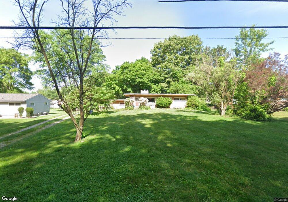
4588 Tweed Dr New Franklin, OH 44319
Estimated Value: $209,000 - $219,000
3
Beds
1
Bath
1,120
Sq Ft
$191/Sq Ft
Est. Value
About This Home
This home is located at 4588 Tweed Dr, New Franklin, OH 44319 and is currently estimated at $213,524, approximately $190 per square foot. 4588 Tweed Dr is a home located in Summit County with nearby schools including Nolley Elementary School, Manchester Middle School, and Manchester High School.
Ownership History
Date
Name
Owned For
Owner Type
Purchase Details
Closed on
Nov 2, 2006
Sold by
Gibson William R
Bought by
Thrasher John E and Thrasher Denise M
Current Estimated Value
Home Financials for this Owner
Home Financials are based on the most recent Mortgage that was taken out on this home.
Original Mortgage
$144,000
Outstanding Balance
$86,322
Interest Rate
6.45%
Mortgage Type
Purchase Money Mortgage
Estimated Equity
$127,202
Create a Home Valuation Report for This Property
The Home Valuation Report is an in-depth analysis detailing your home's value as well as a comparison with similar homes in the area
Home Values in the Area
Average Home Value in this Area
Purchase History
| Date | Buyer | Sale Price | Title Company |
|---|---|---|---|
| Thrasher John E | $144,000 | Title One |
Source: Public Records
Mortgage History
| Date | Status | Borrower | Loan Amount |
|---|---|---|---|
| Open | Thrasher John E | $144,000 |
Source: Public Records
Tax History Compared to Growth
Tax History
| Year | Tax Paid | Tax Assessment Tax Assessment Total Assessment is a certain percentage of the fair market value that is determined by local assessors to be the total taxable value of land and additions on the property. | Land | Improvement |
|---|---|---|---|---|
| 2025 | $2,804 | $56,399 | $10,640 | $45,759 |
| 2024 | $2,804 | $56,399 | $10,640 | $45,759 |
| 2023 | $2,804 | $56,399 | $10,640 | $45,759 |
| 2022 | $2,362 | $40,576 | $7,655 | $32,921 |
| 2021 | $2,365 | $40,576 | $7,655 | $32,921 |
| 2020 | $2,300 | $40,580 | $7,660 | $32,920 |
| 2019 | $2,498 | $40,600 | $6,120 | $34,480 |
| 2018 | $2,471 | $40,600 | $6,120 | $34,480 |
| 2017 | $2,291 | $40,600 | $6,120 | $34,480 |
| 2016 | $2,203 | $33,770 | $6,120 | $27,650 |
| 2015 | $2,291 | $34,630 | $6,980 | $27,650 |
| 2014 | $2,296 | $34,630 | $6,980 | $27,650 |
| 2013 | $2,267 | $34,700 | $6,980 | $27,720 |
Source: Public Records
Map
Nearby Homes
- 0 W Turkeyfoot Lake Rd Unit 5157637
- 4973 Patricia Dr
- 1343 Vermillion Dr
- 4216 State Rd
- 1365 Vanderhoof Rd
- 4393 Hilltop Dr
- 538 Melcher Ave
- 4034 Manchester Rd
- 4131 State Park Dr
- 4119 Melton Ave
- 855 Fowler Ave
- 715 Jolson Ave
- 3826 Powell Ave
- 410 Silk Ct
- 3738 Random Dr
- 834 State Mill Rd
- 3739 Bower Ave
- 4944 Coleman Dr
- 4869 Coleman Dr
- 1742 Turkeyfoot Lake Rd