Estimated Value: $372,657 - $426,000
--
Bed
4
Baths
1,850
Sq Ft
$211/Sq Ft
Est. Value
About This Home
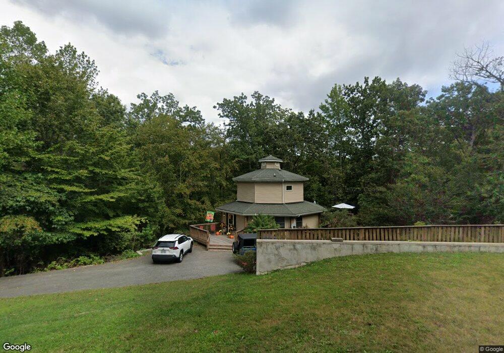
This home is located at 459 Bronco Trail, Lusby, MD 20657 and is currently estimated at $389,914, approximately $210 per square foot. 459 Bronco Trail is a home located in Calvert County with nearby schools including Patuxent Appeal Elementary Campus, Mill Creek Middle School, and Patuxent High School.
Ownership History
Date
Name
Owned For
Owner Type
Purchase Details
Closed on
May 22, 2013
Sold by
Brownle David C and Maholick Melanie
Bought by
Pierson Kathy Marie
Current Estimated Value
Home Financials for this Owner
Home Financials are based on the most recent Mortgage that was taken out on this home.
Original Mortgage
$242,857
Outstanding Balance
$171,703
Interest Rate
3.43%
Mortgage Type
New Conventional
Estimated Equity
$218,211
Purchase Details
Closed on
Feb 24, 2010
Sold by
Brownlee David
Bought by
Brownlee David C and Brownlee Melanie Maholick
Purchase Details
Closed on
Jul 13, 1998
Sold by
Brownlee Stella G
Bought by
Brownlee David
Create a Home Valuation Report for This Property
The Home Valuation Report is an in-depth analysis detailing your home's value as well as a comparison with similar homes in the area
Home Values in the Area
Average Home Value in this Area
Purchase History
| Date | Buyer | Sale Price | Title Company |
|---|---|---|---|
| Pierson Kathy Marie | $238,000 | None Available | |
| Brownlee David C | -- | -- | |
| Brownlee David | $7,500 | -- |
Source: Public Records
Mortgage History
| Date | Status | Borrower | Loan Amount |
|---|---|---|---|
| Open | Pierson Kathy Marie | $242,857 |
Source: Public Records
Tax History Compared to Growth
Tax History
| Year | Tax Paid | Tax Assessment Tax Assessment Total Assessment is a certain percentage of the fair market value that is determined by local assessors to be the total taxable value of land and additions on the property. | Land | Improvement |
|---|---|---|---|---|
| 2025 | $3,330 | $296,067 | $0 | $0 |
| 2024 | $3,330 | $270,133 | $0 | $0 |
| 2023 | $2,691 | $244,200 | $55,200 | $189,000 |
| 2022 | $2,460 | $236,767 | $0 | $0 |
| 2021 | $5,772 | $229,333 | $0 | $0 |
| 2020 | $2,737 | $221,900 | $55,200 | $166,700 |
| 2019 | $2,314 | $220,600 | $0 | $0 |
| 2018 | $2,300 | $219,300 | $0 | $0 |
| 2017 | $2,590 | $218,000 | $0 | $0 |
| 2016 | -- | $208,400 | $0 | $0 |
| 2015 | $2,736 | $198,800 | $0 | $0 |
| 2014 | $2,736 | $189,200 | $0 | $0 |
Source: Public Records
Map
Nearby Homes
- 463 Bronco Trail
- 12501 San Jose Ct
- 12476 Catalina Dr
- 12447 El Segunda Ln
- 428 Buffalo Rd
- 502 Dodge Trail
- 513 Cody Trail
- 1049 Golden Way W
- 12407 Tahoe Ct
- 12284 Bandera Ln
- 1076 San Angelo Dr
- 542 Chisholm Trail
- 634 Silver Rock Rd
- 12439 Rimrock Ln
- 1078 Fort Sill Trail
- 12375 Algonquin Trail
- 356 Clubhouse Dr
- 12115 Tall Pine Trail
- 12667 Amarillo Dr
- 12361 Silver Rock Cir
- 455 Bronco Trail
- 416 Round up Rd
- 458 Bronco Trail
- 12505 San Jose Ct
- 12497 San Jose Ct
- 469 Bronco Trail
- 451 Round up Rd
- 12509 San Jose Ct
- 425 Round up Rd
- 468 Bronco Trail
- 420 Round up Rd
- 465 Round up Rd
- 424 Round up Rd
- 12485 Hisperia Rd
- 12481 Hisperia Rd
- 12517 San Jose Ct
- 452 Round up Rd
- 471 Round up Rd
- 473 Bronco Trail
- 12489 San Jose Ct