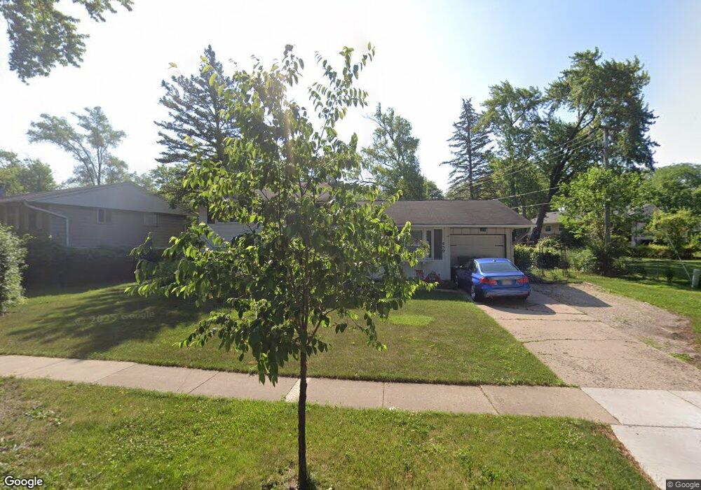
459 White Pine Rd Buffalo Grove, IL 60089
South Buffalo Grove NeighborhoodEstimated Value: $326,000 - $439,000
3
Beds
2
Baths
1,083
Sq Ft
$361/Sq Ft
Est. Value
About This Home
This home is located at 459 White Pine Rd, Buffalo Grove, IL 60089 and is currently estimated at $391,128, approximately $361 per square foot. 459 White Pine Rd is a home located in Cook County with nearby schools including Henry W Longfellow Elementary School, Cooper Middle School, and Buffalo Grove High School.
Ownership History
Date
Name
Owned For
Owner Type
Purchase Details
Closed on
Mar 30, 2000
Sold by
Kruckman Jeffrey T and Kruckman Susan R
Bought by
Wziontka Timothy J and Soto Rosalinda C
Current Estimated Value
Home Financials for this Owner
Home Financials are based on the most recent Mortgage that was taken out on this home.
Original Mortgage
$203,000
Outstanding Balance
$66,090
Interest Rate
8.39%
Mortgage Type
VA
Estimated Equity
$325,038
Create a Home Valuation Report for This Property
The Home Valuation Report is an in-depth analysis detailing your home's value as well as a comparison with similar homes in the area
Home Values in the Area
Average Home Value in this Area
Purchase History
| Date | Buyer | Sale Price | Title Company |
|---|---|---|---|
| Wziontka Timothy J | $202,000 | -- |
Source: Public Records
Mortgage History
| Date | Status | Borrower | Loan Amount |
|---|---|---|---|
| Open | Wziontka Timothy J | $203,000 |
Source: Public Records
Tax History
| Year | Tax Paid | Tax Assessment Tax Assessment Total Assessment is a certain percentage of the fair market value that is determined by local assessors to be the total taxable value of land and additions on the property. | Land | Improvement |
|---|---|---|---|---|
| 2025 | $6,732 | $31,001 | $8,453 | $22,548 |
| 2024 | $6,732 | $27,000 | $7,245 | $19,755 |
| 2023 | $7,261 | $27,000 | $7,245 | $19,755 |
| 2022 | $7,261 | $27,000 | $7,245 | $19,755 |
| 2021 | $7,420 | $24,333 | $4,628 | $19,705 |
| 2020 | $7,299 | $24,333 | $4,628 | $19,705 |
| 2019 | $7,291 | $26,977 | $4,628 | $22,349 |
| 2018 | $6,998 | $23,755 | $4,025 | $19,730 |
| 2017 | $6,889 | $23,755 | $4,025 | $19,730 |
| 2016 | $6,676 | $23,755 | $4,025 | $19,730 |
| 2015 | $6,350 | $21,316 | $3,421 | $17,895 |
| 2014 | $6,263 | $21,316 | $3,421 | $17,895 |
| 2013 | $5,771 | $21,316 | $3,421 | $17,895 |
Source: Public Records
Map
Nearby Homes
- 517 Longwood Dr
- 267 Timber Hill Rd
- 170 Cherrywood Rd
- 800 Weidner Rd Unit 208
- 671 Hapsfield Ln Unit 105
- 462 Longwood Dr
- 271 Terrace Place
- 820 Weidner Rd Unit 4013
- 820 Weidner Rd Unit 409
- 621 Hapsfield Ln Unit 103
- 334 Stillwell Dr
- 496 Raupp Blvd
- 760 Weidner Rd Unit 107
- 760 Weidner Rd Unit 307
- 631 Hapsfield Ln Unit 631106
- 1096 Beechwood Rd
- 3401 N Carriageway Dr Unit 208
- 3451 N Carriageway Dr Unit 305
- 222 Saint Marys Pkwy
- 8 Oak Creek Dr Unit 2802
- 477 White Pine Rd
- 648 Elmwood Dr
- 441 White Pine Rd
- 636 Elmwood Dr
- 628 Elmwood Dr
- 622 Elmwood Dr
- 433 White Pine Rd
- 466 White Pine Rd
- 450 White Pine Rd
- 458 White Pine Rd
- 442 White Pine Rd
- 476 White Pine Rd
- 436 White Pine Rd
- 616 Elmwood Dr
- 484 White Pine Rd
- 425 White Pine Rd
- 657 Elmwood Dr Unit 6
- 428 White Pine Rd
- 494 White Pine Rd
- 608 Elmwood Dr
Your Personal Tour Guide
Ask me questions while you tour the home.