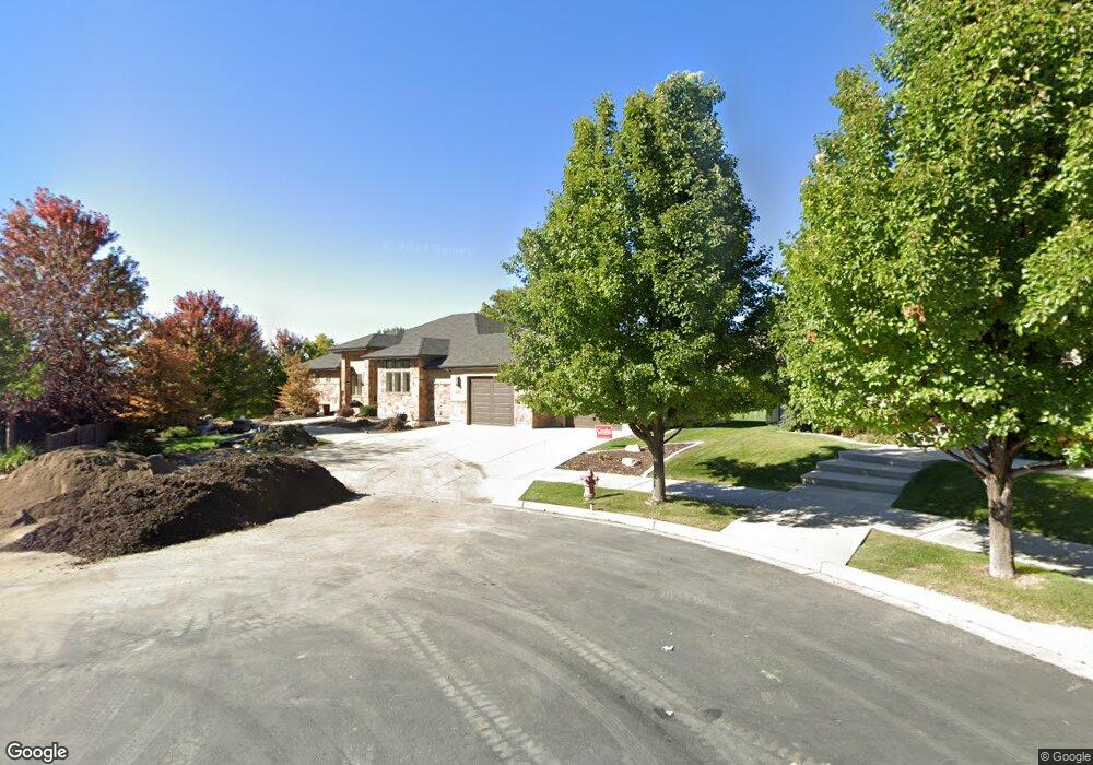
4595 N 425 E Provo, UT 84604
Rock Canyon NeighborhoodEstimated Value: $1,027,000 - $1,312,912
5
Beds
4
Baths
4,604
Sq Ft
$260/Sq Ft
Est. Value
About This Home
This home is located at 4595 N 425 E, Provo, UT 84604 and is currently estimated at $1,199,304, approximately $260 per square foot. 4595 N 425 E is a home located in Utah County with nearby schools including Canyon Crest Elementary School, Centennial Middle School, and Timpview High School.
Ownership History
Date
Name
Owned For
Owner Type
Purchase Details
Closed on
Apr 26, 2023
Sold by
Kim Christopher
Bought by
Tamela G Blake Irrevocable Trust
Current Estimated Value
Purchase Details
Closed on
May 15, 2014
Sold by
Alward William Taylor
Bought by
Kim Christopher and Kim Seongmi
Home Financials for this Owner
Home Financials are based on the most recent Mortgage that was taken out on this home.
Original Mortgage
$280,000
Interest Rate
4.31%
Mortgage Type
New Conventional
Purchase Details
Closed on
Jul 31, 2013
Sold by
Alward William T and Alward Susan E
Bought by
Alward William Taylor and Alward Susan Eileen
Purchase Details
Closed on
Jul 28, 2010
Sold by
Armada Investments Lp
Bought by
Alward William T and Alward Susan E
Purchase Details
Closed on
Feb 9, 2007
Sold by
Utah Land Group Inc
Bought by
Armada Investments Lp
Create a Home Valuation Report for This Property
The Home Valuation Report is an in-depth analysis detailing your home's value as well as a comparison with similar homes in the area
Home Values in the Area
Average Home Value in this Area
Purchase History
| Date | Buyer | Sale Price | Title Company |
|---|---|---|---|
| Tamela G Blake Irrevocable Trust | -- | Bartlett Title | |
| Kim Christopher | -- | Greenbrier Title Insurance | |
| Alward William Taylor | -- | None Available | |
| Alward William T | -- | Backman | |
| Armada Investments Lp | -- | First American Title Prov |
Source: Public Records
Mortgage History
| Date | Status | Borrower | Loan Amount |
|---|---|---|---|
| Previous Owner | Kim Christopher | $280,000 |
Source: Public Records
Tax History
| Year | Tax Paid | Tax Assessment Tax Assessment Total Assessment is a certain percentage of the fair market value that is determined by local assessors to be the total taxable value of land and additions on the property. | Land | Improvement |
|---|---|---|---|---|
| 2025 | $6,018 | $587,895 | -- | -- |
| 2024 | $6,018 | $592,405 | $0 | $0 |
| 2023 | $6,335 | $614,735 | $0 | $0 |
| 2022 | $5,883 | $575,630 | $0 | $0 |
| 2021 | $4,936 | $842,400 | $396,100 | $446,300 |
| 2020 | $4,915 | $786,300 | $344,400 | $441,900 |
| 2019 | $4,726 | $786,300 | $344,400 | $441,900 |
| 2018 | $4,512 | $761,300 | $344,400 | $416,900 |
| 2017 | $3,490 | $323,620 | $0 | $0 |
| 2016 | $3,653 | $315,700 | $0 | $0 |
| 2015 | $3,589 | $313,500 | $0 | $0 |
| 2014 | $3,030 | $275,880 | $0 | $0 |
Source: Public Records
Map
Nearby Homes
- 645 Foothill Dr
- 285 Three Fountains Dr
- 4601 Foothill Dr
- 221 E 4735 N
- 4606 Brookshire Cir
- 4640 Brookshire Cir
- 299 E 4000 N
- 5005 N Edgewood Dr Unit 310
- 4380 Stone Creek Ln
- 981 Waterford Dr Unit 5&6
- 407 E 3900 Rd N Unit 1
- 407 E 3900 Rd N
- 1085 Windsor Dr
- 4612 N Bristol Cir
- 4299 Ivy Ln
- 4529 Windsor Dr
- 3711 N Canyon Rd
- 80 N 1200 E
- 4277 N Imperial Way Unit 347
- 3702 N 920 E
- 4595 N 425 E Unit 4
- 4589 N 425 E
- 4592 N 425 E
- 4592 N 425 E Unit 5
- 4586 N 425 E
- 4586 N 425 E Unit 6
- 4567 N 425 E
- 4567 N 425 E Unit 2
- 4564 N 425 E
- 4587 N 475 E Unit 11
- 4587 N 475 E
- 4593 N 475 E Unit res
- 4593 N 475 E
- 4593 N 475 E Unit 12
- 4541 N 425 E Unit 1
- 4541 N 425 E
- 4541 N 425 E Unit 4541
- 4538 N 425 E Unit 8
- 4565 N 475 E
- 4596 N 475 E Unit 13
Your Personal Tour Guide
Ask me questions while you tour the home.