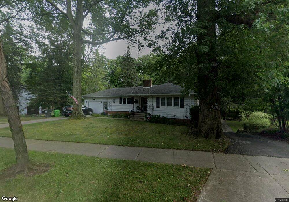
4596 Anderson Rd Cleveland, OH 44121
Estimated Value: $173,000 - $223,000
3
Beds
2
Baths
1,144
Sq Ft
$173/Sq Ft
Est. Value
About This Home
This home is located at 4596 Anderson Rd, Cleveland, OH 44121 and is currently estimated at $198,408, approximately $173 per square foot. 4596 Anderson Rd is a home located in Cuyahoga County with nearby schools including Adrian Elementary School, Greenview Upper Elementary School, and Memorial Junior High School.
Ownership History
Date
Name
Owned For
Owner Type
Purchase Details
Closed on
Aug 11, 2017
Sold by
Whipkey Tami and Whipkey Tami R
Bought by
Frank David M
Current Estimated Value
Home Financials for this Owner
Home Financials are based on the most recent Mortgage that was taken out on this home.
Original Mortgage
$56,700
Outstanding Balance
$30,241
Interest Rate
3.88%
Mortgage Type
New Conventional
Estimated Equity
$168,167
Purchase Details
Closed on
May 17, 2004
Sold by
Garfield Frank
Bought by
Heitman Michael and Heitman Tami R
Home Financials for this Owner
Home Financials are based on the most recent Mortgage that was taken out on this home.
Original Mortgage
$74,400
Interest Rate
5.25%
Mortgage Type
Purchase Money Mortgage
Purchase Details
Closed on
Jan 1, 1989
Bought by
Dewitt Helen E
Create a Home Valuation Report for This Property
The Home Valuation Report is an in-depth analysis detailing your home's value as well as a comparison with similar homes in the area
Home Values in the Area
Average Home Value in this Area
Purchase History
| Date | Buyer | Sale Price | Title Company |
|---|---|---|---|
| Frank David M | $63,000 | Guardian Title | |
| Heitman Michael | $93,000 | Certified Title Agency Inc | |
| Dewitt Helen E | -- | -- |
Source: Public Records
Mortgage History
| Date | Status | Borrower | Loan Amount |
|---|---|---|---|
| Open | Frank David M | $56,700 | |
| Previous Owner | Heitman Michael | $74,400 |
Source: Public Records
Tax History Compared to Growth
Tax History
| Year | Tax Paid | Tax Assessment Tax Assessment Total Assessment is a certain percentage of the fair market value that is determined by local assessors to be the total taxable value of land and additions on the property. | Land | Improvement |
|---|---|---|---|---|
| 2024 | $4,084 | $52,640 | $15,225 | $37,415 |
| 2023 | $3,655 | $37,910 | $10,750 | $27,160 |
| 2022 | $3,636 | $37,905 | $10,745 | $27,160 |
| 2021 | $3,608 | $37,910 | $10,750 | $27,160 |
| 2020 | $3,566 | $32,690 | $9,280 | $23,420 |
| 2019 | $3,216 | $92,000 | $26,500 | $65,500 |
| 2018 | $3,421 | $32,200 | $9,280 | $22,930 |
| 2017 | $3,841 | $35,180 | $9,240 | $25,940 |
| 2016 | $3,818 | $35,180 | $9,240 | $25,940 |
| 2015 | $3,619 | $35,180 | $9,240 | $25,940 |
| 2014 | $3,619 | $35,180 | $9,240 | $25,940 |
Source: Public Records
Map
Nearby Homes
- 4532 Anderson Rd
- 4561 Wilburn Dr
- 4591 Wilburn Dr
- 4742 Anderson Rd
- 4616 Mcfarland Rd
- 4643 Monticello Blvd
- 4769 Edenwood Rd
- 981 Hanley Rd
- 4765 Monticello Blvd
- 4781 Dorshwood Rd
- 4880 Anderson Rd
- 4859 Delevan Dr
- 4669 Liberty Rd
- 4832 Monticello Blvd
- 963 Chelston Rd
- 4785 Donald Ave
- 4650 Liberty Rd
- 4866 Fairlawn Rd
- 1271 Dorsh Rd
- 4927 Delevan Dr
- 4600 Anderson Rd
- 4584 Anderson Rd
- 4595 Anderson Rd
- 4603 Anderson Rd
- 4599 Anderson Rd
- 4607 Anderson Rd
- 4597 Anderson Rd
- 4572 Anderson Rd
- 4611 Anderson Rd
- 4630 Anderson Rd
- 942 King George Blvd
- 4587 Anderson Rd
- 4564 Anderson Rd
- 4620 Anderson Rd
- 4632 Anderson Rd
- 4573 Anderson Rd
- 4634 Anderson Rd
- 936 King George Blvd
- 4550 Anderson Rd
- 943 Stuart Dr