Estimated Value: $330,653 - $342,000
4
Beds
3
Baths
2,479
Sq Ft
$136/Sq Ft
Est. Value
About This Home
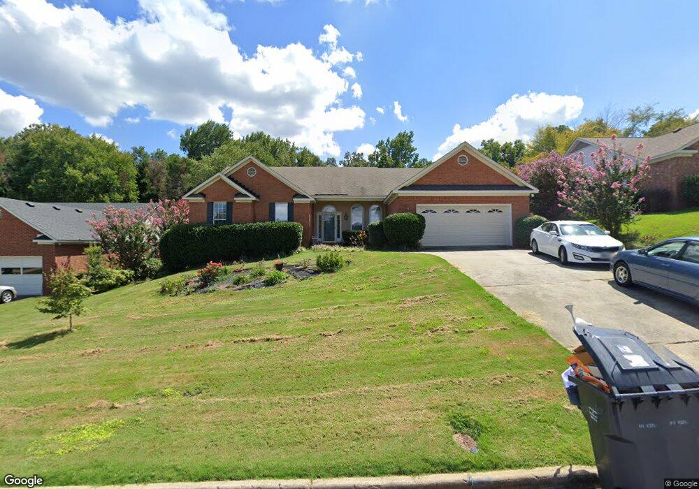
This home is located at 4596 Oxford Dr, Evans, GA 30809 and is currently estimated at $337,413, approximately $136 per square foot. 4596 Oxford Dr is a home located in Columbia County with nearby schools including Evans Elementary School, John F. Kennedy Middle School, and Evans Middle School.
Ownership History
Date
Name
Owned For
Owner Type
Purchase Details
Closed on
Apr 28, 2017
Sold by
Stewart Jason A
Bought by
Vos Stanley J and Vos Elizabeth A
Current Estimated Value
Home Financials for this Owner
Home Financials are based on the most recent Mortgage that was taken out on this home.
Original Mortgage
$204,000
Outstanding Balance
$169,432
Interest Rate
4.14%
Mortgage Type
VA
Estimated Equity
$167,981
Purchase Details
Closed on
Jun 5, 2001
Sold by
Stewart Jason A and Stewart Shelia M
Bought by
Stewart Jason A and Stewart Shelia M
Create a Home Valuation Report for This Property
The Home Valuation Report is an in-depth analysis detailing your home's value as well as a comparison with similar homes in the area
Home Values in the Area
Average Home Value in this Area
Purchase History
| Date | Buyer | Sale Price | Title Company |
|---|---|---|---|
| Vos Stanley J | $204,000 | -- | |
| Stewart Jason A | $52,400 | -- |
Source: Public Records
Mortgage History
| Date | Status | Borrower | Loan Amount |
|---|---|---|---|
| Open | Vos Stanley J | $204,000 |
Source: Public Records
Tax History Compared to Growth
Tax History
| Year | Tax Paid | Tax Assessment Tax Assessment Total Assessment is a certain percentage of the fair market value that is determined by local assessors to be the total taxable value of land and additions on the property. | Land | Improvement |
|---|---|---|---|---|
| 2025 | $3,176 | $130,725 | $23,804 | $106,921 |
| 2024 | $3,184 | $125,120 | $23,804 | $101,316 |
| 2023 | $3,184 | $128,846 | $20,604 | $108,242 |
| 2022 | $2,921 | $110,159 | $20,604 | $89,555 |
| 2021 | $2,932 | $105,709 | $19,304 | $86,405 |
| 2020 | $2,578 | $90,754 | $17,104 | $73,650 |
| 2019 | $2,668 | $93,983 | $17,604 | $76,379 |
| 2018 | $2,332 | $81,600 | $15,404 | $66,196 |
| 2017 | $2,317 | $80,777 | $15,304 | $65,473 |
| 2016 | $2,188 | $79,011 | $14,180 | $64,831 |
| 2015 | $2,211 | $79,720 | $13,980 | $65,740 |
| 2014 | $2,044 | $72,592 | $13,280 | $59,312 |
Source: Public Records
Map
Nearby Homes
- 4586 Oxford Ct
- 4597 Gray Ln
- 4569 Gray Ln
- 489 Connemara Trail
- 586 Gibbs Rd
- 217 Dry Creek Rd
- 231 Dry Creek Rd
- 4421 Hereford Farm Rd
- 4560 Mulberry Creek Dr
- 5068 Hereford Farm Rd
- 4517 Glennwood Dr
- 464 Rachel Dr
- 4648 Leeward Dr
- 525 Pheasant Run Dr
- 245 Belair Rd N
- 4558 Glenda Ln
- 4521 Zola Dr
- 4709 Walnut Hill Dr
- 385 Canterbury Dr
- 599 Windward Ct
- 4594 Oxford Dr
- 4598 Oxford Dr
- 4600 Oxford Dr
- 4592 Oxford Dr
- 4593 Oxford Dr
- 4589 Oxford Dr
- 4602 Oxford Dr
- 4520 Hereford Farm Rd
- 4587 Oxford Dr
- 4590 Oxford Dr
- 4522 Hereford Farm Rd
- 4518 Hereford Farm Rd 2co
- 4518 Hereford Farm Rd
- 4604 Sheffield Dr
- 4605 Sheffield Dr
- 4585 Oxford Dr
- 4595 Oxford Dr
- 4606 Nottingham Dr
- 4526 Hereford Farm Rd
- 4606 Sheffield Dr