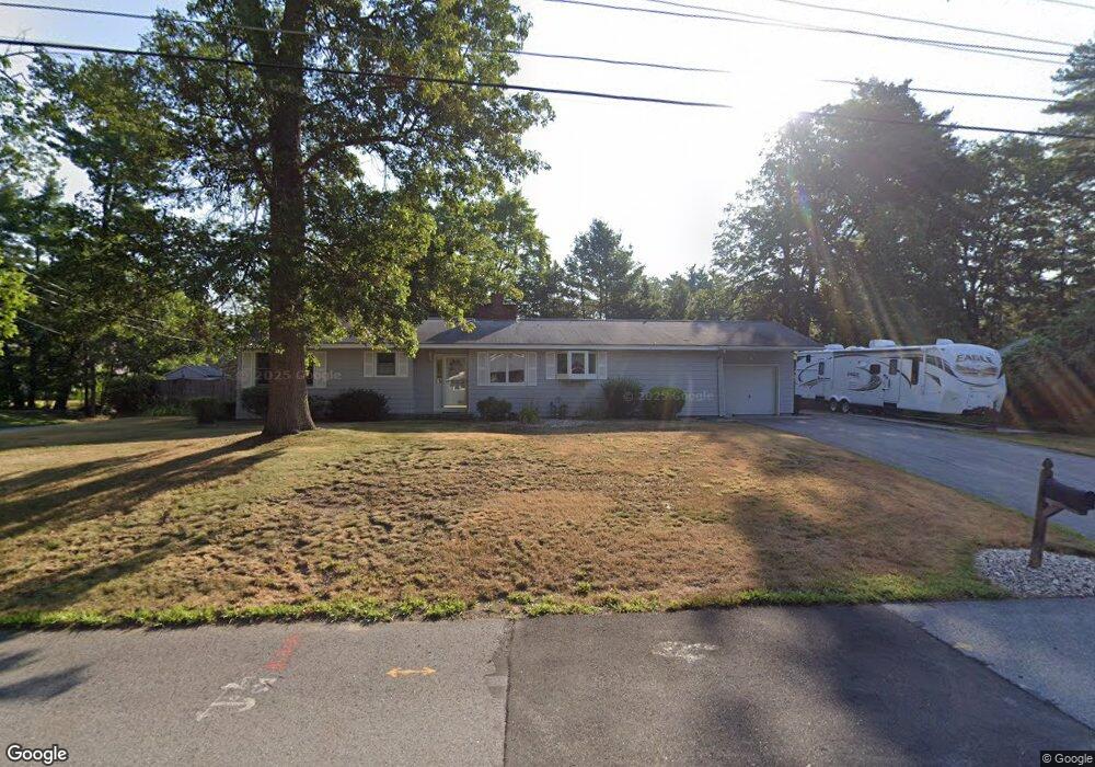
46 Dunbarton Dr Nashua, NH 03063
Northwest Nashua NeighborhoodEstimated Value: $506,806 - $642,000
3
Beds
1
Bath
1,426
Sq Ft
$413/Sq Ft
Est. Value
About This Home
This home is located at 46 Dunbarton Dr, Nashua, NH 03063 and is currently estimated at $589,202, approximately $413 per square foot. 46 Dunbarton Dr is a home located in Hillsborough County with nearby schools including Birch Hill Elementary School, Elm Street Middle School, and Nashua High School North.
Ownership History
Date
Name
Owned For
Owner Type
Purchase Details
Closed on
Feb 10, 2017
Sold by
Steeves Gregory D and Steeves Cassandra L
Bought by
Steeves Gregory D
Current Estimated Value
Home Financials for this Owner
Home Financials are based on the most recent Mortgage that was taken out on this home.
Original Mortgage
$246,133
Outstanding Balance
$200,146
Interest Rate
3.75%
Mortgage Type
FHA
Estimated Equity
$389,056
Purchase Details
Closed on
Jul 25, 2003
Sold by
Fredette Kevin B and Fredette Kimberly J
Bought by
Steeves Gregory D and Steeves Cassandra L
Home Financials for this Owner
Home Financials are based on the most recent Mortgage that was taken out on this home.
Original Mortgage
$233,600
Interest Rate
5.27%
Mortgage Type
Purchase Money Mortgage
Create a Home Valuation Report for This Property
The Home Valuation Report is an in-depth analysis detailing your home's value as well as a comparison with similar homes in the area
Home Values in the Area
Average Home Value in this Area
Purchase History
| Date | Buyer | Sale Price | Title Company |
|---|---|---|---|
| Steeves Gregory D | -- | -- | |
| Steeves Gregory D | $292,000 | -- |
Source: Public Records
Mortgage History
| Date | Status | Borrower | Loan Amount |
|---|---|---|---|
| Open | Steeves Gregory D | $246,133 | |
| Previous Owner | Steeves Gregory D | $256,000 | |
| Previous Owner | Steeves Gregory D | $32,000 | |
| Previous Owner | Steeves Gregory D | $233,600 |
Source: Public Records
Tax History
| Year | Tax Paid | Tax Assessment Tax Assessment Total Assessment is a certain percentage of the fair market value that is determined by local assessors to be the total taxable value of land and additions on the property. | Land | Improvement |
|---|---|---|---|---|
| 2024 | $8,152 | $512,700 | $180,100 | $332,600 |
| 2023 | $7,839 | $430,000 | $144,100 | $285,900 |
| 2022 | $7,770 | $430,000 | $144,100 | $285,900 |
| 2021 | $7,358 | $316,900 | $105,600 | $211,300 |
| 2020 | $7,016 | $310,300 | $105,600 | $204,700 |
| 2019 | $6,752 | $310,300 | $105,600 | $204,700 |
| 2018 | $6,581 | $310,300 | $105,600 | $204,700 |
| 2017 | $5,658 | $219,400 | $87,000 | $132,400 |
| 2016 | $5,500 | $219,400 | $87,000 | $132,400 |
| 2015 | $5,382 | $219,400 | $87,000 | $132,400 |
| 2014 | $5,277 | $219,400 | $87,000 | $132,400 |
Source: Public Records
Map
Nearby Homes
- 111 Coburn Ave Unit 33
- 15 Dover St
- 44 Coburn Woods Unit 44
- 21 Sims St
- 33 Cannongate Rd Unit 33
- 36 Profile Cir
- 7 Mount Vernon St
- 44 Broad St
- 24 Sanborn Dr
- 6 Cornwall Ln Unit 7
- 7 Meghan Dr Unit U22
- 7 Buker St
- 3 Kirk St Unit 57
- 11 Amherst Terrace
- 63 Tampa St
- 43 Hawkstead Hollow Unit U34
- 3 Paddington Place
- 26 Sunapee St
- 2 Natick St
- 18 Century Rd
- 50 Dunbarton Dr
- 26 Woodland Dr
- 24 Woodland Dr
- 47 Dunbarton Dr
- 40 Dunbarton Dr
- 51 Dunbarton Dr
- 30 Woodland Dr
- 41 Dunbarton Dr
- 22 Woodland Dr
- 25 Woodland Dr
- 53 Dunbarton Dr
- 36 Dunbarton Dr
- 13 Meredith Dr
- 32 Woodland Dr
- 23 Woodland Dr
- 15 Meredith Dr
- 5 Freedom St
- 37 Dunbarton Dr
- 61 Dunbarton Dr
- 16 Woodland Dr
Your Personal Tour Guide
Ask me questions while you tour the home.