Estimated Value: $1,194,000 - $1,459,000
5
Beds
3
Baths
3,200
Sq Ft
$422/Sq Ft
Est. Value
About This Home
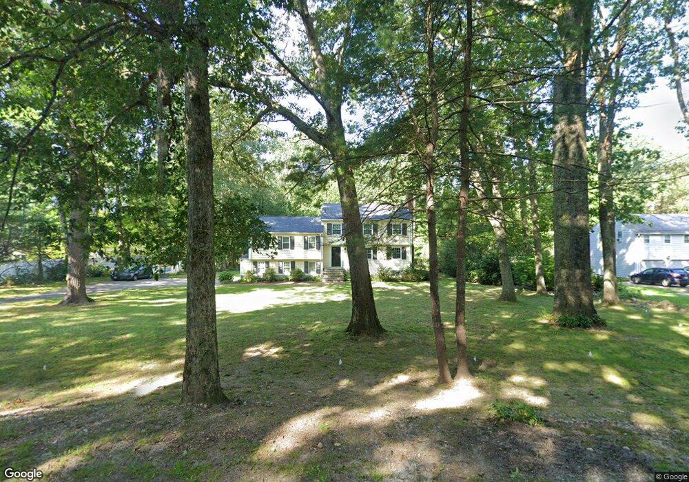
This home is located at 46 Glen St Unit 1, Dover, MA 02030 and is currently estimated at $1,349,098, approximately $421 per square foot. 46 Glen St Unit 1 is a home located in Norfolk County with nearby schools including Chickering Elementary School, Dover-Sherborn Regional Middle School, and Dover-Sherborn Regional High School.
Ownership History
Date
Name
Owned For
Owner Type
Purchase Details
Closed on
Dec 30, 2018
Sold by
Gould Forrest J
Bought by
Bailey Thomas A and Puerini Sarah J
Current Estimated Value
Home Financials for this Owner
Home Financials are based on the most recent Mortgage that was taken out on this home.
Original Mortgage
$656,000
Interest Rate
4.5%
Mortgage Type
New Conventional
Purchase Details
Closed on
Mar 17, 2017
Sold by
Gould Forrest J and Kupervaser Claudia R
Bought by
Gould Forrest J
Purchase Details
Closed on
Apr 30, 1998
Sold by
Ronstadt Tr Robert C
Bought by
Alessandro Michael A and Alessandro Theresa
Purchase Details
Closed on
Jul 21, 1993
Sold by
Ronstadt Robert C and Ronstadt Rebecca
Bought by
Ronstadt Rt and Ronstadt Robert C
Create a Home Valuation Report for This Property
The Home Valuation Report is an in-depth analysis detailing your home's value as well as a comparison with similar homes in the area
Home Values in the Area
Average Home Value in this Area
Purchase History
| Date | Buyer | Sale Price | Title Company |
|---|---|---|---|
| Bailey Thomas A | $820,000 | -- | |
| Gould Forrest J | -- | -- | |
| Alessandro Michael A | $367,500 | -- | |
| Ronstadt Rt | $330,000 | -- |
Source: Public Records
Mortgage History
| Date | Status | Borrower | Loan Amount |
|---|---|---|---|
| Previous Owner | Bailey Thomas A | $656,000 | |
| Previous Owner | Ronstadt Rt | $300,000 | |
| Previous Owner | Ronstadt Rt | $275,000 |
Source: Public Records
Tax History
| Year | Tax Paid | Tax Assessment Tax Assessment Total Assessment is a certain percentage of the fair market value that is determined by local assessors to be the total taxable value of land and additions on the property. | Land | Improvement |
|---|---|---|---|---|
| 2025 | $11,903 | $1,056,200 | $645,100 | $411,100 |
| 2024 | $10,804 | $985,800 | $601,600 | $384,200 |
| 2023 | $10,487 | $860,300 | $525,100 | $335,200 |
| 2022 | $9,638 | $776,000 | $481,600 | $294,400 |
| 2021 | $9,002 | $698,400 | $416,200 | $282,200 |
| 2020 | $8,967 | $698,400 | $416,200 | $282,200 |
| 2019 | $8,994 | $695,600 | $416,200 | $279,400 |
| 2018 | $8,807 | $685,900 | $416,200 | $269,700 |
| 2017 | $8,351 | $639,900 | $361,800 | $278,100 |
| 2016 | $8,102 | $629,000 | $350,900 | $278,100 |
| 2015 | $8,404 | $661,700 | $383,600 | $278,100 |
Source: Public Records
Map
Nearby Homes
Your Personal Tour Guide
Ask me questions while you tour the home.