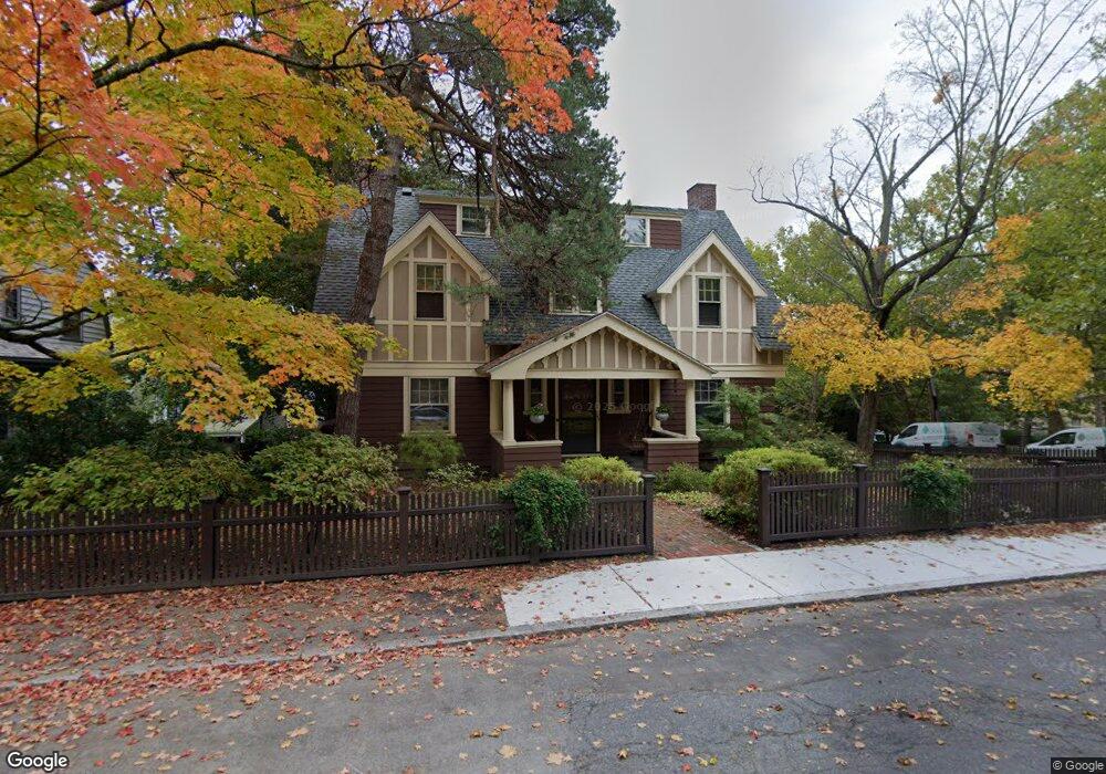
46 Hawthorn Rd Brookline, MA 02445
Brookline Village NeighborhoodEstimated Value: $2,635,073 - $3,055,000
6
Beds
3
Baths
2,693
Sq Ft
$1,070/Sq Ft
Est. Value
About This Home
This home is located at 46 Hawthorn Rd, Brookline, MA 02445 and is currently estimated at $2,882,518, approximately $1,070 per square foot. 46 Hawthorn Rd is a home located in Norfolk County with nearby schools including William H. Lincoln School, Roxbury Preparatory Charter School, and St. Mary of the Assumption Elementary School.
Ownership History
Date
Name
Owned For
Owner Type
Purchase Details
Closed on
Jul 10, 2024
Sold by
Weiss Leonard A
Bought by
Leonard A Weiss Ret and Weiss
Current Estimated Value
Purchase Details
Closed on
Aug 21, 2001
Sold by
Smith Robert and Smith Sarah
Bought by
Weiss Leonard A
Create a Home Valuation Report for This Property
The Home Valuation Report is an in-depth analysis detailing your home's value as well as a comparison with similar homes in the area
Home Values in the Area
Average Home Value in this Area
Purchase History
| Date | Buyer | Sale Price | Title Company |
|---|---|---|---|
| Leonard A Weiss Ret | -- | None Available | |
| Leonard A Weiss Ret | -- | None Available | |
| Weiss Leonard A | $1,180,145 | -- | |
| Weiss Leonard A | $1,180,145 | -- |
Source: Public Records
Mortgage History
| Date | Status | Borrower | Loan Amount |
|---|---|---|---|
| Previous Owner | Weiss Leonard A | $50,000 |
Source: Public Records
Tax History Compared to Growth
Tax History
| Year | Tax Paid | Tax Assessment Tax Assessment Total Assessment is a certain percentage of the fair market value that is determined by local assessors to be the total taxable value of land and additions on the property. | Land | Improvement |
|---|---|---|---|---|
| 2025 | $23,264 | $2,357,000 | $1,381,300 | $975,700 |
| 2024 | $22,144 | $2,266,500 | $1,328,200 | $938,300 |
| 2023 | $19,445 | $1,950,400 | $1,030,000 | $920,400 |
| 2022 | $18,927 | $1,857,400 | $980,900 | $876,500 |
| 2021 | $17,503 | $1,786,000 | $943,200 | $842,800 |
| 2020 | $15,954 | $1,688,300 | $857,400 | $830,900 |
| 2019 | $15,066 | $1,607,900 | $816,600 | $791,300 |
| 2018 | $14,345 | $1,516,400 | $735,000 | $781,400 |
| 2017 | $14,134 | $1,430,600 | $693,400 | $737,200 |
| 2016 | $13,932 | $1,337,000 | $648,000 | $689,000 |
| 2015 | $13,345 | $1,249,500 | $605,600 | $643,900 |
| 2014 | $13,502 | $1,185,400 | $550,500 | $634,900 |
Source: Public Records
Map
Nearby Homes
- 99 Pond Ave Unit 608
- 36 Allerton St
- 81 Glen Rd Unit S2
- 60 Glen Rd Unit 101
- 77 Pond Ave Unit 1103
- 77 Pond Ave Unit 1506
- 33 Pond Ave Unit 422
- 33 Pond Ave Unit 709
- 33 Pond Ave Unit 523
- 33 Pond Ave Unit 919
- 6 Juniper St Unit 16
- 44 Washington St Unit 501
- 70 Jamaicaway Unit 16
- 50 Jamaicaway Unit 1
- 20 Rice St Unit 2
- 39 Kent St Unit B
- 390 Riverway Unit 6
- 90 Bynner St Unit 7
- 105 Franklin St Unit 1
- 58 Kent St Unit 302
- 21 Cumberland Ave
- 40 Hawthorn Rd
- 43 Glen Rd
- 34 Hawthorn Rd
- 30 Cumberland Ave Unit 5
- 30 Cumberland Ave Unit 2
- 30 Cumberland Ave Unit W5
- 30 Cumberland Ave Unit W3
- 38 Cumberland Ave
- 38 Cumberland Ave Unit 3
- 38 Cumberland Ave Unit 4
- 37 Glen Rd
- 35 Hawthorn Rd
- 46 Glen Rd
- 15 Cumberland Ave
- 28 Hawthorn Rd
- 31 Glen Rd
- 36 Glen Rd
- 29 Hawthorn Rd
- 47 Cumberland Ave