Estimated Value: $1,105,182 - $1,354,000
4
Beds
3
Baths
2,740
Sq Ft
$449/Sq Ft
Est. Value
About This Home
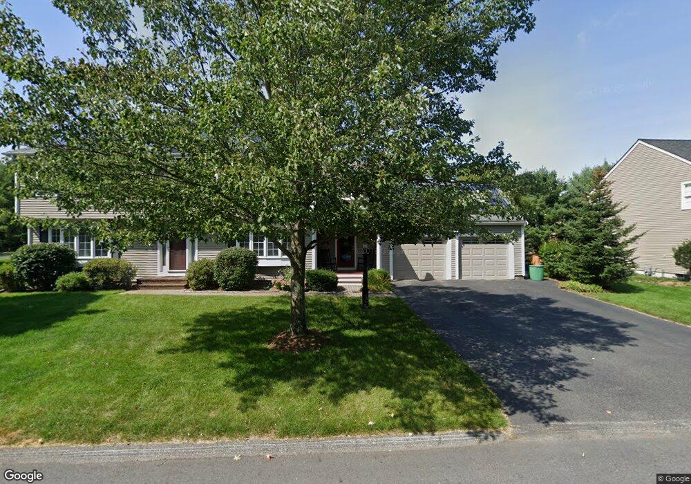
This home is located at 46 Lexington Dr, Acton, MA 01720 and is currently estimated at $1,231,046, approximately $449 per square foot. 46 Lexington Dr is a home located in Middlesex County with nearby schools including Acton-Boxborough Regional High School and Concord Academy.
Ownership History
Date
Name
Owned For
Owner Type
Purchase Details
Closed on
Nov 6, 1997
Sold by
Lawsbrook Inc
Bought by
Reed Peter A and Reed Diane B
Current Estimated Value
Home Financials for this Owner
Home Financials are based on the most recent Mortgage that was taken out on this home.
Original Mortgage
$267,000
Interest Rate
7.19%
Mortgage Type
Purchase Money Mortgage
Create a Home Valuation Report for This Property
The Home Valuation Report is an in-depth analysis detailing your home's value as well as a comparison with similar homes in the area
Home Values in the Area
Average Home Value in this Area
Purchase History
| Date | Buyer | Sale Price | Title Company |
|---|---|---|---|
| Reed Peter A | $362,000 | -- |
Source: Public Records
Mortgage History
| Date | Status | Borrower | Loan Amount |
|---|---|---|---|
| Open | Reed Peter A | $119,000 | |
| Open | Reed Peter A | $417,000 | |
| Closed | Reed Peter A | $60,000 | |
| Closed | Reed Peter A | $267,000 |
Source: Public Records
Tax History Compared to Growth
Tax History
| Year | Tax Paid | Tax Assessment Tax Assessment Total Assessment is a certain percentage of the fair market value that is determined by local assessors to be the total taxable value of land and additions on the property. | Land | Improvement |
|---|---|---|---|---|
| 2025 | $16,855 | $982,800 | $306,200 | $676,600 |
| 2024 | $15,910 | $954,400 | $306,200 | $648,200 |
| 2023 | $15,553 | $885,700 | $278,200 | $607,500 |
| 2022 | $14,665 | $754,000 | $241,800 | $512,200 |
| 2021 | $14,343 | $709,000 | $224,000 | $485,000 |
| 2020 | $13,724 | $713,300 | $224,000 | $489,300 |
| 2019 | $13,063 | $674,400 | $224,000 | $450,400 |
| 2018 | $12,795 | $660,200 | $224,000 | $436,200 |
| 2017 | $12,448 | $653,100 | $224,000 | $429,100 |
| 2016 | $12,236 | $636,300 | $224,000 | $412,300 |
| 2015 | $11,832 | $621,100 | $224,000 | $397,100 |
| 2014 | $11,328 | $582,400 | $224,000 | $358,400 |
Source: Public Records
Map
Nearby Homes
- 60 Lawsbrook Rd
- 65 Summit St
- 128 Parker St Unit 3B
- 37 Water St
- 132 Parker St Unit G5
- 27 Water St
- 1828 Main St
- 1844 Main St Unit 1844
- 3 Drummer Rd Unit B3
- 66 Old Stow Rd
- 1687 Main St
- 7 Concetta Cir
- 100 Harrington Ave
- 70 River St
- 54 Maple St
- 102 Highland St
- 70 McCallar Ln
- 96 Forest Ridge Rd Unit 96
- 1 Bayberry Rd
- 40 High St
- 44 Lexington Dr
- 44 Lexington Dr Unit 44
- 20 Lexington Dr
- 45 Lexington Dr
- 18 Lexington Dr
- 22 Lexington Dr
- 47 Lexington Dr
- 43 Lexington Dr
- 50 Lexington Dr
- 16 Lexington Dr
- 49 Lexington Dr
- 24 Lexington Dr
- 15 Lexington Dr
- 17 Lexington Dr
- 41 Lexington Dr
- 13 Lexington Dr
- 19 Lexington Dr
- 51 Lexington Dr
- 51 Lexington Dr Unit 51
- 40 Lexington Dr