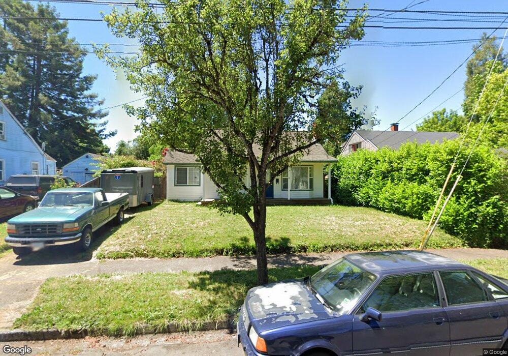
46 N Adams St Eugene, OR 97402
Whiteaker NeighborhoodEstimated Value: $383,000 - $446,000
3
Beds
1
Bath
1,164
Sq Ft
$360/Sq Ft
Est. Value
About This Home
This home is located at 46 N Adams St, Eugene, OR 97402 and is currently estimated at $419,311, approximately $360 per square foot. 46 N Adams St is a home located in Lane County with nearby schools including River Road/El Camino del Río Elementary School, Kelly Middle School, and North Eugene High School.
Ownership History
Date
Name
Owned For
Owner Type
Purchase Details
Closed on
Dec 17, 2009
Sold by
Agar Jason D
Bought by
Dagord Cesar L
Current Estimated Value
Home Financials for this Owner
Home Financials are based on the most recent Mortgage that was taken out on this home.
Original Mortgage
$191,468
Outstanding Balance
$124,444
Interest Rate
4.91%
Mortgage Type
FHA
Estimated Equity
$294,867
Purchase Details
Closed on
Nov 30, 2000
Sold by
Kemple Megan M and Agar Jason D
Bought by
Agar Jason D
Purchase Details
Closed on
Jun 2, 1999
Sold by
Tucker Cruikshank D and Tucker Lisa K
Bought by
Kemple Megan M and Agar Jason D
Home Financials for this Owner
Home Financials are based on the most recent Mortgage that was taken out on this home.
Original Mortgage
$71,000
Interest Rate
6.84%
Create a Home Valuation Report for This Property
The Home Valuation Report is an in-depth analysis detailing your home's value as well as a comparison with similar homes in the area
Home Values in the Area
Average Home Value in this Area
Purchase History
| Date | Buyer | Sale Price | Title Company |
|---|---|---|---|
| Dagord Cesar L | $195,000 | First American Title | |
| Agar Jason D | -- | -- | |
| Kemple Megan M | $124,000 | Western Pioneer Title Co |
Source: Public Records
Mortgage History
| Date | Status | Borrower | Loan Amount |
|---|---|---|---|
| Open | Dagord Cesar L | $191,468 | |
| Previous Owner | Kemple Megan M | $71,000 |
Source: Public Records
Tax History Compared to Growth
Tax History
| Year | Tax Paid | Tax Assessment Tax Assessment Total Assessment is a certain percentage of the fair market value that is determined by local assessors to be the total taxable value of land and additions on the property. | Land | Improvement |
|---|---|---|---|---|
| 2025 | $2,846 | $146,090 | -- | -- |
| 2024 | $2,811 | $141,835 | -- | -- |
| 2023 | $2,811 | $137,704 | $0 | $0 |
| 2022 | $2,633 | $133,694 | $0 | $0 |
| 2021 | $2,473 | $129,800 | $0 | $0 |
| 2020 | $2,482 | $126,020 | $0 | $0 |
| 2019 | $2,397 | $122,350 | $0 | $0 |
| 2018 | $2,257 | $115,327 | $0 | $0 |
| 2017 | $2,155 | $115,327 | $0 | $0 |
| 2016 | $2,102 | $111,968 | $0 | $0 |
| 2015 | $2,042 | $108,707 | $0 | $0 |
| 2014 | $2,000 | $105,541 | $0 | $0 |
Source: Public Records
Map
Nearby Homes
- 11 Monroe St
- 9 N Monroe St Unit C
- 9 N Monroe St Unit B
- 9 N Monroe St Unit D
- 9 N Monroe St Unit A
- 461 Blair Blvd
- 458 Blair Blvd
- 301 N Polk St
- 1030 W 5th Ave
- 1026 W 5th Ave
- 511 Madison St
- 490 W 4th Ave
- 1303 W 5th Ave
- 427 Washington St
- 5719 Bainbridge Rd
- 5726 Bainbridge Rd
- 990 W 7th Ave
- 729 Monroe St
- 1230 W 7th Ave
- 147 Shelton McMurphey Blvd