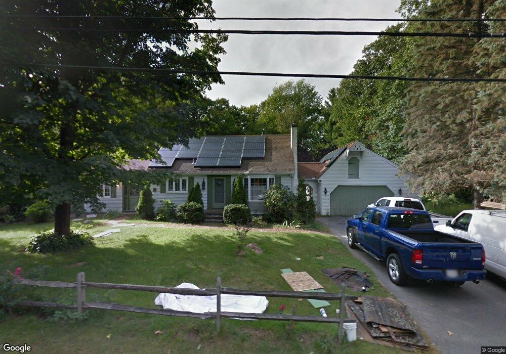
46 N Common Rd Westminster, MA 01473
Estimated Value: $477,611 - $578,000
3
Beds
1
Bath
2,004
Sq Ft
$254/Sq Ft
Est. Value
About This Home
This home is located at 46 N Common Rd, Westminster, MA 01473 and is currently estimated at $508,403, approximately $253 per square foot. 46 N Common Rd is a home located in Worcester County with nearby schools including Oakmont Regional High School and Wachusett Hills Christian School.
Ownership History
Date
Name
Owned For
Owner Type
Purchase Details
Closed on
Dec 2, 2025
Sold by
Baldor Lt and Baldor
Bought by
Turning Pt Hm Buyers Llc
Current Estimated Value
Purchase Details
Closed on
May 25, 2016
Sold by
Baldor Kathryn R
Bought by
Baldor Lt and Baldor
Purchase Details
Closed on
Nov 21, 2005
Sold by
Casavant Roger F
Bought by
Baldor Kathryn R
Home Financials for this Owner
Home Financials are based on the most recent Mortgage that was taken out on this home.
Original Mortgage
$224,000
Interest Rate
6.07%
Mortgage Type
Purchase Money Mortgage
Create a Home Valuation Report for This Property
The Home Valuation Report is an in-depth analysis detailing your home's value as well as a comparison with similar homes in the area
Home Values in the Area
Average Home Value in this Area
Purchase History
| Date | Buyer | Sale Price | Title Company |
|---|---|---|---|
| Turning Pt Hm Buyers Llc | $351,030 | -- | |
| Baldor Lt | -- | -- | |
| Baldor Kathryn R | $280,000 | -- | |
| Baldor Kathryn R | $280,000 | -- |
Source: Public Records
Mortgage History
| Date | Status | Borrower | Loan Amount |
|---|---|---|---|
| Previous Owner | Baldor Kathryn R | $175,000 | |
| Previous Owner | Baldor Kathryn R | $207,000 | |
| Previous Owner | Baldor Kathryn R | $224,000 | |
| Previous Owner | Baldor Kathryn R | $51,000 |
Source: Public Records
Tax History
| Year | Tax Paid | Tax Assessment Tax Assessment Total Assessment is a certain percentage of the fair market value that is determined by local assessors to be the total taxable value of land and additions on the property. | Land | Improvement |
|---|---|---|---|---|
| 2025 | $5,307 | $431,500 | $117,500 | $314,000 |
| 2024 | $5,077 | $414,100 | $117,500 | $296,600 |
| 2023 | $5,133 | $393,000 | $109,800 | $283,200 |
| 2022 | $5,222 | $330,500 | $95,500 | $235,000 |
| 2021 | $4,701 | $280,500 | $81,200 | $199,300 |
| 2020 | $4,595 | $261,800 | $73,800 | $188,000 |
| 2019 | $4,504 | $246,800 | $60,900 | $185,900 |
| 2018 | $3,899 | $226,300 | $60,900 | $165,400 |
| 2017 | $4,049 | $222,600 | $60,900 | $161,700 |
| 2016 | $3,953 | $210,500 | $50,700 | $159,800 |
| 2015 | $3,989 | $210,500 | $50,700 | $159,800 |
| 2014 | $3,995 | $210,500 | $50,700 | $159,800 |
Source: Public Records
Map
Nearby Homes
- 0 Syd Smith Rd Unit 73395578
- 0 Syd Smith Rd (Rear)
- 0 Syd Smith Rd Map 71 Lot 4-2
- 0
- 2 Roberts Way
- 170 N Common Rd
- 2 Seaver St
- 17 Leominster St
- 0 Worcester Rd Unit 73326124
- 100A W Main St
- 29 Dawley Rd
- 9 Knower Rd
- 38 Knower Rd
- 2 Taymax Rd
- Lot 0 Narrows Rd
- 6 Shady Ave
- 29 Sunset Rd
- Lot 3 Sunset Rd
- Lot 5 Sunset Rd
- 25 Sunset Rd
- 44 N Common Rd
- 50 N Common Rd
- 51 N Common Rd
- 52 N Common Rd
- 41 N Common Rd
- 42 N Common Rd
- 45 N Common Rd
- 39 N Common Rd
- 55 N Common Rd
- 54 N Common Rd
- 40 N Common Rd
- 37 N Common Rd
- 0 Livermore Hill Unit 70689771
- Lot 19A Tommy Francis
- L1-6 Pierce Rd and Bragg Hill Rd
- Lot28 Old Mill Cir Unit Townsend
- 38 N Common Rd
- 0 N Common Rd (Rear) Unit 71261447
- 35 N Common Rd
- 2 Oakmont Ave
Your Personal Tour Guide
Ask me questions while you tour the home.