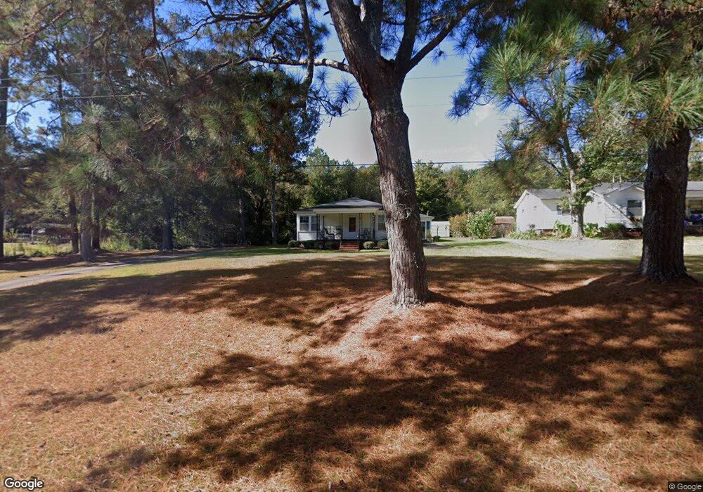
46 New Airport Rd Lagrange, GA 30240
Estimated Value: $136,000 - $170,000
3
Beds
2
Baths
1,492
Sq Ft
$103/Sq Ft
Est. Value
About This Home
This home is located at 46 New Airport Rd, Lagrange, GA 30240 and is currently estimated at $154,341, approximately $103 per square foot. 46 New Airport Rd is a home located in Troup County with nearby schools including Ethel W. Kight Elementary School, Hollis Hand Elementary School, and Franklin Forest Elementary School.
Ownership History
Date
Name
Owned For
Owner Type
Purchase Details
Closed on
Aug 24, 2007
Sold by
Keeth Kenneth Charles
Bought by
Bartley Linda
Current Estimated Value
Home Financials for this Owner
Home Financials are based on the most recent Mortgage that was taken out on this home.
Original Mortgage
$93,000
Outstanding Balance
$56,111
Interest Rate
6.65%
Mortgage Type
New Conventional
Estimated Equity
$98,230
Purchase Details
Closed on
Jun 2, 2005
Sold by
Keeth Brennan Joseph
Bought by
Keeth Kenneth Charles Joseph and Keeth Paula A
Purchase Details
Closed on
Sep 8, 1998
Sold by
Cottle Barbara
Bought by
Melissa Brennan J and Melissa Clow
Purchase Details
Closed on
Oct 24, 1997
Sold by
Charlie Fred Cottle By Ex
Bought by
Cottle Barbara
Purchase Details
Closed on
Jan 1, 1955
Bought by
Charlie Fred Cottle By Ex
Create a Home Valuation Report for This Property
The Home Valuation Report is an in-depth analysis detailing your home's value as well as a comparison with similar homes in the area
Home Values in the Area
Average Home Value in this Area
Purchase History
| Date | Buyer | Sale Price | Title Company |
|---|---|---|---|
| Bartley Linda | $93,000 | -- | |
| Keeth Kenneth Charles Joseph | $78,813 | -- | |
| Melissa Brennan J | $72,300 | -- | |
| Cottle Barbara | -- | -- | |
| Charlie Fred Cottle By Ex | -- | -- |
Source: Public Records
Mortgage History
| Date | Status | Borrower | Loan Amount |
|---|---|---|---|
| Open | Bartley Linda | $93,000 |
Source: Public Records
Tax History Compared to Growth
Tax History
| Year | Tax Paid | Tax Assessment Tax Assessment Total Assessment is a certain percentage of the fair market value that is determined by local assessors to be the total taxable value of land and additions on the property. | Land | Improvement |
|---|---|---|---|---|
| 2024 | $1,139 | $41,756 | $7,000 | $34,756 |
| 2023 | $1,061 | $38,916 | $7,000 | $31,916 |
| 2022 | $1,016 | $36,396 | $7,000 | $29,396 |
| 2021 | $803 | $26,612 | $7,000 | $19,612 |
| 2020 | $803 | $26,612 | $7,000 | $19,612 |
| 2019 | $820 | $27,172 | $7,000 | $20,172 |
| 2018 | $766 | $25,404 | $7,088 | $18,316 |
| 2017 | $766 | $25,404 | $7,088 | $18,316 |
| 2016 | $758 | $25,133 | $7,088 | $18,045 |
| 2015 | $759 | $25,133 | $7,088 | $18,045 |
| 2014 | $732 | $24,183 | $7,088 | $17,095 |
| 2013 | -- | $25,009 | $7,088 | $17,921 |
Source: Public Records
Map
Nearby Homes
- 0 Unit 10514554
- 141 Avery Dr
- 212 Aster Way
- 101 Crown St Unit LOT 5
- 102 Crown St Unit LOT 1
- The Rhodes Plan at Crown Street Cottages
- The Truitt Plan at Crown Street Cottages
- The Callaway Plan at Crown Street Cottages
- 167 S Kight Dr
- 802 Monroe St
- 205 Grady St
- 608 Wilburn Ave
- 610 Wilburn Ave
- 107 Clark St
- 119 Jones St
- 211 Moores Hill
- 0 Moores Hill
- 202 Parker Ln
- 102 Parker St
- 109 Garfield St
- 52 New Airport Rd
- 18 New Airport Rd
- 53 New Airport Rd
- 2005 West Point Rd
- 41 New Airport Rd
- 74 New Airport Rd
- 65 New Airport Rd
- 27 New Airport Rd
- 84 New Airport Rd
- 92 New Airport Rd
- 2053 West Point Rd
- 2002 W Point Rd
- 1970 West Point Rd
- 106 New Airport Rd
- 9 Terrace Dr
- 104 Old Airport Rd
- 102 Old Airport Rd
- 118 New Airport Rd
- 106 Old Airport Rd
- 8 Sunset Dr