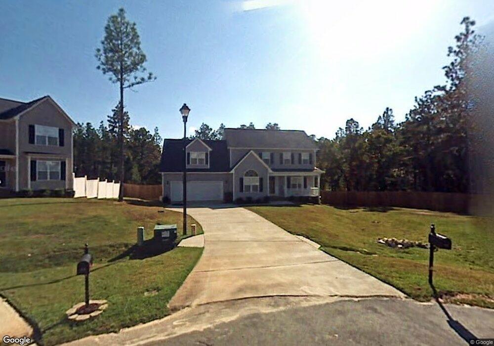
46 Red Bud Cir Lillington, NC 27546
Estimated Value: $294,976 - $344,000
3
Beds
3
Baths
2,044
Sq Ft
$152/Sq Ft
Est. Value
About This Home
This home is located at 46 Red Bud Cir, Lillington, NC 27546 and is currently estimated at $310,744, approximately $152 per square foot. 46 Red Bud Cir is a home located in Harnett County with nearby schools including Anderson Creek Primary School, South Harnett Elementary School, and Western Harnett Middle School.
Ownership History
Date
Name
Owned For
Owner Type
Purchase Details
Closed on
May 31, 2006
Sold by
H & H Constructors Inc
Bought by
Robinson Curtis L and Robinson Sherry A
Current Estimated Value
Home Financials for this Owner
Home Financials are based on the most recent Mortgage that was taken out on this home.
Original Mortgage
$190,918
Outstanding Balance
$111,426
Interest Rate
6.44%
Mortgage Type
VA
Estimated Equity
$199,318
Create a Home Valuation Report for This Property
The Home Valuation Report is an in-depth analysis detailing your home's value as well as a comparison with similar homes in the area
Home Values in the Area
Average Home Value in this Area
Purchase History
| Date | Buyer | Sale Price | Title Company |
|---|---|---|---|
| Robinson Curtis L | $187,000 | None Available |
Source: Public Records
Mortgage History
| Date | Status | Borrower | Loan Amount |
|---|---|---|---|
| Open | Robinson Curtis L | $190,918 |
Source: Public Records
Tax History Compared to Growth
Tax History
| Year | Tax Paid | Tax Assessment Tax Assessment Total Assessment is a certain percentage of the fair market value that is determined by local assessors to be the total taxable value of land and additions on the property. | Land | Improvement |
|---|---|---|---|---|
| 2025 | $1,624 | $219,520 | $0 | $0 |
| 2024 | $1,624 | $219,520 | $0 | $0 |
| 2023 | $1,624 | $219,520 | $0 | $0 |
| 2022 | $1,631 | $219,520 | $0 | $0 |
| 2021 | $1,631 | $179,710 | $0 | $0 |
| 2020 | $1,631 | $179,710 | $0 | $0 |
| 2019 | $1,616 | $179,710 | $0 | $0 |
| 2018 | $1,616 | $179,710 | $0 | $0 |
| 2017 | $1,616 | $179,710 | $0 | $0 |
| 2016 | $1,743 | $194,490 | $0 | $0 |
| 2015 | $1,743 | $194,490 | $0 | $0 |
| 2014 | $1,743 | $194,490 | $0 | $0 |
Source: Public Records
Map
Nearby Homes
- 57 Spring Water Ct
- 16 Spring Pond Ln
- 1234 Micahs Way N
- 32 Overview Ct
- 412 Dunbar Dr
- 85 Heatherspring Way
- 170 Valley Stream Rd
- 222 Broadlake (639) Ln
- 232 Broadlake (640) Ln
- 77 Teak Wood Ct
- 182 Broadlake (637) Ln
- 162 Broadlake (636) Ln
- 195 Broadlake (643)
- 152 Broadlake (635) Ln
- 132 Broadlake (634) Ln
- 1009 Micahs Way N
- 36 Red Bud Cir
- 45 Red Bud Cir
- 35 Red Bud Cir
- 16 Red Bud Cir
- 135 Silver Oaks Dr
- 1517 Micahs Way N
- 410 Irwin Garrish Hwy
- 2062 Oyster Harbour Pkwy SW
- 1511 Micahs Way N
- 11 Union Cir
- 1507 Micahs Way N
- 1447 Micahs Way N
- 1501 Micahs Way N
- 1453 Micahs Way N
- 1431 Micahs Way N
- 1465 Micahs Way N
- 1459 Micahs Way N
- 1495 Micahs Way N
- 1423 Micahs Way N
- 31 Union Cir