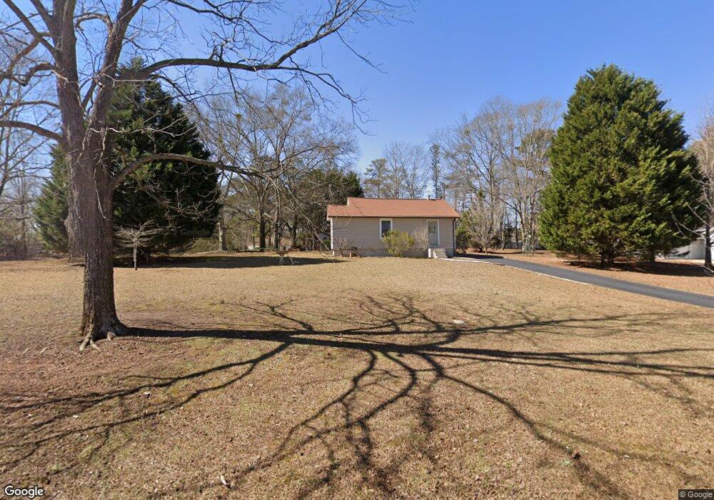
46 S Barnes Dr Locust Grove, GA 30248
Estimated Value: $139,000 - $198,000
2
Beds
1
Bath
948
Sq Ft
$173/Sq Ft
Est. Value
About This Home
This home is located at 46 S Barnes Dr, Locust Grove, GA 30248 and is currently estimated at $163,532, approximately $172 per square foot. 46 S Barnes Dr is a home with nearby schools including Locust Grove Elementary School, Locust Grove Middle School, and Locust Grove High School.
Ownership History
Date
Name
Owned For
Owner Type
Purchase Details
Closed on
Apr 26, 2000
Sold by
Barnes D Mariee
Bought by
Love Kenneth and Love Pamela A
Current Estimated Value
Home Financials for this Owner
Home Financials are based on the most recent Mortgage that was taken out on this home.
Original Mortgage
$44,383
Outstanding Balance
$15,216
Interest Rate
8.24%
Mortgage Type
FHA
Estimated Equity
$148,316
Create a Home Valuation Report for This Property
The Home Valuation Report is an in-depth analysis detailing your home's value as well as a comparison with similar homes in the area
Home Values in the Area
Average Home Value in this Area
Purchase History
| Date | Buyer | Sale Price | Title Company |
|---|---|---|---|
| Love Kenneth | $44,800 | -- |
Source: Public Records
Mortgage History
| Date | Status | Borrower | Loan Amount |
|---|---|---|---|
| Open | Love Kenneth | $44,383 |
Source: Public Records
Tax History Compared to Growth
Tax History
| Year | Tax Paid | Tax Assessment Tax Assessment Total Assessment is a certain percentage of the fair market value that is determined by local assessors to be the total taxable value of land and additions on the property. | Land | Improvement |
|---|---|---|---|---|
| 2025 | $1,273 | $46,040 | $14,480 | $31,560 |
| 2024 | $1,273 | $44,560 | $13,640 | $30,920 |
| 2023 | $627 | $40,880 | $13,160 | $27,720 |
| 2022 | $812 | $30,800 | $12,120 | $18,680 |
| 2021 | $657 | $24,200 | $10,400 | $13,800 |
| 2020 | $545 | $20,600 | $9,800 | $10,800 |
| 2019 | $485 | $18,880 | $9,320 | $9,560 |
| 2018 | $702 | $18,160 | $8,600 | $9,560 |
| 2016 | $606 | $14,760 | $6,560 | $8,200 |
| 2015 | $456 | $10,520 | $6,880 | $3,640 |
| 2014 | $217 | $10,000 | $6,880 | $3,120 |
Source: Public Records
Map
Nearby Homes
- 143 Massey Ln
- 231 Ferguson Ave
- 239 Ferguson Ave
- 4 Skyland Dr W
- 50 Grove Rd
- 1064 Lear Dr
- 501 Grove Park Dr
- 36 Highpoint Ln
- 565 Carleton Place
- 65 Grove Creek Dr
- 149 Pristine Dr
- 26 Skyland Dr W
- 1537 Jackson St
- 155 Skyland Dr E
- 878 Jackson St
- 176 Rockwood Ln
- 0 Locust Rd Unit 10495072
- 0 Locust Rd Unit 19967321
- 0 Jackson St Unit 10554689
- 863 Jackson St
- 22 S Barnes Dr
- 33 S Barnes Dr
- 127 Barnes Dr
- 66 S Barnes Dr
- 107 Barnes Dr
- 53 S Barnes Dr
- S S Barnes Dr
- 129 Barnes Dr
- 55 S Barnes Dr
- 101 Barnes Dr
- 140 Barnes Dr
- 4394 Highway 42
- 57 S Barnes Dr
- 63 Barnes Dr
- 106 Massey Ln
- 104 Massey Ln
- 78 Barnes Dr
- 102 Massey Ln
- 0 S Barnes Dr Unit 7233768
- 0 S Barnes Dr Unit 7154294