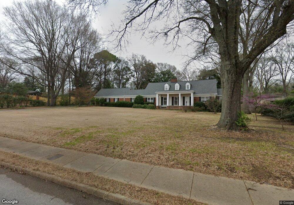
46 S Perkins Rd Memphis, TN 38117
Audubon Park NeighborhoodEstimated Value: $769,000 - $864,000
5
Beds
4
Baths
4,919
Sq Ft
$168/Sq Ft
Est. Value
About This Home
This home is located at 46 S Perkins Rd, Memphis, TN 38117 and is currently estimated at $826,690, approximately $168 per square foot. 46 S Perkins Rd is a home located in Shelby County with nearby schools including White Station Elementary School, White Station High, and White Station Middle.
Ownership History
Date
Name
Owned For
Owner Type
Purchase Details
Closed on
Aug 12, 2010
Sold by
National Advisors Trust Company
Bought by
Smith Noreen Cathey
Current Estimated Value
Purchase Details
Closed on
Nov 15, 2006
Sold by
Cathey Jeannene T
Bought by
Cathey Jeannene T and Revocable Trust Agreement Of Jeannene T
Create a Home Valuation Report for This Property
The Home Valuation Report is an in-depth analysis detailing your home's value as well as a comparison with similar homes in the area
Home Values in the Area
Average Home Value in this Area
Purchase History
| Date | Buyer | Sale Price | Title Company |
|---|---|---|---|
| Smith Noreen Cathey | $250,000 | Multiple | |
| Cathey Jeannene T | -- | None Available | |
| Cathey Jeannene T | -- | None Available |
Source: Public Records
Tax History Compared to Growth
Tax History
| Year | Tax Paid | Tax Assessment Tax Assessment Total Assessment is a certain percentage of the fair market value that is determined by local assessors to be the total taxable value of land and additions on the property. | Land | Improvement |
|---|---|---|---|---|
| 2025 | $5,276 | $213,025 | $92,300 | $120,725 |
| 2024 | -- | $155,625 | $67,450 | $88,175 |
| 2023 | $9,480 | $155,625 | $67,450 | $88,175 |
| 2022 | $9,480 | $155,625 | $67,450 | $88,175 |
| 2021 | $9,591 | $155,625 | $67,450 | $88,175 |
| 2020 | $10,871 | $150,025 | $67,450 | $82,575 |
| 2019 | $10,871 | $150,025 | $67,450 | $82,575 |
| 2018 | $10,871 | $150,025 | $67,450 | $82,575 |
| 2017 | $6,166 | $150,025 | $67,450 | $82,575 |
| 2016 | $6,121 | $140,075 | $0 | $0 |
| 2014 | $6,121 | $140,075 | $0 | $0 |
Source: Public Records
Map
Nearby Homes
- 4679 Walnut Grove Rd
- 137 Perkins Extension
- 154 Perkins Extension
- 4772 Gwynne Rd
- 4723 Normandy Ln
- 4798 Normandy Ln
- 105 Grove Park Cir
- 427 S Perkins Rd Unit 427-2
- 4859 Gwynne Rd
- 4654 Hemlock Ln
- 196 E Cherry Cir
- 131 N Mendenhall Rd
- 271 Wakefield Dr
- 4975 Brookwood Cove
- 135 Cherry Rd
- 356 Clove Dr
- 4736 All Spice Dr Unit 71E
- 4348 Gwynne Rd
- 4501 Minden Rd
- 4956 Robindale Ln
- 60 S Perkins Rd
- 4695 Walnut Grove Rd
- 80 Perkins Extension
- 63 Norwal Rd
- 4715 Walnut Grove Rd
- 79 Norwal Rd
- 90 S Perkins Rd
- 95 Norwal Rd
- 106 S Perkins Rd
- 37 Walnut Grove Ct
- 0 Walnut Grove Rd
- 4745 Walnut Grove Rd
- 33 Walnut Grove Ct
- 0 Walnut Grove Ct
- 25 Walnut Grove Ct
- 111 Norwal Rd
- 116 Perkins Extension
- 64 Norwal Rd
- 116 S Perkins Rd
- 29 Walnut Grove Ct