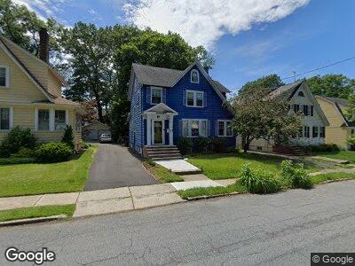
46 S Pierson Rd Maplewood, NJ 07040
Estimated Value: $863,101 - $980,000
--
Bed
--
Bath
1,660
Sq Ft
$549/Sq Ft
Est. Value
About This Home
This home is located at 46 S Pierson Rd, Maplewood, NJ 07040 and is currently estimated at $911,275, approximately $548 per square foot. 46 S Pierson Rd is a home located in Essex County with nearby schools including Tuscan Elementary School, Maplewood Middle School, and Columbia Senior High School.
Ownership History
Date
Name
Owned For
Owner Type
Purchase Details
Closed on
Aug 29, 2001
Sold by
Burn Mark
Bought by
Carbonara Peter
Current Estimated Value
Home Financials for this Owner
Home Financials are based on the most recent Mortgage that was taken out on this home.
Original Mortgage
$275,000
Interest Rate
6.99%
Purchase Details
Closed on
Jun 28, 1991
Sold by
Alford Richard and Alford Sophie
Bought by
Burn Mark and Burn Russell,Stephanie
Create a Home Valuation Report for This Property
The Home Valuation Report is an in-depth analysis detailing your home's value as well as a comparison with similar homes in the area
Home Values in the Area
Average Home Value in this Area
Purchase History
| Date | Buyer | Sale Price | Title Company |
|---|---|---|---|
| Carbonara Peter | $313,000 | -- | |
| -- | $310,000 | -- | |
| Burn Mark | $160,000 | -- |
Source: Public Records
Mortgage History
| Date | Status | Borrower | Loan Amount |
|---|---|---|---|
| Open | Carbonara Peter J | $262,150 | |
| Closed | Carbonara Peter J | $15,000 | |
| Closed | -- | $275,000 |
Source: Public Records
Tax History Compared to Growth
Tax History
| Year | Tax Paid | Tax Assessment Tax Assessment Total Assessment is a certain percentage of the fair market value that is determined by local assessors to be the total taxable value of land and additions on the property. | Land | Improvement |
|---|---|---|---|---|
| 2024 | $16,738 | $702,500 | $353,100 | $349,400 |
| 2022 | $16,322 | $462,900 | $301,300 | $161,600 |
| 2021 | $15,827 | $462,900 | $301,300 | $161,600 |
| 2020 | $15,378 | $462,900 | $301,300 | $161,600 |
| 2019 | $14,933 | $462,900 | $301,300 | $161,600 |
| 2018 | $14,549 | $462,900 | $301,300 | $161,600 |
| 2017 | $14,114 | $462,900 | $301,300 | $161,600 |
| 2016 | $13,012 | $353,100 | $228,800 | $124,300 |
| 2015 | $12,712 | $353,100 | $228,800 | $124,300 |
| 2014 | $12,443 | $353,100 | $228,800 | $124,300 |
Source: Public Records
Map
Nearby Homes
- 44 S Pierson Rd
- 39 S Pierson Rd
- 33 Overlook Terrace
- 28 Park Ave
- 24 Manley Terrace
- 14 Manley Terrace
- 31 Sommer Ave
- 720 Valley St
- 716 Prospect St
- 329 Oregon St
- 385 Russell St
- 217 Hilton Ave
- 374 Russell St
- 46 Yale St
- 200 Franklin Ave
- 19 Astoria Place
- 780 Prospect St
- 133 Laurel Ave
- 385 Stiles St
- 360 Tower St
- 46 S Pierson Rd
- 48 S Pierson Rd
- 50 S Pierson Rd
- 42 S Pierson Rd
- 53 Broadview Ave
- 49 Broadview Ave Unit 51
- 47 Broadview Ave
- 57 Broadview Ave
- 52 S Pierson Rd
- 45 Broadview Ave
- 40 S Pierson Rd
- 59 Broadview Ave
- 47 S Pierson Rd
- 45 S Pierson Rd
- 43 Broadview Ave
- 49 S Pierson Rd
- 54 S Pierson Rd
- 63 Broadview Ave
- 51 S Pierson Rd
- 38 S Pierson Rd