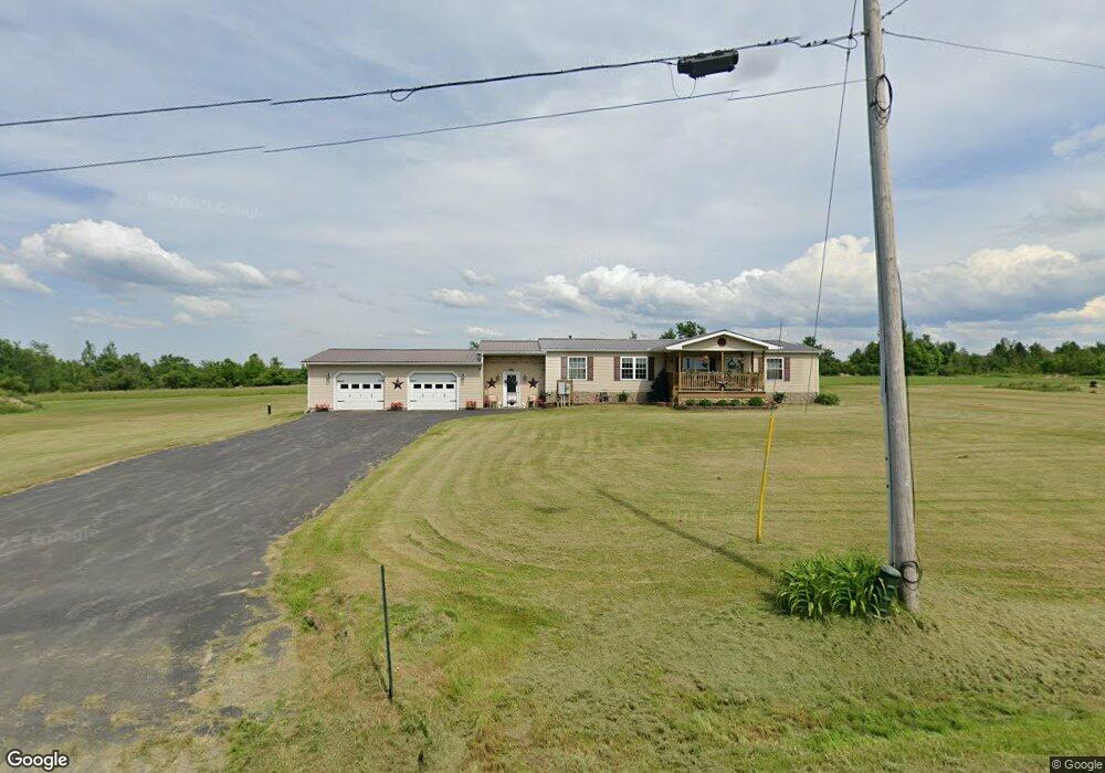
46 Taylor Rd North Bangor, NY 12966
Estimated Value: $84,000 - $172,000
1
Bed
2
Baths
1,160
Sq Ft
$114/Sq Ft
Est. Value
About This Home
This home is located at 46 Taylor Rd, North Bangor, NY 12966 and is currently estimated at $132,597, approximately $114 per square foot. 46 Taylor Rd is a home with nearby schools including Brushton-Moira Elementary School and Brushton-Moira High School.
Ownership History
Date
Name
Owned For
Owner Type
Purchase Details
Closed on
Oct 31, 2023
Sold by
Hosler Dianne M
Bought by
Gardner Carly and Mason Danielle M
Current Estimated Value
Purchase Details
Closed on
Jan 31, 2017
Sold by
Hosler Harold J and Hosler Dianne M
Bought by
Hosler Dianne M
Home Financials for this Owner
Home Financials are based on the most recent Mortgage that was taken out on this home.
Original Mortgage
$50,000
Interest Rate
4.09%
Mortgage Type
New Conventional
Purchase Details
Closed on
Jul 14, 1999
Sold by
Manchester Stanley A
Bought by
Hosler Harold J
Create a Home Valuation Report for This Property
The Home Valuation Report is an in-depth analysis detailing your home's value as well as a comparison with similar homes in the area
Home Values in the Area
Average Home Value in this Area
Purchase History
| Date | Buyer | Sale Price | Title Company |
|---|---|---|---|
| Gardner Carly | $33,000 | None Listed On Document | |
| Krempasky Dawn | -- | None Listed On Document | |
| Hosler Dianne M | -- | -- | |
| Hosler Harold J | $6,000 | John Aber |
Source: Public Records
Mortgage History
| Date | Status | Borrower | Loan Amount |
|---|---|---|---|
| Previous Owner | Hosler Dianne M | $50,000 |
Source: Public Records
Tax History Compared to Growth
Tax History
| Year | Tax Paid | Tax Assessment Tax Assessment Total Assessment is a certain percentage of the fair market value that is determined by local assessors to be the total taxable value of land and additions on the property. | Land | Improvement |
|---|---|---|---|---|
| 2024 | $2,641 | $68,200 | $16,000 | $52,200 |
| 2023 | $3,169 | $93,400 | $25,000 | $68,400 |
| 2022 | $3,212 | $93,400 | $25,000 | $68,400 |
| 2021 | $3,189 | $93,400 | $25,000 | $68,400 |
| 2020 | $2,002 | $93,400 | $25,000 | $68,400 |
| 2019 | $1,819 | $93,400 | $25,000 | $68,400 |
| 2018 | $1,680 | $93,400 | $25,000 | $68,400 |
| 2017 | $1,635 | $93,400 | $25,000 | $68,400 |
| 2016 | $2,143 | $93,400 | $25,000 | $68,400 |
| 2015 | -- | $93,400 | $25,000 | $68,400 |
| 2014 | -- | $93,400 | $25,000 | $68,400 |
Source: Public Records
Map
Nearby Homes
- 0 Cox Rd Unit 204813
- 20 Mill St
- 87 Van Dusen Dr
- 2422 U S 11
- 1107 County Rt 53
- 1822 State Route 11
- 390 Co Rt 12
- 0 Wagner Rd Unit 203197
- 40 Mccarthy Rd
- 662 Baker Rd
- 1434 County Route 22
- 192 Wiley Rd
- 715 S South Woods Rd Rd
- 725 S Woods Rd
- 752 S Woods Rd
- 1482 U S 11
- 2945 State Route 11
- 601 Limekiln Rd
- 1336 State Route 11b
- 75 Cr Rt 3
- 36 Taylor Rd
- 39 Taylor Rd
- 55 Taylor Rd
- 61 Taylor Rd
- 71 Taylor Rd
- 11 Taylor Rd
- 77 Taylor Rd
- 7 Taylor Rd
- 2257 State Route 11b
- 2245 State Route 11b
- 2267 State Route 11b
- 3 Taylor Rd
- 2231 State Route 11b
- 91 Taylor Rd
- 2279 State Route 11b
- 2225 State Route 11b
- 2258 State Route 11b
- 96 Taylor Rd
- 2238 State Route 11b
- 2287 State Route 11b