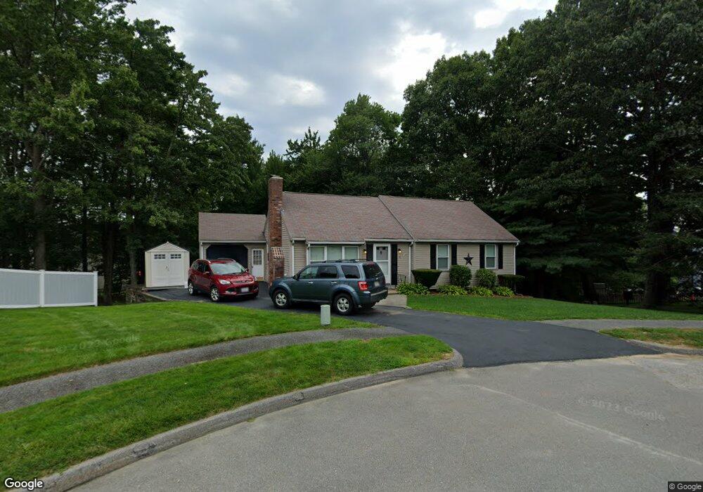
46 Westport Rd Worcester, MA 01605
Forest Grove NeighborhoodEstimated Value: $484,981 - $497,000
3
Beds
2
Baths
1,229
Sq Ft
$400/Sq Ft
Est. Value
About This Home
This home is located at 46 Westport Rd, Worcester, MA 01605 and is currently estimated at $491,245, approximately $399 per square foot. 46 Westport Rd is a home located in Worcester County with nearby schools including Nelson Place Elementary School, Jacob Hiatt Magnet School, and Chandler Magnet.
Ownership History
Date
Name
Owned For
Owner Type
Purchase Details
Closed on
Dec 3, 2007
Sold by
Rees Brian J and Rees Natalie C
Bought by
Wilson Karen A and Wilson Paul S
Current Estimated Value
Home Financials for this Owner
Home Financials are based on the most recent Mortgage that was taken out on this home.
Original Mortgage
$251,750
Outstanding Balance
$160,824
Interest Rate
6.48%
Mortgage Type
Purchase Money Mortgage
Estimated Equity
$330,421
Purchase Details
Closed on
Apr 27, 2004
Sold by
Executive Relocation C
Bought by
Rees Brian J and Rees Natalie C
Home Financials for this Owner
Home Financials are based on the most recent Mortgage that was taken out on this home.
Original Mortgage
$206,400
Interest Rate
5.4%
Mortgage Type
Purchase Money Mortgage
Purchase Details
Closed on
Oct 22, 1999
Sold by
Ritacco Laurie J
Bought by
Cantwell Todd J
Purchase Details
Closed on
Apr 12, 1995
Sold by
Mcmanaman Lynn
Bought by
Ritacco David and Ritacco Laurie
Purchase Details
Closed on
Jul 29, 1987
Sold by
Cusson Mary P
Bought by
Mcmanaman Linda J
Create a Home Valuation Report for This Property
The Home Valuation Report is an in-depth analysis detailing your home's value as well as a comparison with similar homes in the area
Home Values in the Area
Average Home Value in this Area
Purchase History
| Date | Buyer | Sale Price | Title Company |
|---|---|---|---|
| Wilson Karen A | $265,000 | -- | |
| Rees Brian J | $258,000 | -- | |
| Executive Relocation C | $258,000 | -- | |
| Cantwell Todd J | $134,000 | -- | |
| Ritacco David | $125,000 | -- | |
| Mcmanaman Linda J | $134,000 | -- |
Source: Public Records
Mortgage History
| Date | Status | Borrower | Loan Amount |
|---|---|---|---|
| Open | Wilson Karen A | $251,750 | |
| Previous Owner | Rees Brian J | $206,400 | |
| Previous Owner | Mcmanaman Linda J | $141,000 | |
| Previous Owner | Mcmanaman Linda J | $133,000 |
Source: Public Records
Tax History Compared to Growth
Tax History
| Year | Tax Paid | Tax Assessment Tax Assessment Total Assessment is a certain percentage of the fair market value that is determined by local assessors to be the total taxable value of land and additions on the property. | Land | Improvement |
|---|---|---|---|---|
| 2025 | $5,591 | $423,900 | $118,700 | $305,200 |
| 2024 | $5,501 | $400,100 | $118,700 | $281,400 |
| 2023 | $5,340 | $372,400 | $103,200 | $269,200 |
| 2022 | $4,750 | $312,300 | $82,600 | $229,700 |
| 2021 | $4,723 | $290,100 | $66,100 | $224,000 |
| 2020 | $4,519 | $265,800 | $66,100 | $199,700 |
| 2019 | $4,246 | $235,900 | $59,500 | $176,400 |
| 2018 | $4,098 | $216,700 | $59,500 | $157,200 |
| 2017 | $4,165 | $216,700 | $59,500 | $157,200 |
| 2016 | $4,118 | $199,800 | $43,700 | $156,100 |
| 2015 | $4,010 | $199,800 | $43,700 | $156,100 |
| 2014 | $3,904 | $199,800 | $43,700 | $156,100 |
Source: Public Records
Map
Nearby Homes
- 7 Otter Trail
- 17 Leslie Rd
- 12 Tattan Farm Rd
- 303 Greenwich Ct Unit 303
- 3901 Knightsbridge Close Unit 3901
- 4004 Brompton Cir
- 9 Emily St
- 61 Barry Rd
- 49 Barry Rd
- 46 Barry Rd
- 97 Parkton Ave
- 90 Lynnwood Ln
- 770 Salisbury St Unit 201
- 27 Tea Party Cir Unit 27
- 308 Holden St
- 2 Explorers Way Unit 2
- 8 Indian Cir Unit 8
- 4 Barrows Rd
- 113 Indian Hill Rd
- 82 Holden St