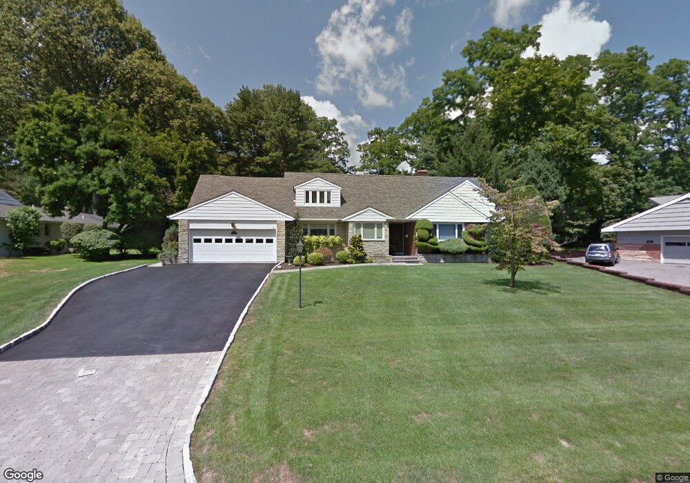
46 Witherspoon Rd Clifton, NJ 07013
Montclair Heights NeighborhoodEstimated Value: $950,000 - $1,219,000
--
Bed
--
Bath
3,761
Sq Ft
$280/Sq Ft
Est. Value
About This Home
This home is located at 46 Witherspoon Rd, Clifton, NJ 07013 and is currently estimated at $1,051,262, approximately $279 per square foot. 46 Witherspoon Rd is a home located in Passaic County with nearby schools including Clifton High School, The Magical Palace of Knowledge, and Saint Philip the Apostle Preparatory School.
Ownership History
Date
Name
Owned For
Owner Type
Purchase Details
Closed on
Feb 14, 1995
Sold by
Ferron Margaret
Bought by
Delucia Joseph and Delucia Teresa
Current Estimated Value
Home Financials for this Owner
Home Financials are based on the most recent Mortgage that was taken out on this home.
Original Mortgage
$231,000
Interest Rate
9.09%
Create a Home Valuation Report for This Property
The Home Valuation Report is an in-depth analysis detailing your home's value as well as a comparison with similar homes in the area
Home Values in the Area
Average Home Value in this Area
Purchase History
| Date | Buyer | Sale Price | Title Company |
|---|---|---|---|
| Delucia Joseph | $310,000 | -- |
Source: Public Records
Mortgage History
| Date | Status | Borrower | Loan Amount |
|---|---|---|---|
| Closed | Delucia Joseph | $231,000 |
Source: Public Records
Tax History Compared to Growth
Tax History
| Year | Tax Paid | Tax Assessment Tax Assessment Total Assessment is a certain percentage of the fair market value that is determined by local assessors to be the total taxable value of land and additions on the property. | Land | Improvement |
|---|---|---|---|---|
| 2025 | $21,429 | $361,000 | $182,700 | $178,300 |
| 2024 | $20,916 | $361,000 | $182,700 | $178,300 |
| 2022 | $20,613 | $361,000 | $182,700 | $178,300 |
| 2021 | $19,765 | $361,000 | $182,700 | $178,300 |
| 2020 | $19,830 | $361,000 | $182,700 | $178,300 |
| 2019 | $19,689 | $361,000 | $182,700 | $178,300 |
| 2018 | $19,577 | $361,000 | $182,700 | $178,300 |
| 2017 | $19,364 | $361,000 | $182,700 | $178,300 |
| 2016 | $18,989 | $361,000 | $182,700 | $178,300 |
| 2015 | $18,804 | $361,000 | $182,700 | $178,300 |
| 2014 | $18,418 | $361,000 | $182,700 | $178,300 |
Source: Public Records
Map
Nearby Homes
- 49 Witherspoon Rd
- 39 Witherspoon Rd
- 54 Witherspoon Rd
- 31 Witherspoon Rd
- 26 Witherspoon Rd
- 62 Witherspoon Rd
- 61 Witherspoon Rd
- 16 Witherspoon Rd
- 123 Pearl Brook Dr
- 19 Witherspoon Rd
- 117 Edwards Rd
- 131 Pearl Brook Dr
- 25 Witherspoon Rd
- 75 Witherspoon Rd
- 64 Woodlawn Ave
- 56 Woodlawn Ave
- 6 Witherspoon Rd
- 115 Pearl Brook Dr
- 74 Woodlawn Ave
- 123 Edwards Rd