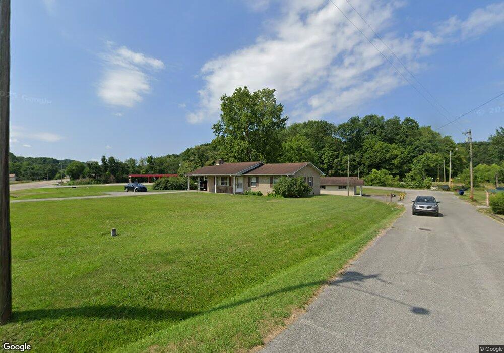
460 Paint Rock Rd Oneida, TN 37841
Estimated Value: $222,000 - $263,049
3
Beds
2
Baths
1,464
Sq Ft
$168/Sq Ft
Est. Value
About This Home
This home is located at 460 Paint Rock Rd, Oneida, TN 37841 and is currently estimated at $245,762, approximately $167 per square foot. 460 Paint Rock Rd is a home located in Scott County with nearby schools including Oneida Elementary School, Oneida Middle School, and Oneida High School.
Ownership History
Date
Name
Owned For
Owner Type
Purchase Details
Closed on
Jun 26, 2008
Sold by
Opal Shepherd
Bought by
Charles Emory
Current Estimated Value
Purchase Details
Closed on
Mar 11, 2008
Sold by
Opal Shepherd
Bought by
Ruth Emory Lillian
Purchase Details
Closed on
Nov 8, 1999
Purchase Details
Closed on
Oct 30, 1989
Purchase Details
Closed on
Jul 8, 1983
Purchase Details
Closed on
Feb 17, 1961
Bought by
Sheppard Perry and Sheppard Opal
Create a Home Valuation Report for This Property
The Home Valuation Report is an in-depth analysis detailing your home's value as well as a comparison with similar homes in the area
Home Values in the Area
Average Home Value in this Area
Purchase History
| Date | Buyer | Sale Price | Title Company |
|---|---|---|---|
| Charles Emory | -- | -- | |
| Ruth Emory Lillian | -- | -- | |
| -- | -- | -- | |
| -- | -- | -- | |
| -- | -- | -- | |
| Sheppard Perry | -- | -- |
Source: Public Records
Tax History
| Year | Tax Paid | Tax Assessment Tax Assessment Total Assessment is a certain percentage of the fair market value that is determined by local assessors to be the total taxable value of land and additions on the property. | Land | Improvement |
|---|---|---|---|---|
| 2025 | $1,687 | $54,025 | $11,825 | $42,200 |
| 2024 | $1,687 | $54,025 | $11,825 | $42,200 |
| 2023 | $1,735 | $54,025 | $11,825 | $42,200 |
| 2022 | $1,350 | $30,325 | $6,525 | $23,800 |
| 2021 | $1,150 | $30,325 | $6,525 | $23,800 |
| 2020 | $912 | $30,325 | $6,525 | $23,800 |
| 2019 | $1,230 | $30,900 | $6,525 | $24,375 |
| 2018 | $1,230 | $30,900 | $6,525 | $24,375 |
| 2017 | $1,269 | $31,875 | $6,525 | $25,350 |
| 2016 | $1,241 | $31,875 | $6,525 | $25,350 |
| 2015 | $1,326 | $35,125 | $6,525 | $28,600 |
| 2014 | $1,326 | $35,125 | $6,525 | $28,600 |
Source: Public Records
Map
Nearby Homes
- 35 Buffalo Rd
- 226 Keeton Ln
- 121 Sexton Ln
- 5821 Buffalo Rd
- 120 Wright St
- 201 Grand Pappy Ln
- 103 Shelton Ln
- 108 W 1st Ave
- 342 Vine Ave
- 0 Marlow St Unit 1321095
- 18741 Alberta St
- 458 Slaven Ln
- 1600 Paint Rock Rd
- 216 Lafayette St
- 202 Chester St
- 420 Southern Ln
- 19421 Alberta St
- 126 Pullman Ln
- Lot 25-26 Summit Dr
- Lot 27-28 Summit Dr
- 120 Perry Ln
- 136 Perry Ln
- 104 Perry Ln
- 0 Buffalo Rd Unit RTC2998931
- 0 Buffalo Rd Unit 1310923
- 0 Buffalo Rd Unit 23634322
- 0 Buffalo Rd Unit 11503602
- 0 Buffalo Rd Unit RTC2828803
- 0 Buffalo Rd Unit 1258697
- 0 Buffalo Rd Unit 1220236
- 0 Buffalo Rd Unit 647615
- 0 Buffalo Rd Unit 673685
- 0 Buffalo Rd Unit 677784
- 0 Buffalo Rd Unit 705400
- 0 Buffalo Rd Unit 755617
- 0 Buffalo Rd Unit 808651
- 0 Buffalo Rd Unit 1025867
- 0 Buffalo Rd Unit 1059185
- 0 Buffalo Rd Unit Lot D 1059249
- 0 Buffalo Rd Unit Lot C 1059248
Your Personal Tour Guide
Ask me questions while you tour the home.