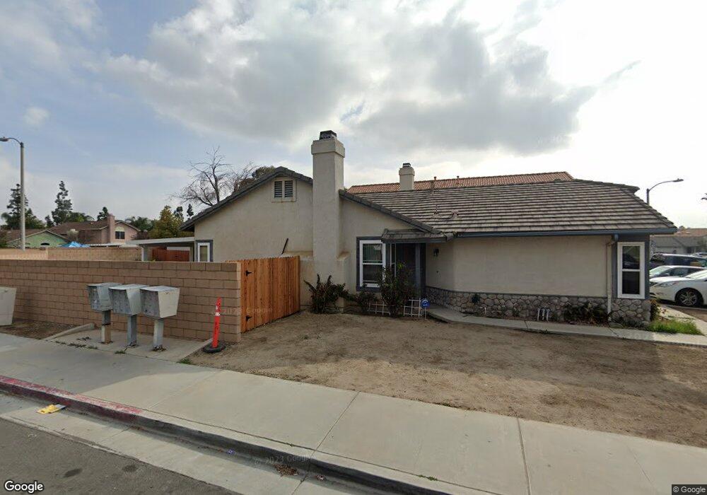
460 Playa de Corte Perris, CA 92571
Central Perris NeighborhoodEstimated Value: $444,000 - $475,000
3
Beds
2
Baths
1,098
Sq Ft
$421/Sq Ft
Est. Value
About This Home
This home is located at 460 Playa de Corte, Perris, CA 92571 and is currently estimated at $461,985, approximately $420 per square foot. 460 Playa de Corte is a home located in Riverside County with nearby schools including Clearwater Elementary School, Pinacate Middle School, and Perris High School.
Ownership History
Date
Name
Owned For
Owner Type
Purchase Details
Closed on
Feb 7, 2003
Sold by
Nochez Miguel Angel and Nochez Esmeralda
Bought by
Yanez Jacqueline M
Current Estimated Value
Home Financials for this Owner
Home Financials are based on the most recent Mortgage that was taken out on this home.
Original Mortgage
$118,400
Outstanding Balance
$50,338
Interest Rate
5.85%
Estimated Equity
$411,647
Purchase Details
Closed on
Sep 23, 1994
Sold by
Rancho Las Perris Associates Lp
Bought by
Nochez Miguel Angel and Nochez Esmeralda
Home Financials for this Owner
Home Financials are based on the most recent Mortgage that was taken out on this home.
Original Mortgage
$85,990
Interest Rate
8.58%
Create a Home Valuation Report for This Property
The Home Valuation Report is an in-depth analysis detailing your home's value as well as a comparison with similar homes in the area
Home Values in the Area
Average Home Value in this Area
Purchase History
| Date | Buyer | Sale Price | Title Company |
|---|---|---|---|
| Yanez Jacqueline M | $148,000 | Chicago Title Co | |
| Nochez Miguel Angel | $86,000 | World Title Company |
Source: Public Records
Mortgage History
| Date | Status | Borrower | Loan Amount |
|---|---|---|---|
| Open | Yanez Jacqueline M | $118,400 | |
| Previous Owner | Nochez Miguel Angel | $85,990 | |
| Closed | Yanez Jacqueline M | $29,600 |
Source: Public Records
Tax History
| Year | Tax Paid | Tax Assessment Tax Assessment Total Assessment is a certain percentage of the fair market value that is determined by local assessors to be the total taxable value of land and additions on the property. | Land | Improvement |
|---|---|---|---|---|
| 2025 | $2,621 | $222,338 | $57,918 | $164,420 |
| 2023 | $2,621 | $213,707 | $55,670 | $158,037 |
| 2022 | $4,055 | $209,518 | $54,579 | $154,939 |
| 2021 | $4,036 | $205,410 | $53,509 | $151,901 |
| 2020 | $3,959 | $203,305 | $52,961 | $150,344 |
| 2019 | $6,963 | $199,320 | $51,923 | $147,397 |
| 2018 | $6,852 | $195,412 | $50,905 | $144,507 |
| 2017 | $7,423 | $191,581 | $49,907 | $141,674 |
| 2016 | $6,071 | $187,826 | $48,929 | $138,897 |
| 2015 | $6,062 | $184,000 | $48,000 | $136,000 |
| 2014 | $2,939 | $181,000 | $47,000 | $134,000 |
Source: Public Records
Map
Nearby Homes
- 507 Coudures Way
- 377 Aurora Dr
- 466 Granite View Dr
- 1826 Avenida San Sebastian
- 1942 Sandcastle Dr
- 544 Turquoise Dr
- 2248 Ridge Ct
- 1777 Amethyst Dr
- 2070 Dayflower Ct
- 2231 Flash Ct
- 1676 Amethyst Dr
- 2269 Firebrand Ave
- 129 Olivetree Dr
- 723 Anthirium Ave
- 705 Fuchsia Ln
- 1829 Springtree Dr
- 763 Anthirium Ave
- 21500 Orange Creek Rd
- 2063 Willowbrook Ln
- 1562 Remembrance Dr
- 468 Playa de Corte
- 476 Playa de Corte
- 482 Playa de Corte
- 1978 Avenida San Sebastian
- 1986 Avenida San Sebastian
- 1970 Avenida San Sebastian
- 1962 Avenida San Sebastian
- 486 Playa de Corte
- 459 Playa de Corte
- 467 Playa de Corte
- 475 Playa de Corte
- 433 Coudures Way
- 1956 Avenida San Sebastian
- 439 Coudures Way
- 427 Coudures Way
- 445 Coudures Way
- 490 Playa de Corte
- 481 Playa de Corte
- 451 Coudures Way
- 1948 Avenida San Sebastian
Your Personal Tour Guide
Ask me questions while you tour the home.