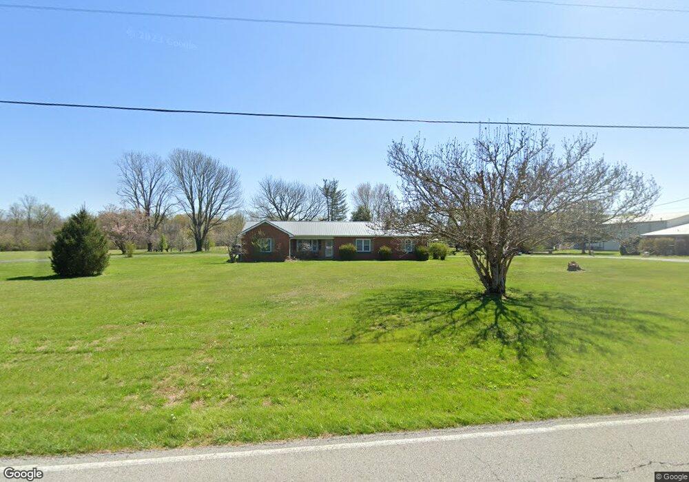
460 Ragsdale Rd Manchester, TN 37355
Estimated Value: $286,000 - $328,000
--
Bed
2
Baths
1,978
Sq Ft
$154/Sq Ft
Est. Value
About This Home
This home is located at 460 Ragsdale Rd, Manchester, TN 37355 and is currently estimated at $304,577, approximately $153 per square foot. 460 Ragsdale Rd is a home located in Coffee County with nearby schools including Westwood Middle School and Temple Baptist Christian School.
Ownership History
Date
Name
Owned For
Owner Type
Purchase Details
Closed on
Sep 12, 2023
Sold by
Morton William B
Bought by
Morton James P
Current Estimated Value
Purchase Details
Closed on
Dec 21, 2007
Sold by
Seckler Terry R
Bought by
Brown Tom B
Purchase Details
Closed on
Aug 29, 1997
Bought by
Seckler Terry Ray & Penny L Sons
Create a Home Valuation Report for This Property
The Home Valuation Report is an in-depth analysis detailing your home's value as well as a comparison with similar homes in the area
Home Values in the Area
Average Home Value in this Area
Purchase History
| Date | Buyer | Sale Price | Title Company |
|---|---|---|---|
| Morton James P | -- | None Listed On Document | |
| Brown Tom B | $185,000 | -- | |
| Seckler Terry Ray & Penny L Sons | $88,000 | -- |
Source: Public Records
Tax History Compared to Growth
Tax History
| Year | Tax Paid | Tax Assessment Tax Assessment Total Assessment is a certain percentage of the fair market value that is determined by local assessors to be the total taxable value of land and additions on the property. | Land | Improvement |
|---|---|---|---|---|
| 2024 | $1,406 | $33,350 | $6,550 | $26,800 |
| 2023 | $1,406 | $33,350 | $0 | $0 |
| 2022 | $1,211 | $33,350 | $6,550 | $26,800 |
| 2021 | $1,148 | $25,075 | $4,425 | $20,650 |
| 2020 | $1,148 | $25,075 | $4,425 | $20,650 |
| 2019 | $1,148 | $25,075 | $4,425 | $20,650 |
| 2018 | $1,148 | $25,075 | $4,425 | $20,650 |
| 2017 | $1,334 | $25,425 | $5,600 | $19,825 |
| 2016 | $1,334 | $25,425 | $5,600 | $19,825 |
| 2015 | $1,334 | $25,425 | $5,600 | $19,825 |
| 2014 | $1,333 | $25,419 | $0 | $0 |
Source: Public Records
Map
Nearby Homes
- 627 Ragsdale Rd
- 775 Ragsdale Rd
- 1292 McMinnville Hwy
- 793 Old Bushy Branch Rd
- 416 Powers Rd
- 215 Wellington Dr
- 54 Stonehenge Ln E
- 31 Stonehenge Ln S
- 1989 Elevation JKL Plan at Stonehenge
- 1726 Elevation JKL Plan at Stonehenge
- 1824 Elevation JKL Plan at Stonehenge
- 1258 Stonehenge Plan at Stonehenge
- 2073 Elevation JKL Plan at Stonehenge
- 1624 Elevation JKL Plan at Stonehenge
- Henry Plan at Stonehenge
- 1315 Elevation JKL Plan at Stonehenge
- 1489 Elevation JKL Plan at Stonehenge
- 2151 Elevation JKL Plan at Stonehenge
- 1567 Elevation JKL Plan at Stonehenge
- 1220 - Stonehenge Plan at Stonehenge
- 426 Ragsdale Rd
- 71 New Bushy Branch Rd
- 455 Ragsdale Rd
- 96 Dove Hollow Ln
- 159 New Bushy Branch Rd
- 160 Dove Hollow Ln
- 593 Ragsdale Rd
- 524 Ragsdale Rd
- 618 Ragsdale Rd
- 263 Ragsdale Rd
- 110 Lavergne St
- 88 Lavergne St
- 684 Ragsdale Rd
- 74 Lavergne St
- 679 Ragsdale Rd
- 109 Lavergne St
- 58 Lavergne St
- 89 Lavergne St
- 42 Lavergne St
- 703 Ragsdale Rd