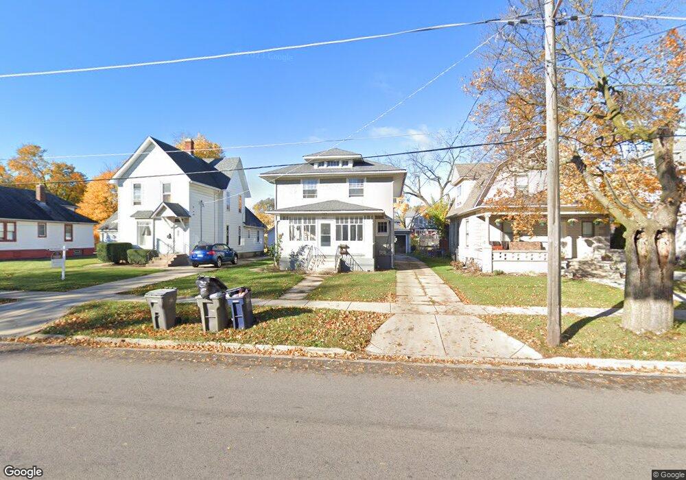
460 S Liberty St Elgin, IL 60120
Elgin National Watch Historic District NeighborhoodEstimated Value: $278,272 - $300,000
4
Beds
2
Baths
2,072
Sq Ft
$139/Sq Ft
Est. Value
About This Home
This home is located at 460 S Liberty St, Elgin, IL 60120 and is currently estimated at $287,318, approximately $138 per square foot. 460 S Liberty St is a home located in Kane County with nearby schools including Huff Elementary School, Ellis Middle School, and Elgin High School.
Ownership History
Date
Name
Owned For
Owner Type
Purchase Details
Closed on
Feb 14, 2011
Sold by
Wells Fargo Bank National Association
Bought by
Shay John T
Current Estimated Value
Purchase Details
Closed on
Jan 25, 2010
Sold by
Brown Paul
Bought by
Wells Fargo Bank National Association
Purchase Details
Closed on
Mar 16, 2005
Sold by
Meyers Ted A
Bought by
Brown Paul
Home Financials for this Owner
Home Financials are based on the most recent Mortgage that was taken out on this home.
Original Mortgage
$135,150
Interest Rate
7.75%
Mortgage Type
Unknown
Create a Home Valuation Report for This Property
The Home Valuation Report is an in-depth analysis detailing your home's value as well as a comparison with similar homes in the area
Home Values in the Area
Average Home Value in this Area
Purchase History
We collect this data history from publicly available records. To have your information removed, we recommend requesting removal directly through your county’s website.
| Date | Buyer | Sale Price | Title Company |
|---|---|---|---|
| Shay John T | $64,000 | Chicago Title Insurance Co | |
| Wells Fargo Bank National Association | -- | None Available | |
| Brown Paul | $159,000 | -- |
Source: Public Records
Mortgage History
We collect this data history from publicly available records. To have your information removed, we recommend requesting removal directly through your county’s website.
| Date | Status | Borrower | Loan Amount |
|---|---|---|---|
| Previous Owner | Brown Paul | $135,150 |
Source: Public Records
Tax History
| Year | Tax Paid | Tax Assessment Tax Assessment Total Assessment is a certain percentage of the fair market value that is determined by local assessors to be the total taxable value of land and additions on the property. | Land | Improvement |
|---|---|---|---|---|
| 2024 | $5,728 | $71,569 | $11,586 | $59,983 |
| 2023 | $5,512 | $64,657 | $10,467 | $54,190 |
| 2022 | $4,723 | $54,464 | $9,544 | $44,920 |
| 2021 | $4,543 | $50,920 | $8,923 | $41,997 |
| 2020 | $4,434 | $48,611 | $8,518 | $40,093 |
| 2019 | $4,325 | $46,305 | $8,114 | $38,191 |
| 2018 | $4,313 | $43,622 | $7,644 | $35,978 |
| 2017 | $4,241 | $41,238 | $7,226 | $34,012 |
| 2016 | $4,080 | $38,258 | $6,704 | $31,554 |
| 2015 | -- | $35,067 | $6,145 | $28,922 |
| 2014 | -- | $34,634 | $6,069 | $28,565 |
| 2013 | -- | $35,547 | $6,229 | $29,318 |
Source: Public Records
Map
Nearby Homes
- 515 Illinois Ave
- 555 S Liberty St
- 700 Villa St
- 513 Cookane Ave
- 483 Barrett St
- 286 Villa St
- 447 Ashland Ave
- 17 S Liberty St
- 711 Bluff City Blvd
- 12 Rugby Place
- 168 Villa St
- 153 Dawson Dr
- 311 Ryerson Ave
- 147 River Walk Ct
- 489 Division St
- 141 S Grove Ave
- 821 Bode Rd Unit 4
- 630 Forest Ave
- 400 Woodview Cir Unit A
- 402 Woodview Cir Unit D
- 456 S Liberty St
- 464 S Liberty St
- 450 S Liberty St
- 470 S Liberty St
- 525 Regent St
- 461 Arlington Ave
- 465 Arlington Ave
- 472 S Liberty St
- 471 Arlington Ave
- 461 S Liberty St
- 451 Arlington Ave
- 467 S Liberty St Unit 69
- 451 S Liberty St
- 432 S Liberty St
- 475 Arlington Ave
- 476 S Liberty St
- 473 S Liberty St
- 433 Arlington Ave
- 439 S Liberty St
- 477 Arlington Ave
Your Personal Tour Guide
Ask me questions while you tour the home.