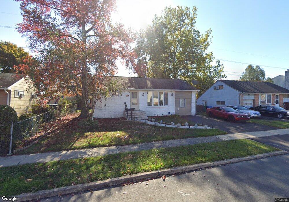
4604 Brookside Ave Bristol, PA 19007
Estimated Value: $312,000 - $358,000
4
Beds
2
Baths
954
Sq Ft
$354/Sq Ft
Est. Value
About This Home
This home is located at 4604 Brookside Ave, Bristol, PA 19007 and is currently estimated at $338,189, approximately $354 per square foot. 4604 Brookside Ave is a home located in Bucks County with nearby schools including Truman Senior High School, Hope Lutheran School, and St. Mark Elementary School.
Ownership History
Date
Name
Owned For
Owner Type
Purchase Details
Closed on
Aug 25, 2005
Sold by
Ruggero John and Ruggero Brandi
Bought by
Lewandowski Michael
Current Estimated Value
Home Financials for this Owner
Home Financials are based on the most recent Mortgage that was taken out on this home.
Original Mortgage
$149,600
Outstanding Balance
$79,734
Interest Rate
5.79%
Mortgage Type
Fannie Mae Freddie Mac
Estimated Equity
$258,455
Purchase Details
Closed on
Sep 6, 1996
Sold by
Martin Richard C and Martin Johanna
Bought by
Ruggero John and Katzmar Brandi
Home Financials for this Owner
Home Financials are based on the most recent Mortgage that was taken out on this home.
Original Mortgage
$86,450
Interest Rate
7.89%
Create a Home Valuation Report for This Property
The Home Valuation Report is an in-depth analysis detailing your home's value as well as a comparison with similar homes in the area
Home Values in the Area
Average Home Value in this Area
Purchase History
| Date | Buyer | Sale Price | Title Company |
|---|---|---|---|
| Lewandowski Michael | $187,000 | Lawyers Title Insurance Corp | |
| Ruggero John | $91,000 | -- |
Source: Public Records
Mortgage History
| Date | Status | Borrower | Loan Amount |
|---|---|---|---|
| Open | Lewandowski Michael | $149,600 | |
| Previous Owner | Ruggero John | $86,450 |
Source: Public Records
Tax History
| Year | Tax Paid | Tax Assessment Tax Assessment Total Assessment is a certain percentage of the fair market value that is determined by local assessors to be the total taxable value of land and additions on the property. | Land | Improvement |
|---|---|---|---|---|
| 2025 | $4,236 | $15,600 | $4,320 | $11,280 |
| 2024 | $4,236 | $15,600 | $4,320 | $11,280 |
| 2023 | $4,205 | $15,600 | $4,320 | $11,280 |
| 2022 | $4,205 | $15,600 | $4,320 | $11,280 |
| 2021 | $4,205 | $15,600 | $4,320 | $11,280 |
| 2020 | $4,205 | $15,600 | $4,320 | $11,280 |
| 2019 | $4,190 | $15,600 | $4,320 | $11,280 |
| 2018 | $4,122 | $15,600 | $4,320 | $11,280 |
| 2017 | $4,060 | $15,600 | $4,320 | $11,280 |
| 2016 | $4,060 | $15,600 | $4,320 | $11,280 |
| 2015 | $3,148 | $15,600 | $4,320 | $11,280 |
| 2014 | $3,148 | $15,600 | $4,320 | $11,280 |
Source: Public Records
Map
Nearby Homes
- 2510 Green Ave
- 2519 Woodlawn Dr
- 4617 Magnolia Ave
- 2715 Crest Ave
- 53 Pamela Ct Unit 318
- 238 Colette Ct Unit 1311
- 187 Delhaas Cir
- 35 Beechtree Rd
- 142 Delhaas Cir
- 135 Delhaas Cir
- 140 Delhaas Cir
- 133 Delhaas Cir
- 138 Delhaas Cir
- 136 Delhaas Cir
- 131 Delhaas Cir
- 129 Delhaas Cir
- 127 Delhaas Cir
- 134 Delhaas Cir
- 124 Delhaas Cir
- 128 Delhaas Cir
- 4602 Brookside Ave
- 4600 Brookside Ave
- 4603 Brookside Ave
- 2501 Green Ave
- 4606 Brookside Ave
- 2500 Woodlawn Dr
- 4608 Brookside Ave
- 4520 Brookside Ave
- 2503 Green Ave
- 2500 Green Ave
- 4610 Brookside Ave
- 4518 Brookside Ave
- 2502 Green Ave
- 2502 Woodlawn Dr
- 2501 Woodlawn Dr
- 4609 Brookside Ave
- 2505 Green Ave
- 4607 David Dr
- 4612 Brookside Ave
- 4605 David Dr
Your Personal Tour Guide
Ask me questions while you tour the home.