
Seller's Agent in 2021
Sandi Green
Waddell Haskin & Green Realty, LLC
(706) 392-6500
31 in this area
88 Total Sales

Estimated Value: $187,000 - $196,000
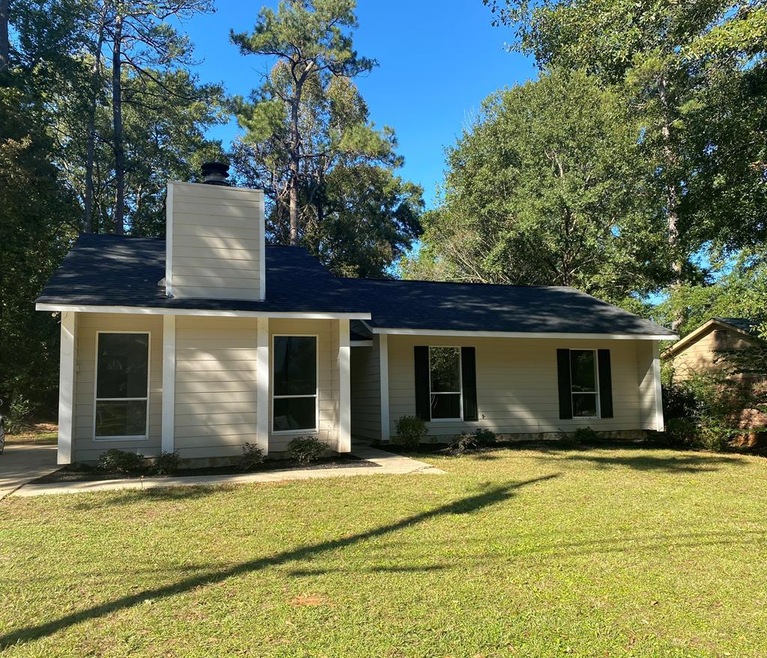
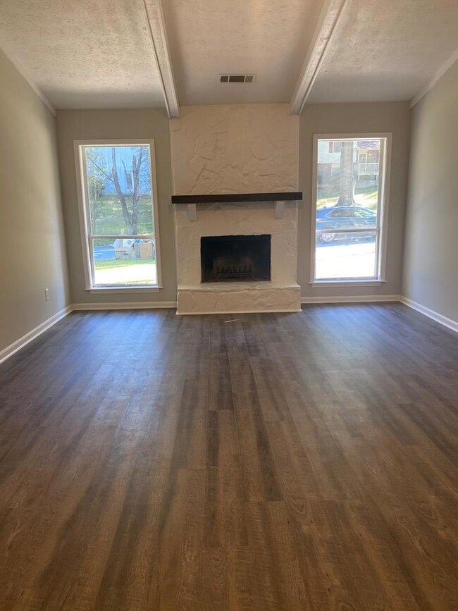
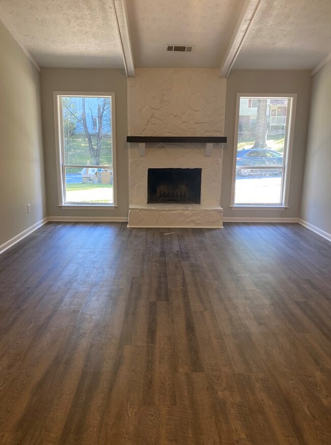
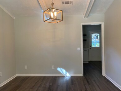
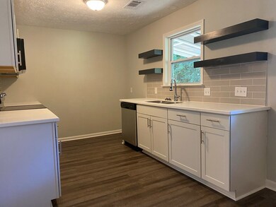
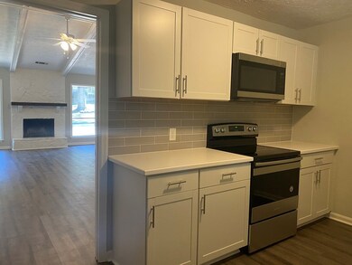
ADORABLE 3 BR, 2 BATH RANCH SITUATED ON A NICE LEVEL TO ROLLING LOT IN CONVENIENT CHARTER OAKS SUBDIVISION. TOTALL Y RENOVATED WITH NEW ROOF, CABINETS, APPLIANCES, PAINT, FLOORING, HVAC, AND MORE!! CATHEDRAL CEILING, WOOD FLOORING AND STONE FIREPLACE IN THE GREATROOM. GREAT KITCHEN WITH NEW CABINETS, APPLIANCES AND COUNTERS. SELLER IS BROTHER OF LISTING AGENT.
Last Agent to Sell the Property
Waddell Haskin & Green Realty, LLC Brokerage Phone: 7062213451 License #53002 Listed on: 11/29/2020
Last Buyer's Agent
Isaiah Thompson
Keller Williams Realty River Cities License #372407
| Date | Buyer | Sale Price | Title Company |
|---|---|---|---|
| Reyes Gelacio | $134,900 | -- | |
| Oates Samuel W | $29,375 | -- | |
| Oates Samuel W | $29,375 | -- |
| Date | Status | Borrower | Loan Amount |
|---|---|---|---|
| Open | Reyes Gelacio | $134,900 |
| Date | Event | Price | List to Sale | Price per Sq Ft |
|---|---|---|---|---|
| 03/01/2021 03/01/21 | Sold | $134,900 | -- | $106 / Sq Ft |
| 11/29/2020 11/29/20 | Pending | -- | -- | -- |
| Year | Tax Paid | Tax Assessment Tax Assessment Total Assessment is a certain percentage of the fair market value that is determined by local assessors to be the total taxable value of land and additions on the property. | Land | Improvement |
|---|---|---|---|---|
| 2025 | $2,364 | $60,392 | $9,912 | $50,480 |
| 2024 | $2,376 | $60,688 | $9,912 | $50,776 |
| 2023 | $2,391 | $60,688 | $9,912 | $50,776 |
| 2022 | $1,999 | $48,956 | $9,912 | $39,044 |
| 2021 | $1,694 | $41,488 | $9,912 | $31,576 |
| 2020 | $1,694 | $41,488 | $9,912 | $31,576 |
| 2019 | $1,700 | $41,488 | $9,912 | $31,576 |
| 2018 | $1,700 | $41,488 | $9,912 | $31,576 |
| 2017 | $1,885 | $41,488 | $9,912 | $31,576 |
| 2016 | $1,242 | $30,115 | $5,914 | $24,201 |
| 2015 | $1,244 | $30,115 | $5,914 | $24,201 |
| 2014 | $1,245 | $30,115 | $5,914 | $24,201 |
| 2013 | -- | $30,115 | $5,914 | $24,201 |
Seller's Agent in 2021
Sandi Green
Waddell Haskin & Green Realty, LLC
(706) 392-6500
31 in this area
88 Total Sales
I
Buyer's Agent in 2021
Isaiah Thompson
Keller Williams Realty River Cities
Source: Columbus Board of REALTORS® (GA)
MLS Number: 182089
APN: 081-014-008
Disclaimer: Certain information contained herein is derived from information provided by parties other than Homes.com. All information provided is deemed reliable, but is not guaranteed to be accurate and should be independently verified.
![]() IDX information is provided exclusively for personal, non-commercial use, and may not be used for any purpose other than to identify prospective properties consumers may be interested in purchasing. Information is deemed reliable but not guaranteed.
IDX information is provided exclusively for personal, non-commercial use, and may not be used for any purpose other than to identify prospective properties consumers may be interested in purchasing. Information is deemed reliable but not guaranteed.