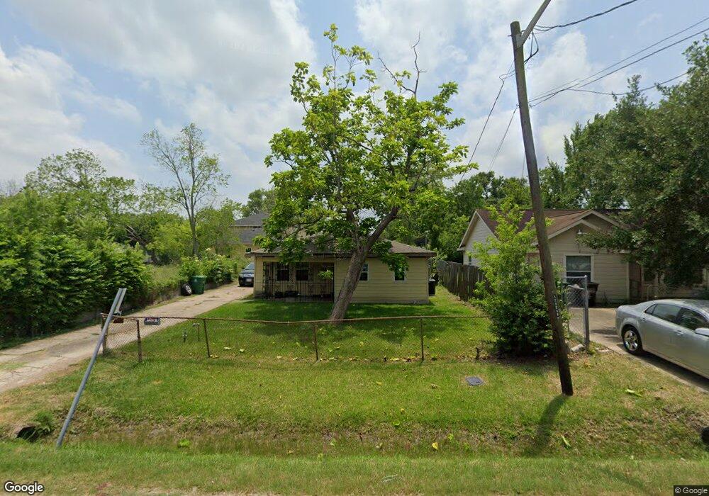
4606 Briscoe St Houston, TX 77051
Sunnyside NeighborhoodEstimated Value: $146,062 - $165,000
2
Beds
1
Bath
1,110
Sq Ft
$140/Sq Ft
Est. Value
About This Home
This home is located at 4606 Briscoe St, Houston, TX 77051 and is currently estimated at $155,266, approximately $139 per square foot. 4606 Briscoe St is a home located in Harris County with nearby schools including Young Elementary School, Attucks Middle School, and Worthing High School.
Ownership History
Date
Name
Owned For
Owner Type
Purchase Details
Closed on
Jun 9, 2012
Sold by
Jabe Resources Llc
Bought by
White Dwayne C
Current Estimated Value
Home Financials for this Owner
Home Financials are based on the most recent Mortgage that was taken out on this home.
Original Mortgage
$9,000
Interest Rate
3.9%
Mortgage Type
Purchase Money Mortgage
Purchase Details
Closed on
Dec 3, 2008
Sold by
Jabe Resources Llc
Bought by
White Dwayne C
Home Financials for this Owner
Home Financials are based on the most recent Mortgage that was taken out on this home.
Original Mortgage
$26,000
Interest Rate
5.7%
Mortgage Type
Seller Take Back
Purchase Details
Closed on
Oct 25, 2005
Sold by
Akumal Inc
Bought by
Jabe Resources
Create a Home Valuation Report for This Property
The Home Valuation Report is an in-depth analysis detailing your home's value as well as a comparison with similar homes in the area
Home Values in the Area
Average Home Value in this Area
Purchase History
| Date | Buyer | Sale Price | Title Company |
|---|---|---|---|
| White Dwayne C | -- | None Available | |
| White Dwayne C | -- | None Available | |
| Jabe Resources | -- | -- |
Source: Public Records
Mortgage History
| Date | Status | Borrower | Loan Amount |
|---|---|---|---|
| Closed | White Dwayne C | $9,000 | |
| Previous Owner | White Dwayne C | $26,000 |
Source: Public Records
Tax History
| Year | Tax Paid | Tax Assessment Tax Assessment Total Assessment is a certain percentage of the fair market value that is determined by local assessors to be the total taxable value of land and additions on the property. | Land | Improvement |
|---|---|---|---|---|
| 2025 | $622 | $113,486 | $78,750 | $34,736 |
| 2024 | $622 | $112,222 | $73,500 | $38,722 |
| 2023 | $622 | $122,437 | $68,250 | $54,187 |
| 2022 | $1,152 | $103,589 | $52,500 | $51,089 |
| 2021 | $1,109 | $69,447 | $36,750 | $32,697 |
| 2020 | $1,047 | $52,893 | $30,188 | $22,705 |
| 2019 | $995 | $45,885 | $22,313 | $23,572 |
| 2018 | $424 | $37,014 | $15,750 | $21,264 |
| 2017 | $822 | $34,158 | $11,813 | $22,345 |
| 2016 | $864 | $34,158 | $11,813 | $22,345 |
| 2015 | $320 | $31,352 | $11,813 | $19,539 |
| 2014 | $320 | $24,413 | $11,813 | $12,600 |
Source: Public Records
Map
Nearby Homes
- 4609 Bricker St Unit ABC
- 4613 Bricker St Unit A B C
- 4607 Bricker St Unit A B C
- 4548 Briscoe St
- 4617 White Rock St
- 4614 Redbud St
- 4608 White Rock St
- 7905 Rock Rose St
- 8107 Calhoun Rd
- 4555 Newberry St
- 4534 Newberry St Unit ABC
- 4533 Rosemont St
- 4501 Newberry St Unit A-D
- 4515 Teton St
- 4830 Teton St
- 8533 Amadwe St
- 8413 Safeguard St
- 4624 Mayflower St Unit A/B
- 8507 Rubin St
- 4815 Edfield St
- 4604 Briscoe St
- 4638 Briscoe St
- 8103 Rock Rose St
- 4605 White Rock St
- 8105 Rock Rose St
- 4607 White Rock St
- 8109 Rock Rose St
- 4601 Whiterock St
- 4601 White Rock St
- 4609 White Rock St
- 4601 White Rock St
- 4622 Briscoe St
- 4609 Briscoe St
- 4605 Briscoe St
- 4611 Briscoe St
- 4611 Briscoe St Unit A
- 4611 Briscoe St Unit A , B
- 4611 Briscoe St Unit B
- 4611 White Rock St
- 8011 Rock Rose St
Your Personal Tour Guide
Ask me questions while you tour the home.