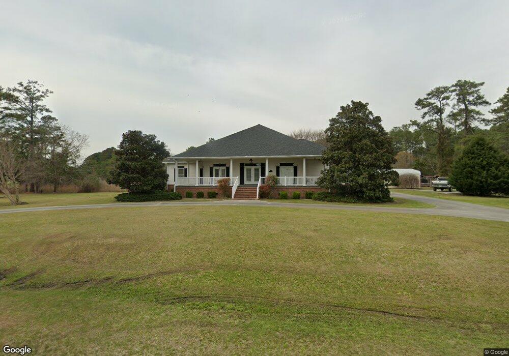
4607 Florence Rd Merritt, NC 28556
Estimated Value: $480,876 - $669,000
3
Beds
2
Baths
3,254
Sq Ft
$177/Sq Ft
Est. Value
About This Home
This home is located at 4607 Florence Rd, Merritt, NC 28556 and is currently estimated at $577,292, approximately $177 per square foot. 4607 Florence Rd is a home with nearby schools including Pamlico County Primary School, Fred A. Anderson Elementary School, and Pamlico County Middle School.
Ownership History
Date
Name
Owned For
Owner Type
Purchase Details
Closed on
May 26, 2019
Sold by
Lupton Joseph M and Lupton Juna G
Bought by
Lupton Joseph M and Lupton Juna G
Current Estimated Value
Home Financials for this Owner
Home Financials are based on the most recent Mortgage that was taken out on this home.
Original Mortgage
$543,000
Outstanding Balance
$538,665
Interest Rate
5.3%
Mortgage Type
Adjustable Rate Mortgage/ARM
Estimated Equity
$38,627
Purchase Details
Closed on
Sep 15, 1998
Bought by
Lupton Juna Gail
Create a Home Valuation Report for This Property
The Home Valuation Report is an in-depth analysis detailing your home's value as well as a comparison with similar homes in the area
Home Values in the Area
Average Home Value in this Area
Purchase History
| Date | Buyer | Sale Price | Title Company |
|---|---|---|---|
| Lupton Joseph M | -- | -- | |
| Lupton Juna Gail | -- | -- |
Source: Public Records
Mortgage History
| Date | Status | Borrower | Loan Amount |
|---|---|---|---|
| Open | Lupton Joseph M | $543,000 |
Source: Public Records
Tax History Compared to Growth
Tax History
| Year | Tax Paid | Tax Assessment Tax Assessment Total Assessment is a certain percentage of the fair market value that is determined by local assessors to be the total taxable value of land and additions on the property. | Land | Improvement |
|---|---|---|---|---|
| 2025 | $2,294 | $324,751 | $56,024 | $268,727 |
| 2024 | $2,294 | $324,751 | $56,024 | $268,727 |
| 2023 | $2,229 | $324,751 | $56,024 | $268,727 |
| 2022 | $2,229 | $324,751 | $56,024 | $268,727 |
| 2021 | $2,229 | $324,751 | $56,024 | $268,727 |
| 2020 | $2,229 | $324,751 | $56,024 | $268,727 |
| 2019 | $2,920 | $425,513 | $102,051 | $323,462 |
| 2018 | $2,920 | $0 | $0 | $0 |
| 2017 | $2,920 | $0 | $0 | $0 |
| 2016 | $2,920 | $0 | $0 | $0 |
| 2015 | $2,920 | $425,513 | $102,051 | $323,462 |
| 2014 | $662 | $96,522 | $96,522 | $0 |
Source: Public Records
Map
Nearby Homes
- 394 Bay Shores
- 430 Bay Shores Rd
- 609 Bell Point Rd
- 466 Bay Shores Rd
- 20 Bay Point Rd
- 117 Oswell Brinson Rd
- 153 Oswell Brinson Rd
- 137 Days Landing Rd
- 804 Murphy Farm Rd
- 0 Quail Unit 100347725
- 188 Quail Rd
- 61 Arant Farm Rd
- 60 Arant Farm Rd
- 880 Arant Farm Rd
- 517 Arant Farm
- 901 Murphy Farm Rd
- 1039 Pasture Point Rd
- 26 Mason Ln
- 87 Mason Ln
- 304 Mason Bay Rd
- 4635 Florence Rd
- 4580 Florence Rd
- 4554 Florence Rd
- 242 Moores Creek Dr
- 4457 Florence Rd
- 176 Moores Creek Dr
- 4771 Florence Rd
- 164 Moores Creek Dr
- 4410 Florence Rd
- 4394 Florence Rd
- 140 Moores Creek Dr
- 4819 Florence Rd
- 4335 Florence Rd
- 116 Moores Creek Dr
- 90 Moores Creek Dr
- 4293 Florence Rd
- 4209 Florence Rd
- 345 Bell Point Rd
- 357 Bell Point Rd
- 297 Bay Shores Rd