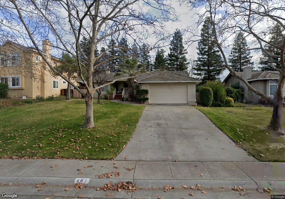
461 Brookside Dr Chico, CA 95928
California Park NeighborhoodEstimated Value: $515,307 - $633,000
3
Beds
2
Baths
1,921
Sq Ft
$301/Sq Ft
Est. Value
About This Home
This home is located at 461 Brookside Dr, Chico, CA 95928 and is currently estimated at $578,327, approximately $301 per square foot. 461 Brookside Dr is a home located in Butte County with nearby schools including Sierra View Elementary School, Harry M. Marsh Junior High School, and Pleasant Valley High School.
Ownership History
Date
Name
Owned For
Owner Type
Purchase Details
Closed on
Nov 28, 2006
Sold by
Lazaro J Emmett and Lazaro Aida P
Bought by
Lazaro J Emmett and Lazaro Aida P
Current Estimated Value
Purchase Details
Closed on
Sep 12, 1997
Sold by
Waggoner Thomas L and Waggoner Diana L
Bought by
Lazaro J Emmett and Lazaro Aida P
Home Financials for this Owner
Home Financials are based on the most recent Mortgage that was taken out on this home.
Original Mortgage
$158,400
Interest Rate
7.34%
Mortgage Type
Balloon
Create a Home Valuation Report for This Property
The Home Valuation Report is an in-depth analysis detailing your home's value as well as a comparison with similar homes in the area
Home Values in the Area
Average Home Value in this Area
Purchase History
| Date | Buyer | Sale Price | Title Company |
|---|---|---|---|
| Lazaro J Emmett | -- | None Available | |
| Lazaro J Emmett | $198,000 | Mid Valley Title & Escrow Co |
Source: Public Records
Mortgage History
| Date | Status | Borrower | Loan Amount |
|---|---|---|---|
| Closed | Lazaro J Emmett | $158,400 |
Source: Public Records
Tax History
| Year | Tax Paid | Tax Assessment Tax Assessment Total Assessment is a certain percentage of the fair market value that is determined by local assessors to be the total taxable value of land and additions on the property. | Land | Improvement |
|---|---|---|---|---|
| 2025 | $3,659 | $337,177 | $105,850 | $231,327 |
| 2024 | $3,659 | $330,567 | $103,775 | $226,792 |
| 2023 | $3,616 | $324,087 | $101,741 | $222,346 |
| 2022 | $3,558 | $317,734 | $99,747 | $217,987 |
| 2021 | $3,491 | $311,505 | $97,792 | $213,713 |
| 2020 | $3,481 | $308,312 | $96,790 | $211,522 |
| 2019 | $3,418 | $302,268 | $94,893 | $207,375 |
| 2018 | $3,356 | $296,342 | $93,033 | $203,309 |
| 2017 | $3,288 | $290,532 | $91,209 | $199,323 |
| 2016 | $3,000 | $284,836 | $89,421 | $195,415 |
| 2015 | $3,000 | $280,558 | $88,078 | $192,480 |
| 2014 | $2,928 | $275,063 | $86,353 | $188,710 |
Source: Public Records
Map
Nearby Homes
- 457 Brookside Dr
- 451 Palisades Dr
- 3171 Sandstone Ln
- 2875 Pennyroyal Dr Unit 46
- 2918 Pennyroyal Dr
- 2932 Pennyroyal Dr
- 2820 Pennyroyal Dr
- 3191 Via Casita Place
- 14 Sparrow Hawk Ln
- 2673 Lakewest Dr
- 2500 Shooting Star Way Unit 64
- 266 Pinyon Hills Dr Unit II
- 267 Idyllwild Cir
- 6 Matada Ct
- 10 Hidden Brooke Way
- 3 Kestrel Ct
- 2629 Lakewest Dr
- 2636 Amanecida Common
- 112 Benson Terrace
- 29 Spicebush Ct
- 463 Brookside Dr
- 459 Brookside Dr
- 460 Palisades Dr
- 458 Palisades Dr
- 465 Brookside Dr
- 462 Palisades Dr
- 456 Palisades Dr
- 456 Brookside Dr
- 458 Brookside Dr
- 455 Brookside Dr
- 454 Brookside Dr Unit 234
- 454 Brookside Dr
- 454 Palisades Dr
- 460 Brookside Dr
- 452 Brookside Dr
- 453 Brookside Dr
- 459 Palisades Dr
- 461 Palisades Dr
- 3080 Shallow Springs Terrace
- 452 Palisades Dr
Your Personal Tour Guide
Ask me questions while you tour the home.