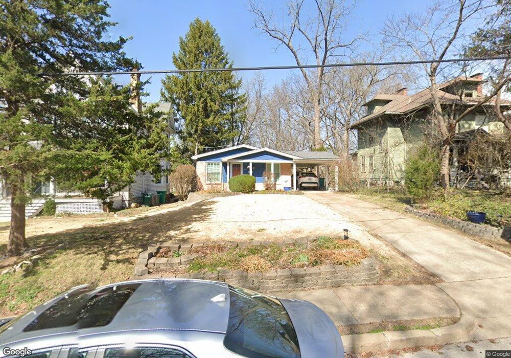
461 Newport Ave Saint Louis, MO 63119
Estimated Value: $357,962 - $460,000
3
Beds
2
Baths
1,025
Sq Ft
$393/Sq Ft
Est. Value
About This Home
This home is located at 461 Newport Ave, Saint Louis, MO 63119 and is currently estimated at $402,991, approximately $393 per square foot. 461 Newport Ave is a home located in St. Louis County with nearby schools including Avery Elementary School, Hixson Middle School, and Webster Groves High School.
Ownership History
Date
Name
Owned For
Owner Type
Purchase Details
Closed on
Aug 13, 2013
Sold by
Pohlman Emily and Pohlman Thomas
Bought by
Lum Jon and Lum Kathleen L
Current Estimated Value
Home Financials for this Owner
Home Financials are based on the most recent Mortgage that was taken out on this home.
Original Mortgage
$199,703
Outstanding Balance
$149,338
Interest Rate
4.53%
Mortgage Type
VA
Estimated Equity
$253,653
Purchase Details
Closed on
Jun 24, 2011
Sold by
Stack Stephen B and Meyer Lisa
Bought by
Pohlman Emily and Pohlman Thomas
Home Financials for this Owner
Home Financials are based on the most recent Mortgage that was taken out on this home.
Original Mortgage
$136,000
Interest Rate
4.7%
Mortgage Type
New Conventional
Purchase Details
Closed on
May 22, 1998
Sold by
Bradley Balsiger Craig
Bought by
Stack Stephen B
Home Financials for this Owner
Home Financials are based on the most recent Mortgage that was taken out on this home.
Original Mortgage
$87,000
Interest Rate
6.91%
Create a Home Valuation Report for This Property
The Home Valuation Report is an in-depth analysis detailing your home's value as well as a comparison with similar homes in the area
Home Values in the Area
Average Home Value in this Area
Purchase History
| Date | Buyer | Sale Price | Title Company |
|---|---|---|---|
| Lum Jon | $195,500 | Continental Title Company | |
| Pohlman Emily | $170,000 | Ust | |
| Stack Stephen B | -- | -- |
Source: Public Records
Mortgage History
| Date | Status | Borrower | Loan Amount |
|---|---|---|---|
| Open | Lum Jon | $199,703 | |
| Previous Owner | Pohlman Emily | $136,000 | |
| Previous Owner | Stack Stephen B | $87,000 |
Source: Public Records
Tax History Compared to Growth
Tax History
| Year | Tax Paid | Tax Assessment Tax Assessment Total Assessment is a certain percentage of the fair market value that is determined by local assessors to be the total taxable value of land and additions on the property. | Land | Improvement |
|---|---|---|---|---|
| 2025 | $3,560 | $58,830 | $44,860 | $13,970 |
| 2024 | $3,560 | $50,920 | $32,620 | $18,300 |
| 2023 | $3,543 | $50,920 | $32,620 | $18,300 |
| 2022 | $3,488 | $46,550 | $32,620 | $13,930 |
| 2021 | $3,476 | $46,550 | $32,620 | $13,930 |
| 2020 | $3,579 | $44,670 | $32,620 | $12,050 |
| 2019 | $3,553 | $44,670 | $32,620 | $12,050 |
| 2018 | $2,785 | $30,970 | $22,840 | $8,130 |
| 2017 | $2,766 | $30,970 | $22,840 | $8,130 |
| 2016 | $3,384 | $36,420 | $19,570 | $16,850 |
| 2015 | $3,395 | $36,420 | $19,570 | $16,850 |
| 2014 | $2,728 | $28,420 | $14,990 | $13,430 |
Source: Public Records
Map
Nearby Homes
- 441 Park Rd
- 610 Cornelia Ave
- 619 N Bompart Ave
- 400 Marion Ave
- 112 Oakwood Ave
- 716 Clark Ave
- 546 Holland Ave
- 544 Summit Ave
- 808 Greeley Ave
- 450 E Lockwood Ave Unit 303
- 814 Holland Ave
- 617 N Elm Ave
- 827 Cornell Ave
- 840 Marshall Ave
- 946 Newport Ave
- 2911 Brazeau Ave
- 8361 Big Bend Blvd
- 835 N Forest Ave
- 940 Brookside Ave
- 946 Marshall Ave Unit D
- 459 Newport Ave
- 463 Newport Ave
- 471 Newport Ave
- 501 Newport Ave
- 449 Newport Ave
- 452 Fairview Ave
- 450 Fairview Ave
- 460 Fairview Ave
- 432 Park Rd
- 444 Fairview Ave
- 507 Newport Ave
- 424 Park Rd
- 438 Park Rd
- 502 Fairview Ave
- 441 Newport Ave
- 440 Fairview Ave
- 511 Newport Ave
- 436 Fairview Ave
- 506 Fairview Ave
- 444 Park Rd