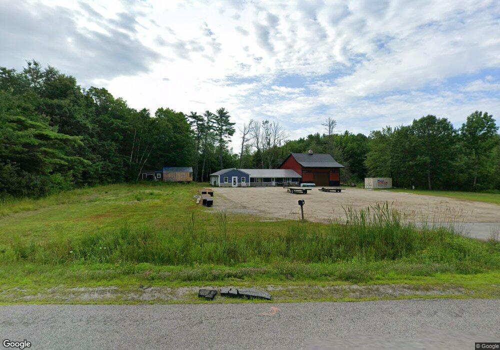
461 Route 202 Greene, ME 04236
Estimated Value: $227,000 - $317,000
1
Bed
--
Bath
797
Sq Ft
$334/Sq Ft
Est. Value
About This Home
This home is located at 461 Route 202, Greene, ME 04236 and is currently estimated at $266,555, approximately $334 per square foot. 461 Route 202 is a home with nearby schools including Tripp Middle School and Leavitt Area High School.
Ownership History
Date
Name
Owned For
Owner Type
Purchase Details
Closed on
Mar 14, 2023
Sold by
Bourgoin Robert Est and Bourgoin
Bought by
Mackenzie Earl and Mackenzie Dawn
Current Estimated Value
Purchase Details
Closed on
Jul 12, 2018
Sold by
Savage Shawn S
Bought by
Big G Realty Llc
Home Financials for this Owner
Home Financials are based on the most recent Mortgage that was taken out on this home.
Original Mortgage
$180,000
Interest Rate
4.5%
Mortgage Type
Unknown
Create a Home Valuation Report for This Property
The Home Valuation Report is an in-depth analysis detailing your home's value as well as a comparison with similar homes in the area
Home Values in the Area
Average Home Value in this Area
Purchase History
| Date | Buyer | Sale Price | Title Company |
|---|---|---|---|
| Mackenzie Earl | $180,000 | None Available | |
| Big G Realty Llc | -- | -- | |
| Big G Realty Llc | -- | -- |
Source: Public Records
Mortgage History
| Date | Status | Borrower | Loan Amount |
|---|---|---|---|
| Previous Owner | Big G Realty Llc | $180,000 |
Source: Public Records
Tax History
| Year | Tax Paid | Tax Assessment Tax Assessment Total Assessment is a certain percentage of the fair market value that is determined by local assessors to be the total taxable value of land and additions on the property. | Land | Improvement |
|---|---|---|---|---|
| 2025 | $3,468 | $290,200 | $94,500 | $195,700 |
| 2024 | $3,481 | $178,500 | $62,200 | $116,300 |
| 2023 | $3,379 | $173,300 | $62,200 | $111,100 |
| 2022 | $3,085 | $173,300 | $62,200 | $111,100 |
| 2021 | $2,963 | $173,300 | $62,200 | $111,100 |
| 2020 | $2,963 | $173,300 | $62,200 | $111,100 |
| 2019 | $5,695 | $173,300 | $62,200 | $111,100 |
| 2018 | $2,728 | $173,300 | $62,200 | $111,100 |
| 2017 | $2,672 | $173,300 | $62,200 | $111,100 |
| 2016 | $2,520 | $173,300 | $62,200 | $111,100 |
| 2015 | $2,471 | $173,300 | $62,200 | $111,100 |
| 2014 | $2,343 | $173,300 | $62,200 | $111,100 |
| 2013 | $2,305 | $173,300 | $62,200 | $111,100 |
Source: Public Records
Map
Nearby Homes
- 144 W Main St
- 25 Jennifer Ave
- 27 Jennifer Ave
- 0 U S Highway 202
- 0 Sedgley Rd
- 951 U S Highway 202
- 14 Penney Ln Unit 1636097
- Lot 6 Berry Rd
- 130 S Hatch Hill Rd
- 65 Bull Run Rd
- 66 S South Hatch Hill Rd
- 764 N River Rd
- 135 Sleeper Rd
- 1639 Main St
- 12 Key Hill Rd
- 20 Copper Ridge Rd
- 26 Island View Dr
- 370 Lane Rd
- 15 Michaud Ave
- 5 Lake Shore Dr
Your Personal Tour Guide
Ask me questions while you tour the home.