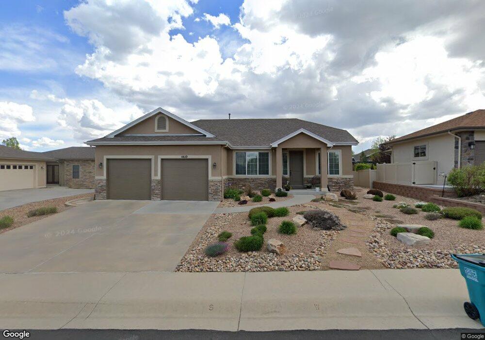
4610 Pompano Dr Windsor, CO 80550
Estimated Value: $603,709 - $730,000
2
Beds
2
Baths
1,842
Sq Ft
$357/Sq Ft
Est. Value
About This Home
This home is located at 4610 Pompano Dr, Windsor, CO 80550 and is currently estimated at $657,677, approximately $357 per square foot. 4610 Pompano Dr is a home located in Larimer County with nearby schools including High Plains School, Mountain View High School, and Colorado Early Colleges Windsor.
Ownership History
Date
Name
Owned For
Owner Type
Purchase Details
Closed on
Apr 24, 2014
Sold by
Lohnes Cheri M and Lohnes John C
Bought by
Evans John A and Evans Rita A
Current Estimated Value
Purchase Details
Closed on
Jul 26, 2011
Sold by
Preo Belmont Ridge Llc
Bought by
Lohnes John C and Lohnes Cheri M
Purchase Details
Closed on
Nov 23, 2010
Sold by
Advantage Bank
Bought by
Preo Belmont Ridge Llc
Purchase Details
Closed on
Feb 19, 2010
Sold by
Coloradobuilder Llc
Bought by
Advantage Bank
Create a Home Valuation Report for This Property
The Home Valuation Report is an in-depth analysis detailing your home's value as well as a comparison with similar homes in the area
Purchase History
| Date | Buyer | Sale Price | Title Company |
|---|---|---|---|
| Evans John A | $330,800 | Land Title Guarantee Company | |
| Lohnes John C | $273,794 | First American Title Ins Co | |
| Preo Belmont Ridge Llc | $40,000 | Land Title Guarantee Company | |
| Advantage Bank | -- | None Available |
Source: Public Records
Tax History
| Year | Tax Paid | Tax Assessment Tax Assessment Total Assessment is a certain percentage of the fair market value that is determined by local assessors to be the total taxable value of land and additions on the property. | Land | Improvement |
|---|---|---|---|---|
| 2025 | $3,460 | $38,744 | $11,875 | $26,869 |
| 2024 | $3,356 | $41,178 | $12,730 | $28,448 |
| 2022 | $2,862 | $31,018 | $4,726 | $26,292 |
| 2021 | $2,934 | $31,910 | $4,862 | $27,048 |
| 2020 | $2,925 | $31,782 | $4,862 | $26,920 |
| 2019 | $2,882 | $31,782 | $4,862 | $26,920 |
| 2018 | $2,517 | $26,683 | $4,896 | $21,787 |
| 2017 | $2,216 | $26,683 | $4,896 | $21,787 |
| 2016 | $2,448 | $28,624 | $5,413 | $23,211 |
| 2015 | $2,417 | $28,620 | $5,410 | $23,210 |
| 2014 | $2,017 | $23,050 | $5,090 | $17,960 |
Source: Public Records
Map
Nearby Homes
- 4609 Freehold Dr
- 7414 Ladbroke Dr
- 7401 Turnbull Ct
- 7418 Thistledown Dr
- 7027 Ruidoso Dr
- 8773 Longs Peak Cir
- 8313 Cherry Blossom Dr
- 6227 Vernazza Way Unit 4
- 6227 Vernazza Way Unit 2
- 6227 Vernazza Way Unit 3
- 6227 Vernazza Way Unit 1
- 6233 Vernazza Way Unit 4
- 6233 Vernazza Way Unit 3
- 6226 Vernazza Way Unit 4
- 6224 Vernazza Way Unit 1
- 8241 White Owl Ct
- 6311 Sanctuary Dr
- 6245 Vernazza Way Unit 3
- 6325 Sanctuary Dr
- 8360 White Owl Ct
- 4612 Pompano Dr
- 4608 Pompano Dr
- 4614 Pompano Dr
- 4603 Freehold Dr
- 4611 Pompano Dr
- 4606 Pompano Dr
- 4609 Pompano Dr
- 4601 Freehold Dr
- 4613 Pompano Dr
- 4607 Pompano Dr
- 4764 Pompano Dr
- 4748 Pompano Dr
- 4726 Pompano Dr
- 4654 Pompano Dr
- 4688 Pompano Dr
- 4792 Pompano Dr
- 4616 Pompano Dr
- 4615 Pompano Dr
- 4606 Freehold Dr
- 4608 Freehold Dr
Your Personal Tour Guide
Ask me questions while you tour the home.