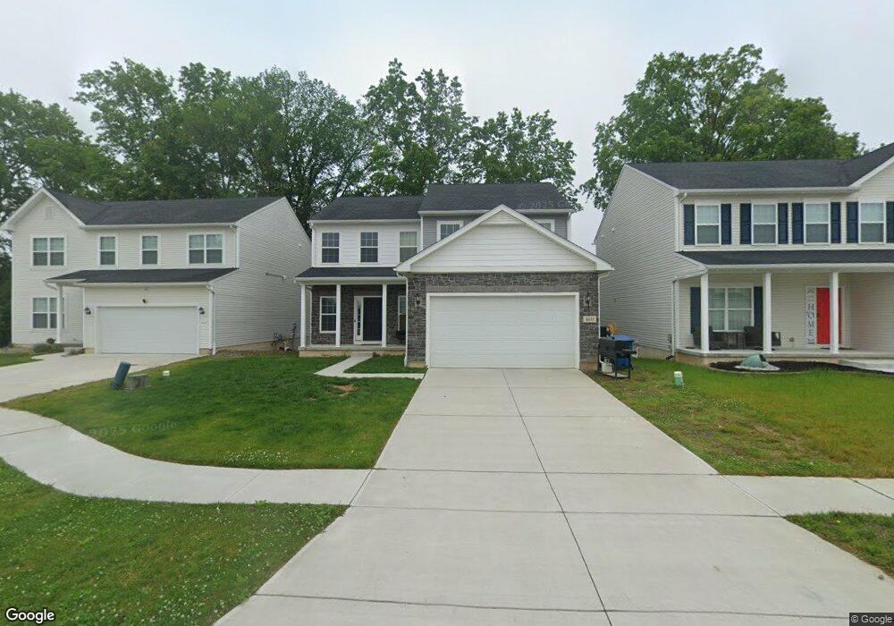
4611 Boulder Ln Lorain, OH 44053
Estimated Value: $390,000 - $467,000
4
Beds
3
Baths
2,371
Sq Ft
$176/Sq Ft
Est. Value
About This Home
This home is located at 4611 Boulder Ln, Lorain, OH 44053 and is currently estimated at $416,243, approximately $175 per square foot. 4611 Boulder Ln is a home with nearby schools including Powers Elementary School, Walter G. Nord Middle School, and Amherst Junior High School.
Ownership History
Date
Name
Owned For
Owner Type
Purchase Details
Closed on
Jan 17, 2022
Sold by
K Hovnanian Cornerstone Farms Llc
Bought by
Fields Brian M and Ammons Amber
Current Estimated Value
Home Financials for this Owner
Home Financials are based on the most recent Mortgage that was taken out on this home.
Original Mortgage
$357,184
Outstanding Balance
$331,081
Interest Rate
3.56%
Mortgage Type
FHA
Estimated Equity
$85,162
Purchase Details
Closed on
Sep 30, 2021
Sold by
Lorain Comerstone Farms Llc
Bought by
K Hovnanian Cornerstone Farms Llc
Home Financials for this Owner
Home Financials are based on the most recent Mortgage that was taken out on this home.
Original Mortgage
$220,092,600
Interest Rate
2.8%
Mortgage Type
Future Advance Clause Open End Mortgage
Create a Home Valuation Report for This Property
The Home Valuation Report is an in-depth analysis detailing your home's value as well as a comparison with similar homes in the area
Home Values in the Area
Average Home Value in this Area
Purchase History
| Date | Buyer | Sale Price | Title Company |
|---|---|---|---|
| Fields Brian M | $363,800 | None Listed On Document | |
| K Hovnanian Cornerstone Farms Llc | $49,200 | French Creek Title Agcy Ltd |
Source: Public Records
Mortgage History
| Date | Status | Borrower | Loan Amount |
|---|---|---|---|
| Open | Fields Brian M | $357,184 | |
| Previous Owner | K Hovnanian Cornerstone Farms Llc | $220,092,600 |
Source: Public Records
Tax History
| Year | Tax Paid | Tax Assessment Tax Assessment Total Assessment is a certain percentage of the fair market value that is determined by local assessors to be the total taxable value of land and additions on the property. | Land | Improvement |
|---|---|---|---|---|
| 2024 | $1,385 | $29,750 | $29,750 | -- |
| 2023 | $918 | $15,621 | $15,621 | $0 |
| 2022 | $758 | $15,621 | $15,621 | $0 |
| 2021 | $0 | $12,495 | $12,495 | $0 |
| 2020 | $0 | $0 | $0 | $0 |
Source: Public Records
Map
Nearby Homes
- 4253 Santina Way
- 4518 Santina Way
- 4513 Vineyard Dr
- 3633 Reserve Trail
- 3794 Freedom Place
- 3784 Freedom Place
- 3774 Freedom Place Unit A
- 3772 Freedom Place Unit B
- 3770 Freedom Place Unit C
- 3769 Freedom Place
- 5227 Clovelly Dr
- 5145 Cardinal Ct
- 4497 Bellow Dr
- 5547 Beavercrest Dr Unit 107
- 5547 Beavercrest Dr Unit 211
- 3439 Morningside Way
- 110 Habant Dr
- 3768 Martins Run Dr
- 4201 Meadow Lark Dr
- 3502 Magnolia Dr
- 4621 Boulder Ln
- 4601 Boulder Ln
- 4631 Boulder Ln
- 4394 Santina Way
- 4384 Santina Way
- 4691 Boulder Ln
- 4436 Santina Way
- 4374 Santina Way
- 4641 Boulder Ln
- 4446 Santina Way
- 4364 Santina Way
- 4610 Boulder Ln
- 4620 Boulder Ln
- 4581 Boulder Ln
- 4651 Boulder Ln
- 4630 Boulder Ln
- 4456 Santina Way
- 4571 Boulder Ln
- 4650 Boulder Ln
- 4354 Santina Way
Your Personal Tour Guide
Ask me questions while you tour the home.