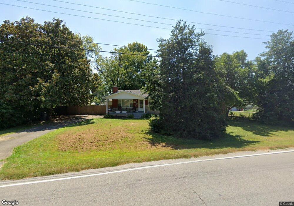
4614 Flintlock Dr Louisville, KY 40216
Pleasure Ridge Park NeighborhoodEstimated Value: $178,749 - $208,000
--
Bed
1
Bath
1,050
Sq Ft
$190/Sq Ft
Est. Value
About This Home
This home is located at 4614 Flintlock Dr, Louisville, KY 40216 and is currently estimated at $199,187, approximately $189 per square foot. 4614 Flintlock Dr is a home located in Jefferson County with nearby schools including Wilkerson Elementary School, Kerrick Elementary School, and Greenwood Elementary School.
Ownership History
Date
Name
Owned For
Owner Type
Purchase Details
Closed on
Jul 19, 2018
Sold by
Pfeiffer Betty and Pfeiffer Robert Mark
Bought by
Hardy Steven L and Hardy Kimberly D
Current Estimated Value
Home Financials for this Owner
Home Financials are based on the most recent Mortgage that was taken out on this home.
Original Mortgage
$119,790
Outstanding Balance
$105,481
Interest Rate
5.25%
Mortgage Type
FHA
Estimated Equity
$93,706
Create a Home Valuation Report for This Property
The Home Valuation Report is an in-depth analysis detailing your home's value as well as a comparison with similar homes in the area
Home Values in the Area
Average Home Value in this Area
Purchase History
| Date | Buyer | Sale Price | Title Company |
|---|---|---|---|
| Hardy Steven L | $122,000 | None Available |
Source: Public Records
Mortgage History
| Date | Status | Borrower | Loan Amount |
|---|---|---|---|
| Open | Hardy Steven L | $119,790 |
Source: Public Records
Tax History Compared to Growth
Tax History
| Year | Tax Paid | Tax Assessment Tax Assessment Total Assessment is a certain percentage of the fair market value that is determined by local assessors to be the total taxable value of land and additions on the property. | Land | Improvement |
|---|---|---|---|---|
| 2024 | $1,655 | $142,060 | $9,540 | $132,520 |
| 2023 | $1,702 | $142,060 | $9,540 | $132,520 |
| 2022 | $1,337 | $111,230 | $20,000 | $91,230 |
| 2021 | $1,440 | $111,230 | $20,000 | $91,230 |
| 2020 | $1,287 | $111,230 | $20,000 | $91,230 |
| 2019 | $1,261 | $111,230 | $20,000 | $91,230 |
| 2018 | $1,237 | $110,420 | $29,000 | $81,420 |
| 2017 | $1,159 | $110,420 | $29,000 | $81,420 |
| 2013 | $1,104 | $110,420 | $29,000 | $81,420 |
Source: Public Records
Map
Nearby Homes
- 2203 Lower Hunters Trace
- 6115 Greenview Dr
- 4912 Hunters Point Cir
- 4901 Hunters Point Cir
- 1904 Donald Dr
- 6300 Derrick Dr
- 5225 Venus Dr
- 2333 Lower Hunters Trace
- 5910 Full Moon Ct
- 2335 Lower Hunters Trace
- 5217 Galaxie Dr
- 4929 Determine Ln
- 6504 Gabriel Dr
- 6506 Gabriel Dr
- 6607 Sky Blue Ave
- 5027 Hunters Point Cir
- 2414 Helen Ave
- 5303 Matterhorn Dr
- 5310 Galaxie Dr
- 4016 Blanton Ln
- 4616 Flintlock Dr
- 5300 Tahia Dr
- 4612 Flintlock Dr
- 4618 Flintlock Dr
- 5302 Tahia Dr
- 4613 Flintlock Dr
- 2126 Ronnie Ave
- 6348 Hunters Grove Rd
- 4615 Flintlock Dr
- 4610 Flintlock Dr
- 6401 Upper Hunters Trace
- 6403 Upper Hunters Trace
- 5306 Tahia Dr
- 2124 Ronnie Ave
- 6405 Upper Hunters Trace
- 4619 Flintlock Dr
- 4609 Flintlock Dr
- 4608 Flintlock Dr
- 6346 Hunters Grove Rd
- 6345 Hunters Grove Rd