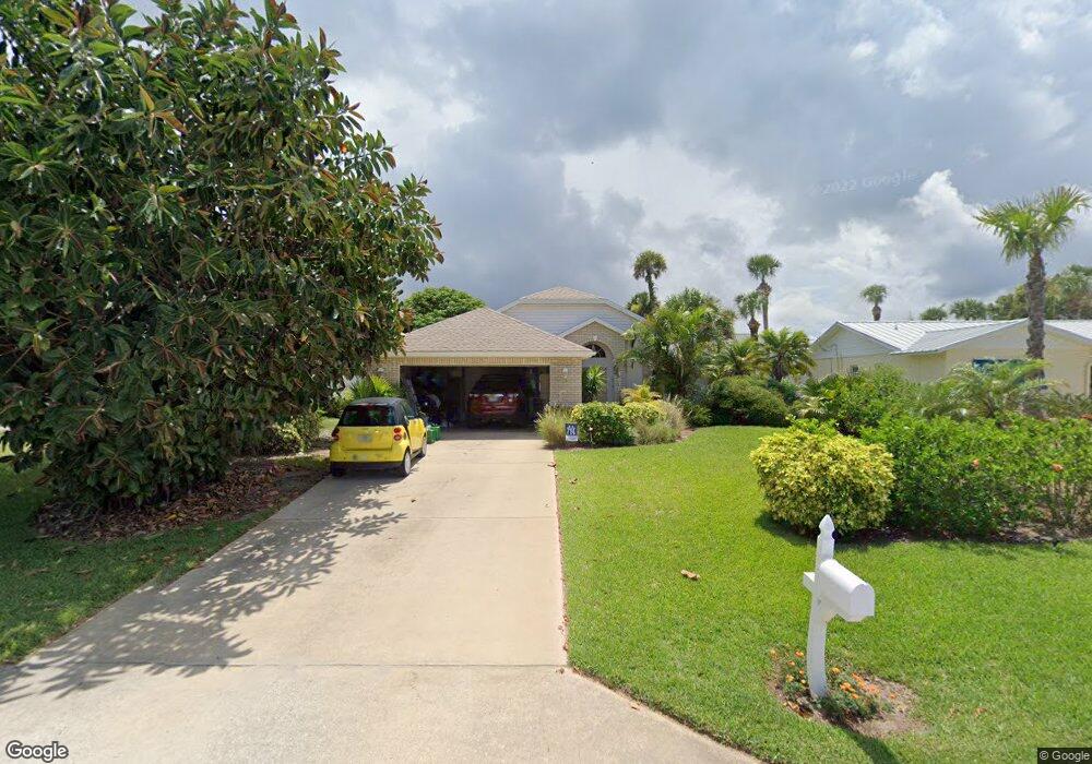
4616 Doris Dr New Smyrna Beach, FL 32169
New Smyrna Beachfront NeighborhoodEstimated Value: $703,157 - $756,000
3
Beds
2
Baths
1,861
Sq Ft
$391/Sq Ft
Est. Value
About This Home
This home is located at 4616 Doris Dr, New Smyrna Beach, FL 32169 and is currently estimated at $727,539, approximately $390 per square foot. 4616 Doris Dr is a home located in Volusia County with nearby schools including Coronado Beach Elementary School, New Smyrna Beach Middle School, and New Smyrna Beach High School.
Ownership History
Date
Name
Owned For
Owner Type
Purchase Details
Closed on
May 31, 2002
Sold by
Blanken John and Blanken Janet G
Bought by
Marzullo Joseph F and Marzullo Kellie M
Current Estimated Value
Home Financials for this Owner
Home Financials are based on the most recent Mortgage that was taken out on this home.
Original Mortgage
$132,000
Outstanding Balance
$55,655
Interest Rate
6.77%
Estimated Equity
$671,884
Purchase Details
Closed on
May 25, 1999
Sold by
Sunrise Homes & Rentals Inc
Bought by
Blanken John and Blanken Janet G
Purchase Details
Closed on
Mar 15, 1994
Sold by
Coman John H and Coman Marian L
Bought by
Barringer Ron and Barringer Mary
Home Financials for this Owner
Home Financials are based on the most recent Mortgage that was taken out on this home.
Original Mortgage
$30,000
Interest Rate
6.97%
Purchase Details
Closed on
Feb 15, 1969
Bought by
Marzullo Joseph F and Marzullo Kellie M
Create a Home Valuation Report for This Property
The Home Valuation Report is an in-depth analysis detailing your home's value as well as a comparison with similar homes in the area
Home Values in the Area
Average Home Value in this Area
Purchase History
| Date | Buyer | Sale Price | Title Company |
|---|---|---|---|
| Marzullo Joseph F | $256,000 | -- | |
| Blanken John | -- | -- | |
| Barringer Ron | $35,000 | -- | |
| Marzullo Joseph F | $2,400 | -- |
Source: Public Records
Mortgage History
| Date | Status | Borrower | Loan Amount |
|---|---|---|---|
| Open | Marzullo Joseph F | $132,000 | |
| Previous Owner | Barringer Ron | $30,000 |
Source: Public Records
Tax History Compared to Growth
Tax History
| Year | Tax Paid | Tax Assessment Tax Assessment Total Assessment is a certain percentage of the fair market value that is determined by local assessors to be the total taxable value of land and additions on the property. | Land | Improvement |
|---|---|---|---|---|
| 2025 | $3,773 | $247,268 | -- | -- |
| 2024 | $3,773 | $240,300 | -- | -- |
| 2023 | $3,773 | $233,301 | $0 | $0 |
| 2022 | $3,704 | $226,506 | $0 | $0 |
| 2021 | $3,807 | $219,909 | $0 | $0 |
| 2020 | $3,746 | $216,873 | $0 | $0 |
| 2019 | $3,822 | $211,997 | $0 | $0 |
| 2018 | $3,791 | $208,044 | $0 | $0 |
| 2017 | $3,793 | $203,765 | $0 | $0 |
| 2016 | $3,909 | $199,574 | $0 | $0 |
| 2015 | $4,006 | $198,187 | $0 | $0 |
| 2014 | $3,951 | $196,614 | $0 | $0 |
Source: Public Records
Map
Nearby Homes
- 4636 Katy Dr
- 0 S Atlantic Ave Unit MFRO6319520
- 0 S Atlantic Ave Unit MFRO6268375
- 0 S Atlantic Ave Unit MFRNS1082495
- 4513 Saxon Dr
- 4715 Van Kleeck Dr
- 4503 Saxon Dr
- 4501 S Atlantic Ave Unit 5070
- 4501 S Atlantic Ave Unit 507
- 4501 S Atlantic Ave Unit 415
- 4501 S Atlantic Ave Unit 5060
- 4501 S Atlantic Ave Unit 4090
- 4501 S Atlantic Ave Unit 4040
- 4493 S Atlantic Ave Unit 3040
- 4381 S Atlantic Ave Unit 504
- 4411 Sea Mist Ct Unit 174
- 4411 Sea Mist Ct Unit 275
- 4407 Sea Mist Ct Unit 267
- 4405 Sea Mist Dr Unit 114
- 4405 Sea Mist Dr Unit 218