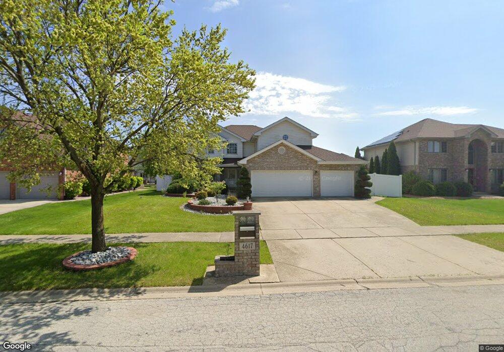
4617 Ashford Dr Matteson, IL 60443
Old Matteson NeighborhoodEstimated Value: $374,000 - $470,000
4
Beds
3
Baths
2,412
Sq Ft
$172/Sq Ft
Est. Value
About This Home
This home is located at 4617 Ashford Dr, Matteson, IL 60443 and is currently estimated at $413,860, approximately $171 per square foot. 4617 Ashford Dr is a home located in Cook County with nearby schools including Illinois School, Indiana Elementary School, and Arcadia Elementary School.
Ownership History
Date
Name
Owned For
Owner Type
Purchase Details
Closed on
Dec 4, 2008
Sold by
Us Bank National Association
Bought by
Hamilton Cheryl Y
Current Estimated Value
Home Financials for this Owner
Home Financials are based on the most recent Mortgage that was taken out on this home.
Original Mortgage
$275,674
Outstanding Balance
$182,684
Interest Rate
6.19%
Mortgage Type
FHA
Estimated Equity
$231,176
Purchase Details
Closed on
May 4, 2008
Sold by
Holloway Kevin and Holloway Patricia
Bought by
Us Bank Na and Structured Asset Investment Loan Trust S
Purchase Details
Closed on
Sep 28, 2004
Sold by
State Bank Of Countryside
Bought by
Holloway Kevin and Holloway Patricia
Home Financials for this Owner
Home Financials are based on the most recent Mortgage that was taken out on this home.
Original Mortgage
$237,212
Interest Rate
6.4%
Mortgage Type
Unknown
Create a Home Valuation Report for This Property
The Home Valuation Report is an in-depth analysis detailing your home's value as well as a comparison with similar homes in the area
Home Values in the Area
Average Home Value in this Area
Purchase History
| Date | Buyer | Sale Price | Title Company |
|---|---|---|---|
| Hamilton Cheryl Y | $280,000 | 1St American Title | |
| Us Bank National Association | -- | 1St American Title | |
| Us Bank Na | -- | None Available | |
| Holloway Kevin | $297,000 | Enterprise Land Title Ltd |
Source: Public Records
Mortgage History
| Date | Status | Borrower | Loan Amount |
|---|---|---|---|
| Open | Hamilton Cheryl Y | $275,674 | |
| Previous Owner | Holloway Kevin | $237,212 | |
| Closed | Holloway Kevin | $59,303 |
Source: Public Records
Tax History Compared to Growth
Tax History
| Year | Tax Paid | Tax Assessment Tax Assessment Total Assessment is a certain percentage of the fair market value that is determined by local assessors to be the total taxable value of land and additions on the property. | Land | Improvement |
|---|---|---|---|---|
| 2024 | $13,509 | $36,000 | $5,595 | $30,405 |
| 2023 | $12,129 | $36,000 | $5,595 | $30,405 |
| 2022 | $12,129 | $25,779 | $4,832 | $20,947 |
| 2021 | $12,344 | $25,777 | $4,831 | $20,946 |
| 2020 | $11,549 | $25,777 | $4,831 | $20,946 |
| 2019 | $8,277 | $19,422 | $4,323 | $15,099 |
| 2018 | $9,296 | $21,400 | $4,323 | $17,077 |
| 2017 | $8,954 | $21,400 | $4,323 | $17,077 |
| 2016 | $10,434 | $23,718 | $3,814 | $19,904 |
| 2015 | $10,283 | $23,718 | $3,814 | $19,904 |
| 2014 | $9,987 | $23,718 | $3,814 | $19,904 |
| 2013 | $11,068 | $28,272 | $3,814 | $24,458 |
Source: Public Records
Map
Nearby Homes
- 4700 203rd St
- 312 Grafton Place
- 4500 203rd St
- 98 Lawrence Ln
- 153 Treehouse Rd
- 135 Treehouse Rd
- 663 Primrose Ln
- 175 Owen St
- 222 Owen St
- 246 Owen St
- 202 Owen St
- 192 Owen St
- 72 Kenneth St
- 820 School Ave
- 858 Academy Ave
- 340 Maryview Ct
- 20340 Crawford Ave
- 4325 Oakwood Ln
- 706 Carnation Ln
- 4329 Applewood Ln
- 4621 Ashford Dr
- 4613 Ashford Dr
- 4620 203rd St
- 4624 203rd St
- 4616 203rd St
- 4625 Ashford Dr
- 4609 Ashford Dr
- 4616 Ashford Dr
- 4620 Ashford Dr
- 4628 203rd St
- 4612 203rd St
- 4626 Ashford Dr
- 4701 Ashford Dr
- 4605 Ashford Dr
- 4608 203rd St
- 4700 Ashford Dr
- 4705 Ashford Dr
- 4601 Ashford Dr
- 4704 Ashford Dr
- 4704 203rd St Unit 3