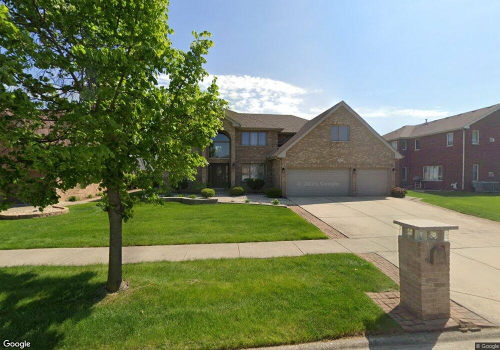
4617 Blarney Dr Matteson, IL 60443
Old Matteson NeighborhoodEstimated Value: $405,180 - $502,000
4
Beds
3
Baths
3,301
Sq Ft
$139/Sq Ft
Est. Value
About This Home
This home is located at 4617 Blarney Dr, Matteson, IL 60443 and is currently estimated at $457,795, approximately $138 per square foot. 4617 Blarney Dr is a home located in Cook County with nearby schools including Illinois School, Arcadia Elementary School, and Indiana Elementary School.
Ownership History
Date
Name
Owned For
Owner Type
Purchase Details
Closed on
Jun 25, 2004
Sold by
State Bank Of Countryside
Bought by
James Antoine and James Kimberly
Current Estimated Value
Home Financials for this Owner
Home Financials are based on the most recent Mortgage that was taken out on this home.
Original Mortgage
$276,024
Outstanding Balance
$125,559
Interest Rate
5.29%
Mortgage Type
Unknown
Estimated Equity
$332,236
Create a Home Valuation Report for This Property
The Home Valuation Report is an in-depth analysis detailing your home's value as well as a comparison with similar homes in the area
Home Values in the Area
Average Home Value in this Area
Purchase History
| Date | Buyer | Sale Price | Title Company |
|---|---|---|---|
| James Antoine | $345,500 | Enterprise Land Title Ltd |
Source: Public Records
Mortgage History
| Date | Status | Borrower | Loan Amount |
|---|---|---|---|
| Open | James Antoine | $276,024 | |
| Closed | James Antoine | $69,006 |
Source: Public Records
Tax History Compared to Growth
Tax History
| Year | Tax Paid | Tax Assessment Tax Assessment Total Assessment is a certain percentage of the fair market value that is determined by local assessors to be the total taxable value of land and additions on the property. | Land | Improvement |
|---|---|---|---|---|
| 2025 | $13,922 | $37,000 | $5,331 | $31,669 |
| 2024 | $13,922 | $37,000 | $5,331 | $31,669 |
| 2023 | $12,895 | $37,000 | $5,331 | $31,669 |
| 2022 | $12,895 | $27,190 | $4,604 | $22,586 |
| 2021 | $13,121 | $27,189 | $4,603 | $22,586 |
| 2020 | $12,268 | $27,189 | $4,603 | $22,586 |
| 2019 | $10,403 | $23,529 | $4,119 | $19,410 |
| 2018 | $10,398 | $23,529 | $4,119 | $19,410 |
| 2017 | $10,012 | $23,529 | $4,119 | $19,410 |
| 2016 | $10,054 | $22,944 | $3,634 | $19,310 |
| 2015 | $10,668 | $24,509 | $3,634 | $20,875 |
| 2014 | $10,360 | $24,509 | $3,634 | $20,875 |
| 2013 | $10,906 | $27,896 | $3,634 | $24,262 |
Source: Public Records
Map
Nearby Homes
- 620 Larkspur Ln
- 4500 203rd St
- 744 Academy Ave
- 153 Treehouse Rd
- 20813 Homeland Rd
- 98 Lawrence Ln
- 135 Treehouse Rd
- 722 Kostner Ave
- 820 School Ave
- 858 Academy Ave
- 175 Owen St
- 246 Owen St
- 202 Owen St
- 4325 Oakwood Ln
- 4329 Applewood Ln
- 4613 Lindenwood Ct
- 4228 Applewood Ln
- 340 Maryview Ct
- 763 Cambridge Ave
- 4110 Applewood Ln
- 4613 Blarney Dr
- 411 Carrick Rd
- 415 Carrick Rd
- 4609 Blarney Dr
- 434 Homeland Rd
- 434 Homeland Rd
- 4616 Blarney Dr
- 423 Carrick Rd
- 4612 Blarney Dr
- 4620 Blarney Dr
- 430 Homeland Rd
- 438 Homeland Rd
- 4605 Blarney Dr
- 4608 Blarney Dr
- 4626 Blarney Dr
- 406 Carrick Rd
- 406 Carrick Rd
- 412 Carrick Rd
- 433 Carrick Rd
- 412 Homeland Rd