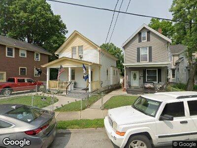
4617 Carter Ave Cincinnati, OH 45212
Estimated Value: $203,000 - $234,000
3
Beds
2
Baths
1,314
Sq Ft
$166/Sq Ft
Est. Value
About This Home
This home is located at 4617 Carter Ave, Cincinnati, OH 45212 and is currently estimated at $217,802, approximately $165 per square foot. 4617 Carter Ave is a home located in Hamilton County with nearby schools including Norwood High School, Cornerstone Christian Academy, and Immaculate Conception Academy.
Ownership History
Date
Name
Owned For
Owner Type
Purchase Details
Closed on
May 8, 2015
Sold by
Alsip Raymond E and Alsip Mary Ann
Bought by
Alsip Timothy L
Current Estimated Value
Purchase Details
Closed on
Mar 23, 2011
Sold by
Roy Lawrence Richard and Roy Kathy
Bought by
Alsip Raymond E and Alsip Mary Ann
Home Financials for this Owner
Home Financials are based on the most recent Mortgage that was taken out on this home.
Original Mortgage
$50,000
Interest Rate
5.09%
Mortgage Type
Unknown
Create a Home Valuation Report for This Property
The Home Valuation Report is an in-depth analysis detailing your home's value as well as a comparison with similar homes in the area
Home Values in the Area
Average Home Value in this Area
Purchase History
| Date | Buyer | Sale Price | Title Company |
|---|---|---|---|
| Alsip Timothy L | -- | Attorney | |
| Alsip Raymond E | $64,500 | Attorney |
Source: Public Records
Mortgage History
| Date | Status | Borrower | Loan Amount |
|---|---|---|---|
| Previous Owner | Alsip Raymond E | $50,000 | |
| Previous Owner | Roy Lawrence R | $7,600 | |
| Previous Owner | Roy Lawrence R | $60,800 |
Source: Public Records
Tax History Compared to Growth
Tax History
| Year | Tax Paid | Tax Assessment Tax Assessment Total Assessment is a certain percentage of the fair market value that is determined by local assessors to be the total taxable value of land and additions on the property. | Land | Improvement |
|---|---|---|---|---|
| 2024 | $2,758 | $54,604 | $12,380 | $42,224 |
| 2023 | $2,828 | $54,604 | $12,380 | $42,224 |
| 2022 | $2,141 | $34,686 | $8,313 | $26,373 |
| 2021 | $2,078 | $34,686 | $8,313 | $26,373 |
| 2020 | $2,081 | $34,686 | $8,313 | $26,373 |
| 2019 | $1,978 | $30,426 | $7,291 | $23,135 |
| 2018 | $1,980 | $30,426 | $7,291 | $23,135 |
| 2017 | $1,872 | $30,426 | $7,291 | $23,135 |
| 2016 | $1,356 | $21,221 | $6,853 | $14,368 |
| 2015 | $1,260 | $21,221 | $6,853 | $14,368 |
| 2014 | $1,258 | $21,221 | $6,853 | $14,368 |
| 2013 | $1,323 | $22,576 | $7,291 | $15,285 |
Source: Public Records
Map
Nearby Homes
- 4614 Carter Ave
- 1734 Sherman Ave
- 1817 Sherman Ave
- 1703 Sherman Ave
- 1720 Mills Ave
- 1732 Lincoln Ave
- 1778 Courtland Ave
- 1837 Lincoln Ave
- 4417 Allison St
- 4411 Allison St
- 2012 Crown Ave
- 2033 Maple Ave
- 4212 Lowry Ave
- 1826 Hopkins Ave
- 2068 Elm Ave
- 2013 Hopkins Ave
- 1768 Williams Ave
- 5129 Warren Ave
- 5107 Hunter Ave
- 2007 Lawn Ave
- 4617 Carter Ave
- 4619 Carter Ave
- 4615 Carter Ave
- 4621 Carter Ave
- 4611 Carter Ave
- 4627 Carter Ave
- 4610 Mcneil Ave
- 1760 Sherman Ave
- 4614 Mcneil Ave
- 4603 Carter Ave
- 4608 Mcneil Ave
- 4618 Mcneil Ave
- 4620 Carter Ave
- 4631 Carter Ave
- 4618 Carter Ave
- 4618 Carter Ave
- 4616 Carter Ave
- 4630 Carter Ave
- 4620 Mcneil Ave
- 1740 Sherman Ave Unit 1-6