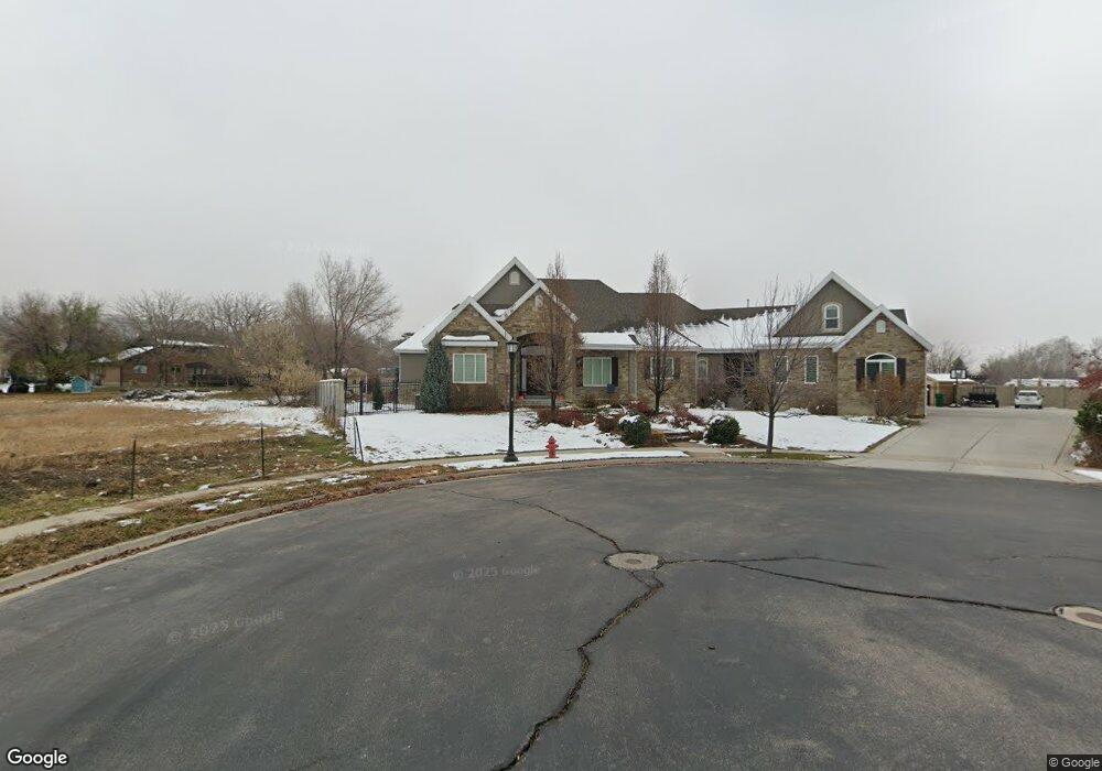
4617 W Brookridge Ln Unit 105 Highland, UT 84003
Estimated Value: $1,594,000 - $2,659,000
2
Beds
6
Baths
4,580
Sq Ft
$501/Sq Ft
Est. Value
About This Home
This home is located at 4617 W Brookridge Ln Unit 105, Highland, UT 84003 and is currently estimated at $2,296,458, approximately $501 per square foot. 4617 W Brookridge Ln Unit 105 is a home located in Utah County with nearby schools including Highland Elementary School, Mountain Ridge Junior High School, and Lone Peak High School.
Ownership History
Date
Name
Owned For
Owner Type
Purchase Details
Closed on
Jul 14, 2016
Sold by
Curtis Don and Curtis Penny
Bought by
Curtis Donald B and Curtis Penny R
Current Estimated Value
Purchase Details
Closed on
Feb 11, 2013
Sold by
Briggs John and Briggs Andrea
Bought by
Curtis Dou and Curtis Penny
Home Financials for this Owner
Home Financials are based on the most recent Mortgage that was taken out on this home.
Original Mortgage
$138,000
Outstanding Balance
$95,933
Interest Rate
3.29%
Mortgage Type
Purchase Money Mortgage
Estimated Equity
$2,200,525
Purchase Details
Closed on
Aug 14, 2006
Sold by
Simons Open Land Development Llc
Bought by
Briggs John and Briggs Andrea
Create a Home Valuation Report for This Property
The Home Valuation Report is an in-depth analysis detailing your home's value as well as a comparison with similar homes in the area
Home Values in the Area
Average Home Value in this Area
Purchase History
| Date | Buyer | Sale Price | Title Company |
|---|---|---|---|
| Curtis Donald B | -- | None Available | |
| Curtis Dou | -- | Select Title Ins Age Inc | |
| Briggs John | -- | 1St National Title Insuranc |
Source: Public Records
Mortgage History
| Date | Status | Borrower | Loan Amount |
|---|---|---|---|
| Open | Curtis Dou | $138,000 |
Source: Public Records
Tax History Compared to Growth
Tax History
| Year | Tax Paid | Tax Assessment Tax Assessment Total Assessment is a certain percentage of the fair market value that is determined by local assessors to be the total taxable value of land and additions on the property. | Land | Improvement |
|---|---|---|---|---|
| 2025 | $8,529 | $1,266,870 | $561,800 | $1,741,600 |
| 2024 | $8,529 | $1,053,525 | $0 | $0 |
| 2023 | $7,830 | $1,043,350 | $0 | $0 |
| 2022 | $7,051 | $910,965 | $0 | $0 |
| 2021 | $5,859 | $1,127,600 | $299,900 | $827,700 |
| 2020 | $5,768 | $1,088,500 | $260,800 | $827,700 |
| 2019 | $5,288 | $1,044,000 | $260,800 | $783,200 |
| 2018 | $5,241 | $983,300 | $260,800 | $722,500 |
| 2017 | $4,970 | $497,750 | $0 | $0 |
| 2016 | $4,526 | $423,665 | $0 | $0 |
| 2015 | $2,986 | $264,935 | $0 | $0 |
| 2014 | $1,892 | $166,400 | $0 | $0 |
Source: Public Records
Map
Nearby Homes
- 10535 Janie Ln
- 4756 W 10370 N
- 4616 W Carriage Ln
- 4292 W Joshua Ln
- 10207 N Cottonwood Dr
- 10052 N Marigold Ln
- 10685 N Jerling Dr
- 4812 W Pocosin Ct
- 4812 Pocosin Ct Unit 754
- 4816 W Pocosin Ct Unit 755
- 4822 W Pocosin Ct Unit 756
- 4822 W Pocosin Ct
- 4811 Pocosin Ct
- 10087 N Torreya Dr Unit 728
- 10587 N Avalon St
- 4821 W Pocosin Ct Unit 751
- 10088 N Loblobby Ln Unit 726
- 10088 N Loblobby Ln
- 4696 W Camellia Ln
- 4083 W Hayes Cir
- 4617 W Brookridge Ln Unit 105
- 4639 W Brookridge Ln
- 10477 N Cherry Ln
- 10470 N Cherry Ln
- 4571 W Dundee Cir
- 10458 N Cherry Ln
- 10458 Cherry Ln
- 10475 N Aberdeen Ln
- 4579 W Dundee Cir
- 4646 W Brookridge Ln
- 10476 Cherry Ln
- 10542 N Janie Ln
- 4671 W Brookridge Ln
- 4671 W Brookridge Ln
- 10487 Aberdeen Ln
- 4569 W Dundee Cir
- 10453 N Aberdeen Ln
- 10453 Aberdeen Ln
- 4636 Brookridge Ln Unit 4
- 4622 Brookridge Ln Unit 5