Estimated Value: $189,055 - $207,000
3
Beds
1
Bath
964
Sq Ft
$204/Sq Ft
Est. Value
About This Home
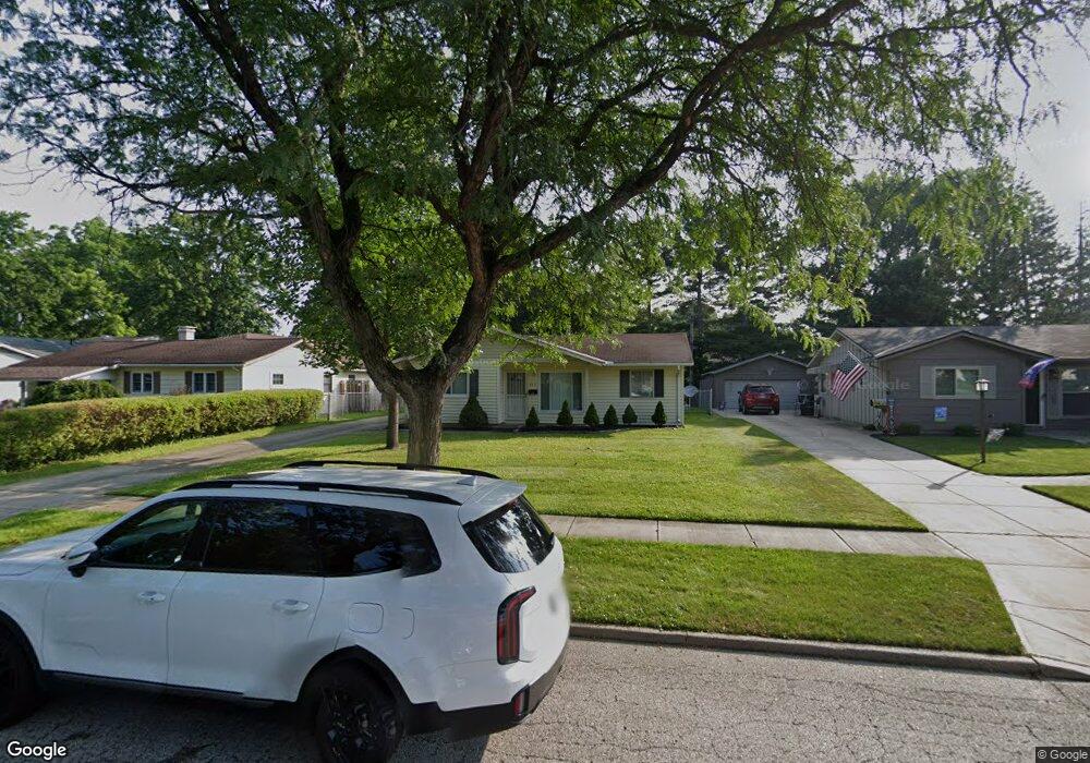
This home is located at 462 Laurel Dr, Berea, OH 44017 and is currently estimated at $196,514, approximately $203 per square foot. 462 Laurel Dr is a home located in Cuyahoga County with nearby schools including Grindstone Elementary School, Berea-Midpark Middle School, and Berea-Midpark High School.
Ownership History
Date
Name
Owned For
Owner Type
Purchase Details
Closed on
Jun 15, 2015
Sold by
Sperk James D and Sperk Arlene
Bought by
Sperk Timothy J
Current Estimated Value
Purchase Details
Closed on
Sep 23, 1985
Bought by
Sperl James D and Sperl Arlene
Purchase Details
Closed on
Apr 12, 1985
Sold by
Mann David R
Bought by
Pyramid Management Co
Purchase Details
Closed on
Apr 6, 1984
Sold by
Cannoy Pamela L
Bought by
Mann David R
Purchase Details
Closed on
Aug 7, 1978
Sold by
Connoy James H and Connoy Pamela L
Bought by
Cannoy Pamela L
Purchase Details
Closed on
Jan 1, 1975
Bought by
Connoy James H and Connoy Pamela L
Create a Home Valuation Report for This Property
The Home Valuation Report is an in-depth analysis detailing your home's value as well as a comparison with similar homes in the area
Home Values in the Area
Average Home Value in this Area
Purchase History
| Date | Buyer | Sale Price | Title Company |
|---|---|---|---|
| Sperk Timothy J | -- | Attorney | |
| Sperl James D | $46,500 | -- | |
| Pyramid Management Co | -- | -- | |
| Mann David R | $34,900 | -- | |
| Cannoy Pamela L | -- | -- | |
| Connoy James H | -- | -- |
Source: Public Records
Tax History
| Year | Tax Paid | Tax Assessment Tax Assessment Total Assessment is a certain percentage of the fair market value that is determined by local assessors to be the total taxable value of land and additions on the property. | Land | Improvement |
|---|---|---|---|---|
| 2025 | $3,325 | $56,140 | $12,215 | $43,925 |
| 2024 | $3,320 | $56,140 | $12,215 | $43,925 |
| 2023 | $2,958 | $41,900 | $9,870 | $32,030 |
| 2022 | $2,940 | $41,900 | $9,870 | $32,030 |
| 2021 | $2,917 | $41,900 | $9,870 | $32,030 |
| 2020 | $2,786 | $35,490 | $8,370 | $27,130 |
| 2019 | $2,714 | $101,400 | $23,900 | $77,500 |
| 2018 | $2,586 | $35,490 | $8,370 | $27,130 |
| 2017 | $2,647 | $32,310 | $7,110 | $25,200 |
| 2016 | $2,628 | $32,310 | $7,110 | $25,200 |
| 2015 | -- | $32,310 | $7,110 | $25,200 |
| 2014 | -- | $34,020 | $7,490 | $26,530 |
Source: Public Records
Map
Nearby Homes
- 446 Redwood Dr
- 379 Laurel Dr
- 428 Park Place
- 160 Stonepointe Dr
- 487 Karen Dr
- 132 Stonefield Dr
- 147 Stone Ridge Way
- 659 Wesley Dr
- 725 Shakespeare Dr
- 6574 Burton Dr
- 100 River Rock Way
- 93 W 5th Ave
- 146 Marian Ln
- 0 River Rd Unit 5169658
- 160 Marian Ln Unit 6A
- 56 3rd Ave
- 7461 River Rd
- 143 Baker St
- 211 W Bridge St
- 300 West St
Your Personal Tour Guide
Ask me questions while you tour the home.