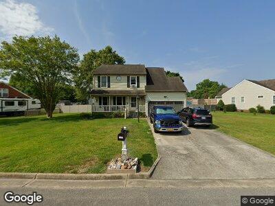
4620 Captain Carter Cir Chesapeake, VA 23321
Western Branch NeighborhoodEstimated Value: $439,000 - $467,000
4
Beds
3
Baths
2,014
Sq Ft
$226/Sq Ft
Est. Value
About This Home
This home is located at 4620 Captain Carter Cir, Chesapeake, VA 23321 and is currently estimated at $455,793, approximately $226 per square foot. 4620 Captain Carter Cir is a home located in Chesapeake City with nearby schools including Edwin W. Chittum Elementary School, Jolliff Middle School, and Western Branch High School.
Ownership History
Date
Name
Owned For
Owner Type
Purchase Details
Closed on
Oct 29, 2013
Sold by
Secretary Of Veterans Affairs
Bought by
Gresham Gregory G
Current Estimated Value
Home Financials for this Owner
Home Financials are based on the most recent Mortgage that was taken out on this home.
Original Mortgage
$194,000
Interest Rate
4.52%
Mortgage Type
New Conventional
Purchase Details
Closed on
Apr 17, 2013
Sold by
Professional Foreclosure Corp and Strausser Charles W
Bought by
Wells Fargo Bank Na
Create a Home Valuation Report for This Property
The Home Valuation Report is an in-depth analysis detailing your home's value as well as a comparison with similar homes in the area
Home Values in the Area
Average Home Value in this Area
Purchase History
| Date | Buyer | Sale Price | Title Company |
|---|---|---|---|
| Gresham Gregory G | $247,000 | -- | |
| Wells Fargo Bank Na | $211,512 | -- |
Source: Public Records
Mortgage History
| Date | Status | Borrower | Loan Amount |
|---|---|---|---|
| Open | Gresham Gregory G | $196,000 | |
| Closed | Gresham Gregory G | $194,000 | |
| Previous Owner | Strausser Charles W | $253,600 | |
| Previous Owner | Strausser Charles W | $252,000 | |
| Previous Owner | Strausser June C | $69,300 |
Source: Public Records
Tax History Compared to Growth
Tax History
| Year | Tax Paid | Tax Assessment Tax Assessment Total Assessment is a certain percentage of the fair market value that is determined by local assessors to be the total taxable value of land and additions on the property. | Land | Improvement |
|---|---|---|---|---|
| 2024 | $4,109 | $406,800 | $150,000 | $256,800 |
| 2023 | $3,565 | $386,000 | $140,000 | $246,000 |
| 2022 | $3,583 | $354,800 | $130,000 | $224,800 |
| 2021 | $3,193 | $304,100 | $110,000 | $194,100 |
| 2020 | $3,107 | $295,900 | $110,000 | $185,900 |
| 2019 | $3,129 | $298,000 | $110,000 | $188,000 |
| 2018 | $3,049 | $275,600 | $95,000 | $180,600 |
| 2017 | $2,951 | $281,000 | $95,000 | $186,000 |
| 2016 | $2,894 | $275,600 | $95,000 | $180,600 |
| 2015 | $2,825 | $269,000 | $90,000 | $179,000 |
| 2014 | $2,755 | $262,400 | $90,000 | $172,400 |
Source: Public Records
Map
Nearby Homes
- 4528 Davids Mill Dr
- 1221 Creekview Dr
- 1209 Willow Creek Ct
- 4713 Jolliff Woods Dr
- 1248 Jolliff Rd
- 4901 Lake Shore Dr
- 4822 Lake Shore Dr
- 1308 Oil Bird Ln
- 1733 Swan Lake Crescent
- 4725 Lake Shore Dr
- 4812 Phoenix Dr
- 4936 Barn Swallow Dr
- 5015 Oriole Dr
- 5533 Willow Lake Rd
- 5520 White Swallow Way
- 5616 Willow Lake Rd
- 1714 Fishers Cove
- 11 Emerald Woods Dr
- 1812 Frederick Ct
- 4409 Anchor Bend Ct
- 4620 Captain Carter Cir
- 4616 Captain Carter Cir
- 4624 Captain Carter Cir
- 4621 Captain Carter Cir
- 4601 Lola B Ct
- 4609 Watson Way
- 4608 Watson Way
- 4615 Captain Carter Cir
- 4626 Captain Carter Cir
- 4612 Captain Carter Cir
- 4601 Pittway Ct
- 4604 Lola B Ct
- 4605 Lola B Ct
- 4605 Pittway Ct
- 4606 Lola B Ct
- 4605 Watson Way
- 4628 Captain Carter Cir
- 4604 Watson Way
- 4608 Captain Carter Cir
- 4600 Pittway Ct