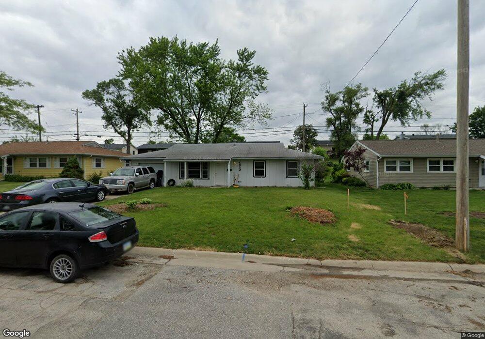
4620 Ford Ave NW Cedar Rapids, IA 52405
Cherry Hill Park NeighborhoodEstimated Value: $135,000 - $181,000
3
Beds
2
Baths
1,159
Sq Ft
$135/Sq Ft
Est. Value
About This Home
This home is located at 4620 Ford Ave NW, Cedar Rapids, IA 52405 and is currently estimated at $156,034, approximately $134 per square foot. 4620 Ford Ave NW is a home located in Linn County with nearby schools including Junction City Elementary School, Hoover Elementary School, and Kentucky Tech - Ashland Reg Tech Center.
Ownership History
Date
Name
Owned For
Owner Type
Purchase Details
Closed on
Sep 15, 2015
Sold by
Hoy Mary Patricia and Hoy Mary P
Bought by
C & R Properties Llc
Current Estimated Value
Home Financials for this Owner
Home Financials are based on the most recent Mortgage that was taken out on this home.
Original Mortgage
$98,000
Outstanding Balance
$58,491
Interest Rate
3.93%
Mortgage Type
Future Advance Clause Open End Mortgage
Estimated Equity
$97,543
Purchase Details
Closed on
Apr 30, 2009
Sold by
Hoy Mary Patricia
Bought by
Hoy Mary Patricia
Home Financials for this Owner
Home Financials are based on the most recent Mortgage that was taken out on this home.
Original Mortgage
$67,500
Interest Rate
5.05%
Mortgage Type
Unknown
Purchase Details
Closed on
Sep 25, 2004
Sold by
Douglas Jane Rae Barrows
Bought by
Douglas Edward K
Create a Home Valuation Report for This Property
The Home Valuation Report is an in-depth analysis detailing your home's value as well as a comparison with similar homes in the area
Home Values in the Area
Average Home Value in this Area
Purchase History
| Date | Buyer | Sale Price | Title Company |
|---|---|---|---|
| C & R Properties Llc | $59,500 | None Available | |
| Hoy Mary Patricia | $74,500 | None Available | |
| Douglas Edward K | -- | -- |
Source: Public Records
Mortgage History
| Date | Status | Borrower | Loan Amount |
|---|---|---|---|
| Open | C & R Properties Llc | $98,000 | |
| Previous Owner | Hoy Mary Patricia | $67,500 |
Source: Public Records
Tax History Compared to Growth
Tax History
| Year | Tax Paid | Tax Assessment Tax Assessment Total Assessment is a certain percentage of the fair market value that is determined by local assessors to be the total taxable value of land and additions on the property. | Land | Improvement |
|---|---|---|---|---|
| 2025 | $1,866 | $120,400 | $34,100 | $86,300 |
| 2024 | $1,994 | $111,200 | $29,500 | $81,700 |
| 2023 | $1,994 | $105,400 | $29,500 | $75,900 |
| 2022 | $1,874 | $94,500 | $24,800 | $69,700 |
| 2021 | $1,832 | $90,500 | $24,800 | $65,700 |
| 2020 | $1,832 | $83,000 | $20,200 | $62,800 |
| 2019 | $1,720 | $79,800 | $20,200 | $59,600 |
| 2018 | $1,672 | $79,800 | $20,200 | $59,600 |
| 2017 | $1,875 | $89,600 | $20,200 | $69,400 |
| 2016 | $1,875 | $88,200 | $20,200 | $68,000 |
| 2015 | $1,937 | $91,062 | $20,163 | $70,899 |
| 2014 | $1,752 | $91,062 | $20,163 | $70,899 |
| 2013 | $1,710 | $91,062 | $20,163 | $70,899 |
Source: Public Records
Map
Nearby Homes
- 4819 Ford Ave NW
- 208 Lenora Dr NW
- 272 Peace Ave NW
- 229 Jacolyn Dr NW
- 281 Jacolyn Dr NW
- 4975 Kesler Rd NW
- 4910 Gordon Ave NW
- 5127 Holly Ave NW
- 4819 Fruitwood Ln NW
- 4622 1st Ave NW Unit E
- 150 Meadowlark Ln NW
- 106 Leroy St NW
- 56 Julia Ann Dr NW
- 4619 1st Ave SW Unit 3
- 3600 Midway Dr NW
- 5530 Skyline Dr NW
- 3509 E Ave NW Unit D
- 3507 E Ave NW Unit F
- 5720 Gordon Ave NW
- 164 Cherry Hill Rd NW
- 4630 Ford Ave NW
- 4610 Ford Ave NW
- 4611 Midway Dr NW
- 4631 Midway Dr NW
- 4640 Ford Ave NW
- 4600 Ford Ave NW
- 4601 Midway Dr NW
- 4641 Midway Dr NW
- 279 Drinkward St NW
- 4550 Ford Ave NW
- 4650 Ford Ave NW
- 279 Boice Rd NW
- 4551 Midway Dr NW
- 276 Drinkward St NW
- 4651 Midway Dr NW
- 275 Drinkward St NW
- 4540 Ford Ave NW
- 4700 Ford Ave NW
- 280 Lenora Dr NW
- 275 Boice Rd NW